Sussex, Wisconsin
Sussex is a village in Waukesha County, Wisconsin, United States. It is approximately 19 miles (31 km) northwest of Milwaukee and 9 miles (14 km) north of Waukesha. The village is 7.24 square miles (19 km2) at an elevation of 930 feet. The population was 10,518 at the 2010 census. It is part of the Milwaukee metropolitan area.
Sussex, Wisconsin | |
|---|---|
 Location of Sussex in Waukesha County, Wisconsin. | |
| Coordinates: 43°8′6″N 88°13′13″W | |
| Country | |
| State | |
| County | Waukesha |
| Area | |
| • Total | 7.84 sq mi (20.29 km2) |
| • Land | 7.78 sq mi (20.16 km2) |
| • Water | 0.05 sq mi (0.13 km2) |
| Elevation | 919 ft (280 m) |
| Population | |
| • Total | 10,518 |
| • Estimate (2019)[4] | 10,981 |
| • Density | 1,393.76/sq mi (538.14/km2) |
| Time zone | UTC-6 (Central (CST)) |
| • Summer (DST) | UTC-5 (CDT) |
| Area code(s) | 262 |
| FIPS code | 55-78750[5] |
| GNIS feature ID | 1575137[2] |
| Website | www |
History
It was founded in 1843 by George Elliott, a bricklayer from Beckley, East Sussex, and Richard Cooling, a blacksmith from Dorset.[6]
Geography
According to the United States Census Bureau, the village has a total area of 7.62 square miles (19.74 km2), of which, 7.57 square miles (19.61 km2) of it is land and 0.05 square miles (0.13 km2) is water.[7] The Bugline Trail, a paved 16-mile rail trail, runs directly through the village.[8]
Demographics
| Historical population | |||
|---|---|---|---|
| Census | Pop. | %± | |
| 1880 | 131 | — | |
| 1930 | 496 | — | |
| 1940 | 548 | 10.5% | |
| 1950 | 679 | 23.9% | |
| 1960 | 1,087 | 60.1% | |
| 1970 | 2,758 | 153.7% | |
| 1980 | 3,482 | 26.3% | |
| 1990 | 5,039 | 44.7% | |
| 2000 | 8,828 | 75.2% | |
| 2010 | 10,518 | 19.1% | |
| Est. 2019 | 10,981 | [4] | 4.4% |
| U.S. Decennial Census[9] | |||
2010 census
As of the census[3] of 2010, there were 10,518 people, 4,039 households, and 2,932 families living in the village. The population density was 1,389.4 inhabitants per square mile (536.5/km2). There were 4,186 housing units at an average density of 553.0 per square mile (213.5/km2). The racial makeup of the village was 95.2% White, 0.8% African American, 0.3% Native American, 2.1% Asian, 0.5% from other races, and 1.1% from two or more races. Hispanic or Latino of any race were 2.4% of the population.
There were 4,039 households of which 39.8% had children under the age of 18 living with them, 60.1% were married couples living together, 9.0% had a female householder with no husband present, 3.4% had a male householder with no wife present, and 27.4% were non-families. 22.5% of all households were made up of individuals and 7.9% had someone living alone who was 65 years of age or older. The average household size was 2.60 and the average family size was 3.09.
The median age in the village was 37.5 years. 28.3% of residents were under the age of 18; 6.6% were between the ages of 18 and 24; 28.1% were from 25 to 44; 27.3% were from 45 to 64; and 9.6% were 65 years of age or older. The gender makeup of the village was 49.4% male and 50.6% female.
2000 census
As of the census[5] of 2000, there were 8,828 people, 3,310 households, and 2,502 families living in the village. The population density was 1,464.0 people per square mile (565.3/km2). There were 3,441 housing units at an average density of 570.6 per square mile (220.3/km2). The racial makeup of the village was 96.98% White, 0.75% African American, 0.18% Native American, 0.80% Asian, 0.05% Pacific Islander, 0.36% from other races, and 0.88% from two or more races. Hispanic or Latino of any race were 1.67% of the population.
There were 3,310 households out of which 41.9% had children under the age of 18 living with them, 63.1% were married couples living together, 9.5% had a female householder with no husband present, and 24.4% were non-families. 19.5% of all households were made up of individuals and 7.6% had someone living alone who was 65 years of age or older. The average household size was 2.67 and the average family size was 3.09.
In the village, the population was spread out with 29.3% under the age of 18, 6.9% from 18 to 24, 36.3% from 25 to 44, 19.2% from 45 to 64, and 8.3% who were 65 years of age or older. The median age was 34 years. For every 100 females, there were 96.0 males. For every 100 females age 18 and over, there were 93.8 males.
The median income for a household in the village was $60,283, and the median income for a family was $65,702. Males had a median income of $46,319 versus $30,182 for females. The per capita income for the village was $23,913. About 3.5% of families and 3.7% of the population were below the poverty line, including 5.0% of those under age 18 and 4.9% of those age 65 or over.
Economy
Education
Sussex is served by the Hamilton School District, which operates one pre-school, four elementary schools, one intermediate school (5th and 6th grade), one middle school(7th and 8th), and one high school in Sussex and the surrounding area.[10]
Sussex is home to the Pauline Haass Public Library, a member library of the Bridges Library System. The Sussex-Lisbon Area Historium is housed in the Sussex Civic Center.[11]
Media
- Sussex Sun - weekly newspaper
- WSJP 1640 AM - Relevant Radio
References
- "2018 U.S. Gazetteer Files". United States Census Bureau. Retrieved Feb 15, 2020.
- "US Board on Geographic Names". United States Geological Survey. 2007-10-25. Retrieved 2008-01-31.
- "U.S. Census website". United States Census Bureau. Retrieved 2012-11-18.
- "Population and Housing Unit Estimates". Retrieved May 21, 2020.
- "U.S. Census website". United States Census Bureau. Retrieved 2008-01-31.
- Katy Rice, 'Across the pond', in Sussex Society, September 2011, p. 29
- "US Gazetteer files 2010". United States Census Bureau. Archived from the original on 2012-01-25. Retrieved 2012-11-18.
- "Bugline Trail | Wisconsin Trails | TrailLink". www.traillink.com. Retrieved 2020-01-18.
- "Census of Population and Housing". Census.gov. Retrieved June 4, 2015.
- "Home". Hamilton School District. Retrieved 2019-04-15.
- "Sussex-Lisbon Area Historium". Sussex-Lisbon Area Historical Museum. Retrieved 2020-01-18.
External links
- Village of Sussex
- Village of Sussex - unofficial website. (broken link)
- Hamilton School District website
Municipalities and communities of Waukesha County, Wisconsin, United States | ||
|---|---|---|
| Cities | 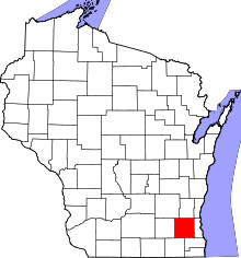 | |
| Villages | ||
| Towns | ||
| CDP | ||
| Unincorporated communities | ||
| Ghost towns/ neighborhoods | ||
| Footnotes | ‡This populated place also has portions in an adjacent county or counties | |
| Central city |  | |
|---|---|---|
| Largest municipalities (over 25,000 in 2010) | ||
| Municipalities (over 10,000 in 2010) | ||
| Smaller municipalities (under 10,000 in 2010) | ||
| Counties | ||
| Other topics | ||
Notes: Vvillage Ttown Ccity | ||
| Authority control |
|
|---|