Sumner, Nebraska
Sumner is a village in Dawson County, Nebraska, United States. It is part of the Lexington, Nebraska Micropolitan Statistical Area. The population was 236 at the 2010 census.
Sumner, Nebraska | |
|---|---|
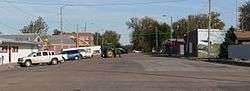 Downtown Sumner | |
 Location of Sumner, Nebraska | |
| Coordinates: 40°56′59″N 99°30′27″W | |
| Country | United States |
| State | Nebraska |
| County | Dawson |
| Area | |
| • Total | 0.29 sq mi (0.76 km2) |
| • Land | 0.29 sq mi (0.76 km2) |
| • Water | 0.00 sq mi (0.00 km2) |
| Elevation | 2,365 ft (721 m) |
| Population | |
| • Total | 236 |
| • Estimate (2017)[3] | 225 |
| • Density | 762.71/sq mi (294.27/km2) |
| Time zone | UTC-6 (Central (CST)) |
| • Summer (DST) | UTC-5 (CDT) |
| ZIP code | 68878 |
| Area code(s) | 308 |
| FIPS code | 31-47675[4] |
| GNIS feature ID | 0837270[5] |
History
Sumner was established in 1890 when the Omaha and Republican Valley Railway was extended to that point.[6] It was named for Charles Sumner, a senator from Massachusetts known for his abolitionist views.[7]
Geography
Sumner is located at 40°56′59″N 99°30′27″W (40.949770, -99.507584).[8]
According to the United States Census Bureau, the village has a total area of 0.30 square miles (0.78 km2), all of it land.[9]
Demographics
| Historical population | |||
|---|---|---|---|
| Census | Pop. | %± | |
| 1900 | 210 | — | |
| 1910 | 321 | 52.9% | |
| 1920 | 345 | 7.5% | |
| 1930 | 297 | −13.9% | |
| 1940 | 296 | −0.3% | |
| 1950 | 267 | −9.8% | |
| 1960 | 254 | −4.9% | |
| 1970 | 222 | −12.6% | |
| 1980 | 254 | 14.4% | |
| 1990 | 210 | −17.3% | |
| 2000 | 237 | 12.9% | |
| 2010 | 236 | −0.4% | |
| Est. 2017 | 225 | [3] | −4.7% |
| U.S. Decennial Census[10] | |||
2010 census
As of the census[2] of 2010, there were 236 people, 97 households, and 62 families residing in the village. The population density was 786.7 inhabitants per square mile (303.7/km2). There were 113 housing units at an average density of 376.7 per square mile (145.4/km2). The racial makeup of the village was 94.1% White, 0.4% Asian, 3.0% from other races, and 2.5% from two or more races. Hispanic or Latino of any race were 4.7% of the population.
There were 97 households of which 30.9% had children under the age of 18 living with them, 52.6% were married couples living together, 8.2% had a female householder with no husband present, 3.1% had a male householder with no wife present, and 36.1% were non-families. 30.9% of all households were made up of individuals and 7.2% had someone living alone who was 65 years of age or older. The average household size was 2.43 and the average family size was 3.08.
The median age in the village was 37 years. 30.5% of residents were under the age of 18; 3% were between the ages of 18 and 24; 26.8% were from 25 to 44; 23.7% were from 45 to 64; and 16.1% were 65 years of age or older. The gender makeup of the village was 47.9% male and 52.1% female.
2000 census
As of the census[4] of 2000, there were 237 people, 102 households, and 60 families residing in the village. The population density was 817.0 people per square mile (315.5/km²). There were 117 housing units at an average density of 403.3 per square mile (155.8/km²). The racial makeup of the village was 94.94% White, 1.27% Native American, 3.38% from other races, and 0.42% from two or more races. Hispanic or Latino of any race were 9.70% of the population.
There were 102 households out of which 29.4% had children under the age of 18 living with them, 51.0% were married couples living together, 5.9% had a female householder with no husband present, and 40.2% were non-families. 35.3% of all households were made up of individuals and 22.5% had someone living alone who was 65 years of age or older. The average household size was 2.32 and the average family size was 3.05.
In the village, the population was spread out with 27.0% under the age of 18, 7.6% from 18 to 24, 24.5% from 25 to 44, 20.7% from 45 to 64, and 20.3% who were 65 years of age or older. The median age was 35 years. For every 100 females, there were 106.1 males. For every 100 females age 18 and over, there were 103.5 males.
As of 2000 the median income for a household in the village was $27,143, and the median income for a family was $33,750. Males had a median income of $25,385 versus $18,125 for females. The per capita income for the village was $14,469. About 8.5% of families and 11.2% of the population were below the poverty line, including 15.3% of those under the age of eighteen and none of those sixty five or over.
References
- "2017 U.S. Gazetteer Files". United States Census Bureau. Retrieved Jan 12, 2019.
- "U.S. Census website". United States Census Bureau. Retrieved 2012-06-24.
- "Population and Housing Unit Estimates". Retrieved March 24, 2018.
- "U.S. Census website". United States Census Bureau. Retrieved 2008-01-31.
- "US Board on Geographic Names". United States Geological Survey. 2007-10-25. Retrieved 2008-01-31.
- "Sumner, Dawson County". Center for Advanced Land Management Information Technologies. University of Nebraska. Retrieved 4 August 2014.
- Fitzpatrick, Lillian L. (1960). Nebraska Place-Names. University of Nebraska Press. p. 52. A 1925 edition is available for download at University of Nebraska—Lincoln Digital Commons.
- "US Gazetteer files: 2010, 2000, and 1990". United States Census Bureau. 2011-02-12. Retrieved 2011-04-23.
- "US Gazetteer files 2010". United States Census Bureau. Archived from the original on 2012-01-25. Retrieved 2012-06-24.
- "Census of Population and Housing". Census.gov. Retrieved June 4, 2015.
Municipalities and communities of Dawson County, Nebraska, United States | ||
|---|---|---|
| Cities | Map of Nebraska highlighting Dawson County | |
| Villages | ||
| CDP | ||
| Unincorporated communities | ||
| Former communities | ||