Sultan Naga Dimaporo, Lanao del Norte
Sultan Naga Dimaporo, officially the Municipality of Sultan Naga Dimaporo, is a 5th class municipality in the province of Lanao del Norte, Philippines. According to the 2015 census, it has a population of 56,764 people.[3]
Sultan Naga Dimaporo | |
|---|---|
| Municipality of Sultan Naga Dimaporo | |
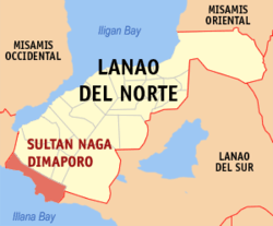 Map of Lanao del Norte with Sultan Naga Dimaporo highlighted | |

| |
.svg.png) Sultan Naga Dimaporo Location within the Philippines | |
| Coordinates: 7°47′N 123°45′E | |
| Country | |
| Region | Northern Mindanao (Region X) |
| Province | Lanao del Norte |
| District | 2nd District |
| Founded | April 10, 1953 |
| Barangays | 37 (see Barangays) |
| Government | |
| • Type | Sangguniang Bayan |
| • Mayor | Motalib M. Dimaporo |
| • Vice Mayor | Ulwan M. Dimaporo |
| • Congressman | Abdullah D. Dimaporo |
| • Electorate | 26,113 voters (2019) |
| Area | |
| • Total | 230.99 km2 (89.19 sq mi) |
| Elevation | 6.6 m (21.7 ft) |
| Population (2015 census)[3] | |
| • Total | 56,764 |
| • Density | 250/km2 (640/sq mi) |
| • Households | 11,422 |
| Economy | |
| • Income class | 5th municipal income class |
| • Poverty incidence | 54.1% (2015)[4] |
| • Revenue (₱) | 105,786,713.46 (2016) |
| Time zone | UTC+8 (PST) |
| ZIP code | 9215 |
| PSGC | |
| IDD : area code | +63 (0)63 |
| Climate type | tropical climate |
| Native languages | Maranao Cebuano Binukid Tagalog |
It is formerly known as Karomatan.
Geography
Sultan Naga Dimaporo or Karomatan is located at the south-western part of the province of Lanao del Norte. It is bordered on the southeast by the municipality of Picong in Lanao del Sur, and on the west by the municipalities of Tukuran and Aurora, both in Zamboanga del Sur. To the south is the tip of Illana Bay, part of the Celebes Sea.
Barangays
Sultan Naga Dimaporo is politically subdivided into 37 barangays.
- Bangaan
- Bangko
- Bansarvil II
- Bauyan
- Cabongbongan
- Calibao
- Calipapa
- Calube
- Campo Islam
- Capocao
- Dableston
- Dalama
- Dangolaan
- Ditago
- Ilian
- Kauswagan
- Kirapan
- Koreo
- Lantawan
- Mabuhay
- Maguindanao
- Mahayahay
- Mamagum
- Mina
- Pandanan
- Payong
- Piraka
- Pikalawag
- Pikinit
- Poblacion
- Ramain
- Rebucon
- Sigayan
- Sugod
- Tagulo
- Tantaon
- Topocon
Climate
| Climate data for Sultan Naga Dimaporo, Lanao del Norte | |||||||||||||
|---|---|---|---|---|---|---|---|---|---|---|---|---|---|
| Month | Jan | Feb | Mar | Apr | May | Jun | Jul | Aug | Sep | Oct | Nov | Dec | Year |
| Average high °C (°F) | 29 (84) |
30 (86) |
31 (88) |
31 (88) |
30 (86) |
30 (86) |
29 (84) |
30 (86) |
30 (86) |
30 (86) |
30 (86) |
29 (84) |
30 (86) |
| Average low °C (°F) | 22 (72) |
22 (72) |
22 (72) |
23 (73) |
24 (75) |
24 (75) |
24 (75) |
24 (75) |
24 (75) |
24 (75) |
23 (73) |
23 (73) |
23 (74) |
| Average precipitation mm (inches) | 69 (2.7) |
58 (2.3) |
67 (2.6) |
60 (2.4) |
109 (4.3) |
114 (4.5) |
83 (3.3) |
78 (3.1) |
76 (3.0) |
92 (3.6) |
86 (3.4) |
63 (2.5) |
955 (37.7) |
| Average rainy days | 12.8 | 11.6 | 14.8 | 17.4 | 24.8 | 23.5 | 20.7 | 18.5 | 17.4 | 22.5 | 21.6 | 15.6 | 221.2 |
| Source: Meteoblue [5] | |||||||||||||
History
Executive Order No. 588, s. 1953 (Signed on April 30, 1953) created the Karomatan from the following:
(note that Lanao was split 1959)
- From Kapatagan: Tagalo, Mabohai, Pandanan, Pikinit, Dangoloan, Dabliston, Calobi, Tapokon, Karomatan, Pitikol, Sigayan
- From Malabang: Bauyan, Dadoan, Calibao Payong
The barrio/baranggay of Karomatan was then made the Poblacion of this municipality
Demographics
| Population census of Sultan Naga Dimaporo | |||||||||||||||||||||||||||||||||||||
|---|---|---|---|---|---|---|---|---|---|---|---|---|---|---|---|---|---|---|---|---|---|---|---|---|---|---|---|---|---|---|---|---|---|---|---|---|---|
|
| ||||||||||||||||||||||||||||||||||||
| Source: Philippine Statistics Authority[3][6][7][8] | |||||||||||||||||||||||||||||||||||||
References
- "Municipality". Quezon City, Philippines: Department of the Interior and Local Government. Retrieved 31 May 2013.
- "Province: Lanao del Norte". PSGC Interactive. Quezon City, Philippines: Philippine Statistics Authority. Retrieved 12 November 2016.
- Census of Population (2015). "Region X (Northern Mindanao)". Total Population by Province, City, Municipality and Barangay. PSA. Retrieved 20 June 2016.
- "PSA releases the 2015 Municipal and City Level Poverty Estimates". Quezon City, Philippines. Retrieved 12 October 2019.
- "Sultan Naga Dimaporo: Average Temperatures and Rainfall". Meteoblue. Retrieved 6 February 2020.
- Census of Population and Housing (2010). "Region X (Northern Mindanao)". Total Population by Province, City, Municipality and Barangay. NSO. Retrieved 29 June 2016.
- Censuses of Population (1903–2007). "Region X (Northern Mindanao)". Table 1. Population Enumerated in Various Censuses by Province/Highly Urbanized City: 1903 to 2007. NSO.
- "Province of Lanao del Norte". Municipality Population Data. Local Water Utilities Administration Research Division. Retrieved 17 December 2016.
External links
- Sultan Naga Dimaporo Profile at PhilAtlas.com
- Official site of Sultan Naga Dimaporo
- Philippine Standard Geographic Code
- Philippine Census Information
- Local Governance Performance Management System
Places adjacent to Sultan Naga Dimaporo, Lanao del Norte | ||||||||||
|---|---|---|---|---|---|---|---|---|---|---|
| ||||||||||
Tubod (capital) | |
| Municipalities | |
| Highly urbanized city |
|