Sulphur Well Historic District
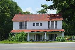
The Sulphur Well Historic District is a 81 acres (33 ha) historic district in Sulphur Well, Kentucky which was listed on the National Register of Historic Places in 1998.[1]
Sulphur Well Historic District | |
 | |
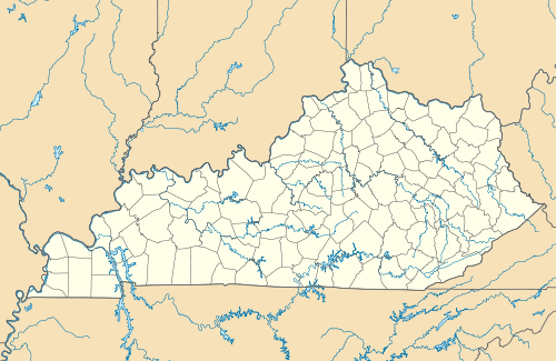  | |
| Location | Roughly by Wister Wallace Rd., S fork of the Little Barren R., Mitchell-Edwards Rd., and KY 70, Sulphur Well, Kentucky |
|---|---|
| Coordinates | 37°06′03″N 85°38′04″W |
| Area | 81 acres (33 ha) |
| Built | 1860 |
| Architectural style | Bungalow/craftsman |
| NRHP reference No. | 98000932[1] |
| Added to NRHP | August 14, 1998 |
It is roughly bounded by Wister Wallace Rd., the southern fork of the Little Barren River, Mitchell-Edwards Rd., and Kentucky Route 70. The listing included 37 contributing buildings, a contributing structure, and five contributing sites.[1]
According to its nomination, "Sulphur Well is a good example of a. small rural mineral water town in western Kentucky that developed between 1860 and 1949."[2]
References
- "National Register Information System". National Register of Historic Places. National Park Service. July 9, 2010.
- Donna G. Logsdon (March 11, 1998). "National Register of Historic Places Registration: Sulphur Well Historic District". National Park Service. Retrieved April 5, 2018. With 37 photos.
| Topics | |
|---|---|
| Lists by state |
|
| Lists by insular areas | |
| Lists by associated state | |
| Other areas | |
| Related | |
| |
This article is issued from Wikipedia. The text is licensed under Creative Commons - Attribution - Sharealike. Additional terms may apply for the media files.