Study Butte, Texas
Study Butte (/ˈstjuːdi ˌbjuːt/ STEW-dee BEWT[2]) is a census-designated place (CDP) in Brewster County, Texas, United States. The population was 233 at the 2010 census.[3] At the 2000 census, the area was part of the Study Butte-Terlingua CDP.
Study Butte, Texas | |
|---|---|
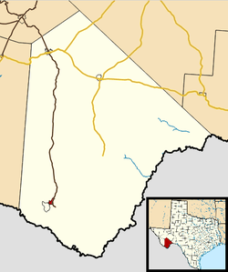 Location in Brewster County and the state of Texas | |
| Coordinates: 29°19′29″N 103°31′44″W | |
| Country | United States |
| State | Texas |
| County | Brewster |
| Area | |
| • Total | 4.7 sq mi (12.3 km2) |
| • Land | 4.7 sq mi (12.3 km2) |
| • Water | 0.0 sq mi (0.0 km2) |
| Population (2010) | |
| • Total | 233 |
| • Density | 49/sq mi (18.9/km2) |
| Time zone | UTC-6 (Central (CST)) |
| • Summer (DST) | UTC-5 (CDT) |
| FIPS code | 48-70688[1] |
Geography
Study Butte is located at 29°19′29″N 103°31′44″W[4] in southern Brewster County. The Terlingua CDP borders Study Butte to the southwest. Texas State Highway 118 passes through Study Butte and leads 3.7 miles (6.0 km) southeast to the west entrance to Big Bend National Park and 78 miles (126 km) north to the city of Alpine.
According to the United States Census Bureau, the Study Butte CDP has a total area of 4.7 square miles (12.3 km2), all of it land.[3]
Climate
This area has a large amount of sunshine year round due to its stable descending air and high pressure. According to the Köppen Climate Classification system, Study Butte-Terlingua has a desert climate, abbreviated "BWh" on climate maps.[5]
- Coordinates: 29.32861°N 103.55306°W
- Elevation: 2,563 feet (781 m)[6]
| Climate data for Study Butte, Texas (May 1, 1993–Jun 30, 2006) | |||||||||||||
|---|---|---|---|---|---|---|---|---|---|---|---|---|---|
| Month | Jan | Feb | Mar | Apr | May | Jun | Jul | Aug | Sep | Oct | Nov | Dec | Year |
| Record high °F (°C) | 88 (31) |
94 (34) |
101 (38) |
107 (42) |
111 (44) |
113 (45) |
111 (44) |
108 (42) |
106 (41) |
102 (39) |
96 (36) |
85 (29) |
113 (45) |
| Average high °F (°C) | 69.2 (20.7) |
73.2 (22.9) |
81.0 (27.2) |
88.9 (31.6) |
98.2 (36.8) |
100.6 (38.1) |
99.6 (37.6) |
98.2 (36.8) |
94.7 (34.8) |
86.3 (30.2) |
75.7 (24.3) |
66.3 (19.1) |
86.0 (30.0) |
| Daily mean °F (°C) | 52.8 (11.6) |
57.3 (14.1) |
64.1 (17.8) |
72.1 (22.3) |
82.2 (27.9) |
86.7 (30.4) |
86.6 (30.3) |
85.6 (29.8) |
81.3 (27.4) |
71.7 (22.1) |
60.8 (16.0) |
51.4 (10.8) |
71.1 (21.7) |
| Average low °F (°C) | 36.5 (2.5) |
41.5 (5.3) |
47.3 (8.5) |
55.2 (12.9) |
66.3 (19.1) |
72.9 (22.7) |
73.8 (23.2) |
73.0 (22.8) |
67.9 (19.9) |
57.2 (14.0) |
45.9 (7.7) |
36.5 (2.5) |
56.2 (13.4) |
| Record low °F (°C) | 18 (−8) |
20 (−7) |
21 (−6) |
37 (3) |
47 (8) |
62 (17) |
61 (16) |
61 (16) |
49 (9) |
27 (−3) |
25 (−4) |
16 (−9) |
16 (−9) |
| Average precipitation inches (mm) | 0.26 (6.6) |
0.17 (4.3) |
0.37 (9.4) |
0.33 (8.4) |
0.63 (16) |
1.32 (34) |
1.86 (47) |
1.77 (45) |
0.61 (15) |
1.09 (28) |
0.47 (12) |
0.26 (6.6) |
9.14 (232) |
| Average snowfall inches (cm) | 0.0 (0.0) |
0.0 (0.0) |
0.0 (0.0) |
0.0 (0.0) |
0.0 (0.0) |
0.0 (0.0) |
0.0 (0.0) |
0.0 (0.0) |
0.0 (0.0) |
0.0 (0.0) |
0.0 (0.0) |
0.0 (0.0) |
0.0 (0.0) |
| Average precipitation days (≥ 0.01 in) | 1 | 1 | 1 | 1 | 2 | 3 | 5 | 4 | 2 | 2 | 2 | 1 | 25 |
| Source: Western Regional Climate Center, Desert Research Institute[7] | |||||||||||||
Education
Study Butte is served by the Terlingua Common School District. The schools are Terlingua School and Big Bend High School.
References
- "U.S. Census website". United States Census Bureau. Retrieved 2008-01-31.
- http://www.texastripper.com/pronounce/locations-s.html
- "Geographic Identifiers: 2010 Demographic Profile Data (G001): Study Butte CDP, Texas". U.S. Census Bureau, American Factfinder. Archived from the original on February 12, 2020. Retrieved April 22, 2014.
- "US Gazetteer files: 2010, 2000, and 1990". United States Census Bureau. 2011-02-12. Retrieved 2011-04-23.
- Climate Summary for Study Butte-Terlingua, Texas
- "US COOP Station Map". Western Regional Climate Center, Desert Research Institute. Retrieved Mar 22, 2016.
- "STUDY BUTTE, TEXAS (4187146959), Period of Record Monthly Climate Summary". Western Regional Climate Center, Desert Research Institute. Retrieved Mar 22, 2016.
External links
Municipalities and communities of Brewster County, Texas, United States | ||
|---|---|---|
| City | 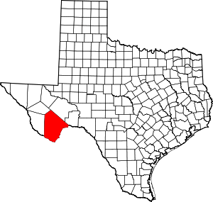 Brewster County map | |
| CDPs | ||
| Other unincorporated communities | ||
| Ghost towns | ||
| Annexed former counties | ||