St. John, Washington
St. John is a town in Whitman County, Washington, United States. The population was 537 at the 2010 census. St. John is the birthplace of the twentieth governor of Washington, Mike Lowry.
St. John | |
|---|---|
| St. John, Washington | |
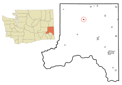 Location of St. John, Washington | |
| Coordinates: 47°5′25″N 117°34′56″W | |
| Country | United States |
| State | Washington |
| County | Whitman |
| Area | |
| • Total | 0.67 sq mi (1.74 km2) |
| • Land | 0.67 sq mi (1.74 km2) |
| • Water | 0.00 sq mi (0.00 km2) |
| Elevation | 1,962 ft (598 m) |
| Population | |
| • Total | 537 |
| • Estimate (2018)[3] | 564 |
| • Density | 840.54/sq mi (324.69/km2) |
| Time zone | UTC-8 (Pacific (PST)) |
| • Summer (DST) | UTC-7 (PDT) |
| ZIP code | 99171 |
| Area code(s) | 509 |
| FIPS code | 53-60860[4] |
| GNIS feature ID | 1508016[5] |
| Website | Town of St. John |
History
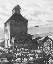
St. John was founded and named in the late 1880s for settler E.T. St. John.[6] St. John was officially incorporated on March 10, 1904.[7]
Geography
St. John is located at 47°05′25″N 117°34′56″W (47.090403, -117.582085).[8]
According to the United States Census Bureau, the town has a total area of 0.63 square miles (1.63 km2), all of it land.[9]
Climate
St. John's climate is classified as warm-summer Mediterranean climate (Csb) according to the Köppen climate classification system, but nearly qualifies as a dry-summer humid continental climate due to its cold winter months.
| Climate data for Saint John | |||||||||||||
|---|---|---|---|---|---|---|---|---|---|---|---|---|---|
| Month | Jan | Feb | Mar | Apr | May | Jun | Jul | Aug | Sep | Oct | Nov | Dec | Year |
| Record high °F (°C) | 61 (16) |
67 (19) |
77 (25) |
92 (33) |
99 (37) |
100 (38) |
107 (42) |
103 (39) |
101 (38) |
91 (33) |
72 (22) |
59 (15) |
107 (42) |
| Average high °F (°C) | 37.9 (3.3) |
44.1 (6.7) |
52 (11) |
60 (16) |
68.7 (20.4) |
76.1 (24.5) |
85.5 (29.7) |
85.2 (29.6) |
76.3 (24.6) |
62.7 (17.1) |
46.2 (7.9) |
37.3 (2.9) |
61 (16) |
| Average low °F (°C) | 24.6 (−4.1) |
27.6 (−2.4) |
30.9 (−0.6) |
34.7 (1.5) |
40.4 (4.7) |
46 (8) |
49.9 (9.9) |
49.3 (9.6) |
42.5 (5.8) |
34 (1) |
30 (−1) |
24.3 (−4.3) |
36.2 (2.3) |
| Record low °F (°C) | −28 (−33) |
−22 (−30) |
5 (−15) |
12 (−11) |
19 (−7) |
25 (−4) |
26 (−3) |
26 (−3) |
17 (−8) |
6 (−14) |
−18 (−28) |
−23 (−31) |
−28 (−33) |
| Average precipitation inches (mm) | 2.11 (54) |
1.43 (36) |
1.69 (43) |
1.46 (37) |
1.54 (39) |
1.2 (30) |
0.66 (17) |
0.61 (15) |
0.73 (19) |
1.19 (30) |
2.21 (56) |
2.41 (61) |
17.24 (438) |
| Average snowfall inches (cm) | 9.6 (24) |
3 (7.6) |
1.3 (3.3) |
0.4 (1.0) |
0 (0) |
0 (0) |
0 (0) |
0 (0) |
0 (0) |
0.1 (0.25) |
2.6 (6.6) |
8.3 (21) |
25.3 (64) |
| Average precipitation days | 13 | 10 | 11 | 9 | 9 | 7 | 4 | 3 | 5 | 8 | 13 | 13 | 105 |
| Source: [10] | |||||||||||||
Demographics
| Historical population | |||
|---|---|---|---|
| Census | Pop. | %± | |
| 1910 | 421 | — | |
| 1920 | 597 | 41.8% | |
| 1930 | 471 | −21.1% | |
| 1940 | 526 | 11.7% | |
| 1950 | 542 | 3.0% | |
| 1960 | 545 | 0.6% | |
| 1970 | 575 | 5.5% | |
| 1980 | 529 | −8.0% | |
| 1990 | 499 | −5.7% | |
| 2000 | 548 | 9.8% | |
| 2010 | 537 | −2.0% | |
| Est. 2018 | 564 | [3] | 5.0% |
| U.S. Decennial Census[11] | |||
2010 census
As of the census[2] of 2010, there were 537 people, 261 households, and 145 families residing in the town. The population density was 852.4 inhabitants per square mile (329.1/km2). There were 304 housing units at an average density of 482.5 per square mile (186.3/km2). The racial makeup of the town was 94.6% White, 0.2% African American, 0.4% Native American, 0.2% Asian, 0.4% Pacific Islander, 0.4% from other races, and 3.9% from two or more races. Hispanic or Latino of any race were 1.9% of the population.
There were 261 households of which 22.2% had children under the age of 18 living with them, 47.1% were married couples living together, 6.9% had a female householder with no husband present, 1.5% had a male householder with no wife present, and 44.4% were non-families. 39.5% of all households were made up of individuals and 22.6% had someone living alone who was 65 years of age or older. The average household size was 2.06 and the average family size was 2.78.
The median age in the town was 50.8 years. 22.3% of residents were under the age of 18; 3.8% were between the ages of 18 and 24; 15.3% were from 25 to 44; 28.8% were from 45 to 64; and 29.8% were 65 years of age or older. The gender makeup of the town was 45.8% male and 54.2% female.
2000 census
As of the census[4] of 2000, there were 548 people, 258 households, and 163 families residing in the town. The population density was 1,056.2 people per square mile (406.9/km2). There were 279 housing units at an average density of 537.7 per square mile (207.2/km2). The racial makeup of the town was 97.81% White, 0.18% Native American, 0.55% Asian, and 1.46% from two or more races. Hispanic or Latino of any race were 1.64% of the population.
There were 258 households out of which 22.1% had children under the age of 18 living with them, 54.7% were married couples living together, 5.8% had a female householder with no husband present, and 36.8% were non-families. 34.1% of all households were made up of individuals and 20.2% had someone living alone who was 65 years of age or older. The average household size was 2.12 and the average family size was 2.72.
In the town, the age distribution of the population shows 20.8% under the age of 18, 3.3% from 18 to 24, 20.4% from 25 to 44, 25.2% from 45 to 64, and 30.3% who were 65 years of age or older. The median age was 49 years. For every 100 females, there were 93.6 males. For every 100 females age 18 and over, there were 86.3 males.
The median income for a household in the town was $33,393, and the median income for a family was $44,643. Males had a median income of $31,389 versus $18,750 for females. The per capita income for the town was $18,722. About 5.4% of families and 7.4% of the population were below the poverty line, including 13.2% of those under age 18 and 3.6% of those age 65 or over.
References
- "2018 U.S. Gazetteer Files". United States Census Bureau. Retrieved February 16, 2020.
- "U.S. Census website". United States Census Bureau. Retrieved 2012-12-19.
- "Population and Housing Unit Estimates". United States Census Bureau. June 27, 2019. Retrieved February 16, 2020.
- "U.S. Census website". United States Census Bureau. Retrieved 2008-01-31.
- "US Board on Geographic Names". United States Geological Survey. 2007-10-25. Retrieved 2008-01-31.
- Meany, Edmond S. (1923). Origin of Washington geographic names. Seattle: University of Washington Press. p. 252.
- Cities and Towns, State of Washington - Dates of Incorporation, Disincorporation, and Changes of Classification Archived 2013-11-26 at the Wayback Machine
- "US Gazetteer files: 2010, 2000, and 1990". United States Census Bureau. 2011-02-12. Retrieved 2011-04-23.
- "US Gazetteer files 2010". United States Census Bureau. Archived from the original on 2012-01-25. Retrieved 2012-12-19.
- "SAINT JOHN, WASHINGTON (457267)". Western Regional Climate Center. Retrieved November 18, 2015.
- United States Census Bureau. "Census of Population and Housing". Retrieved September 24, 2014.
External links
Municipalities and communities of Whitman County, Washington, United States | ||
|---|---|---|
| Cities | 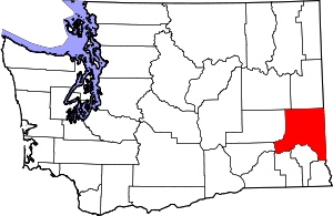 Map of Washington highlighting Whitman County | |
| Towns | ||
| CDP | ||
| Other unincorporated communities | ||
| Ghost towns | ||