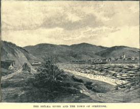
Sretensk
Sretensk (Russian: Сретенск, IPA: [ˈsrʲetʲɪnsk]) is a town and the administrative center of Sretensky District in Zabaykalsky Krai, Russia, located on the right bank of the Shilka River (Amur basin), 385 kilometers (239 mi) east of Chita, the administrative center of the krai. Population: 6,850 (2010 Census);[2] 8,192 (2002 Census);[9] 10,445 (1989 Census).[10]
Sretensk Сретенск | |
|---|---|
Town[1] | |
.png) Flag _(2011).png) Coat of arms | |
Location of Sretensk 
| |
 Sretensk Location of Sretensk  Sretensk Sretensk (Zabaykalsky Krai) | |
| Coordinates: 52°15′N 117°43′E | |
| Country | Russia |
| Federal subject | Zabaykalsky Krai[1] |
| Administrative district | Sretensky District[1] |
| Founded | 1689 |
| Town status since | 1926 |
| Area | |
| • Total | 36 km2 (14 sq mi) |
| Elevation | 490 m (1,610 ft) |
| Population | |
| • Total | 6,850 |
| • Estimate (2018)[3] | 6,581 (-3.9%) |
| • Density | 190/km2 (490/sq mi) |
| • Capital of | Sretensky District[1] |
| • Municipal district | Sretensky Municipal District[4] |
| • Urban settlement | Sretenskoye Urban Settlement[4] |
| • Capital of | Sretensky Municipal District[5], Sretenskoye Urban Settlement[6] |
| Time zone | UTC+9 (MSK+6 |
| Postal code(s)[8] | 673500, 673504 |
| OKTMO ID | 76640101001 |
History
It was founded in 1689 and granted town status in 1926. Between October 1914 and 1921, it accommodated the Sretensk prisoner of war camp.
Administrative and municipal status
Within the framework of administrative divisions, Sretensk serves as the administrative center of Sretensky District, to which it is directly subordinated.[1] As a municipal division, the town of Sretensk, together with one rural locality (the selo of Morgul), is incorporated within Sretensky Municipal District as Sretenskoye Urban Settlement.[4]
Transportation
The P426 road leads west to Nerchinsk. The P429 road leads west to Shelopugino, Gazimursky Zavod, Nerchinsky Zavod, and eventually to the border with China.
Climate
Sretensk has a very continental subarctic climate (Köppen climate classification Dwc) bordering closely on a humid continental climate (Köppen climate classification Dwb), with severely cold winters and warm summers. Precipitation is quite low but is much higher in summer than at other times of the year.
| Climate data for Sretensk | |||||||||||||
|---|---|---|---|---|---|---|---|---|---|---|---|---|---|
| Month | Jan | Feb | Mar | Apr | May | Jun | Jul | Aug | Sep | Oct | Nov | Dec | Year |
| Record high °C (°F) | 0.2 (32.4) |
3.1 (37.6) |
18.4 (65.1) |
27.3 (81.1) |
33.6 (92.5) |
41.3 (106.3) |
39.7 (103.5) |
36.7 (98.1) |
31.4 (88.5) |
26.7 (80.1) |
11.7 (53.1) |
2.6 (36.7) |
41.3 (106.3) |
| Average high °C (°F) | −22.9 (−9.2) |
−15.2 (4.6) |
−3.7 (25.3) |
8.4 (47.1) |
17.8 (64.0) |
24.5 (76.1) |
26.2 (79.2) |
23.4 (74.1) |
16.6 (61.9) |
6.6 (43.9) |
−9.2 (15.4) |
−21.0 (−5.8) |
4.3 (39.7) |
| Daily mean °C (°F) | −29.2 (−20.6) |
−23.6 (−10.5) |
−12.2 (10.0) |
1.2 (34.2) |
9.8 (49.6) |
16.5 (61.7) |
19.1 (66.4) |
16.3 (61.3) |
8.8 (47.8) |
−0.8 (30.6) |
−15.8 (3.6) |
−26.7 (−16.1) |
−3.0 (26.6) |
| Average low °C (°F) | −34.6 (−30.3) |
−30.7 (−23.3) |
−20.2 (−4.4) |
−5.7 (21.7) |
2.0 (35.6) |
9.0 (48.2) |
13.1 (55.6) |
10.7 (51.3) |
2.8 (37.0) |
−6.7 (19.9) |
−21.3 (−6.3) |
−31.8 (−25.2) |
−9.4 (15.1) |
| Record low °C (°F) | −50.7 (−59.3) |
−48.6 (−55.5) |
−40.0 (−40.0) |
−24.7 (−12.5) |
−10.2 (13.6) |
−4.0 (24.8) |
0.6 (33.1) |
−2.6 (27.3) |
−12.5 (9.5) |
−29.3 (−20.7) |
−41.1 (−42.0) |
−48.4 (−55.1) |
−50.7 (−59.3) |
| Average precipitation mm (inches) | 3.7 (0.15) |
3.2 (0.13) |
4.7 (0.19) |
12.7 (0.50) |
27.0 (1.06) |
54.9 (2.16) |
97.2 (3.83) |
84.1 (3.31) |
41.9 (1.65) |
12.0 (0.47) |
8.2 (0.32) |
6.2 (0.24) |
355.8 (14.01) |
| Average precipitation days (≥ 0.1 mm) | 6.0 | 4.5 | 4.3 | 5.4 | 7.3 | 11.3 | 14.2 | 13.4 | 9.4 | 5.3 | 7.1 | 8.1 | 96.3 |
| Average relative humidity (%) | 73.4 | 69.3 | 60.0 | 46.8 | 46.6 | 60.4 | 68.6 | 71.4 | 66.3 | 61.5 | 71.2 | 75.1 | 64.2 |
| Mean monthly sunshine hours | 151 | 191 | 246 | 235 | 262 | 261 | 242 | 211 | 193 | 195 | 150 | 120 | 2,457 |
| Source: climatebase.ru (1936-2012)[11] June record high)[12] | |||||||||||||
References
Notes
- Registry of the Administrative-Territorial Units and the Inhabited Localities of Zabaykalsky Krai
- Russian Federal State Statistics Service (2011). "Всероссийская перепись населения 2010 года. Том 1" [2010 All-Russian Population Census, vol. 1]. Всероссийская перепись населения 2010 года [2010 All-Russia Population Census] (in Russian). Federal State Statistics Service.
- "26. Численность постоянного населения Российской Федерации по муниципальным образованиям на 1 января 2018 года". Federal State Statistics Service. Retrieved January 23, 2019.
- Law #317-ZZK
- Law #316-ZZK
- Федеральная служба государственной статистики. Федеральное агентство по технологическому регулированию и метрологии. №ОК 033-2013 1 января 2014 г. «Общероссийский классификатор территорий муниципальных образований. Код 76 640 101». (Federal State Statistics Service. Federal Agency on Technological Regulation and Metrology. #OK 033-2013 January 1, 2014 Russian Classification of Territories of Municipal Formations. Code 76 640 101. ).
- "Об исчислении времени". Официальный интернет-портал правовой информации (in Russian). June 3, 2011. Retrieved January 19, 2019.
- Почта России. Информационно-вычислительный центр ОАСУ РПО. (Russian Post). Поиск объектов почтовой связи (Postal Objects Search) (in Russian)
- Russian Federal State Statistics Service (May 21, 2004). "Численность населения России, субъектов Российской Федерации в составе федеральных округов, районов, городских поселений, сельских населённых пунктов – районных центров и сельских населённых пунктов с населением 3 тысячи и более человек" [Population of Russia, Its Federal Districts, Federal Subjects, Districts, Urban Localities, Rural Localities—Administrative Centers, and Rural Localities with Population of Over 3,000] (XLS). Всероссийская перепись населения 2002 года [All-Russia Population Census of 2002] (in Russian).
- "Всесоюзная перепись населения 1989 г. Численность наличного населения союзных и автономных республик, автономных областей и округов, краёв, областей, районов, городских поселений и сёл-райцентров" [All Union Population Census of 1989: Present Population of Union and Autonomous Republics, Autonomous Oblasts and Okrugs, Krais, Oblasts, Districts, Urban Settlements, and Villages Serving as District Administrative Centers]. Всесоюзная перепись населения 1989 года [All-Union Population Census of 1989] (in Russian). Институт демографии Национального исследовательского университета: Высшая школа экономики [Institute of Demography at the National Research University: Higher School of Economics]. 1989 – via Demoscope Weekly.
- "Sretensk, Russia". Climatebase.ru. Retrieved January 24, 2013.
- . Climatebase.ru http://climatebase.ru/station/30777/from2000/?lang=en. Retrieved January 24, 2013. Missing or empty
|title=(help)
Sources
- Министерство территориального развития Забайкальского края. 1 января 2014 г. «Реестр административно-территориальных единиц и населённых пунктов Забайкальского края», в ред. Распоряжения №209-р от 10 июня 2014 г.. (Ministry of the Territorial Development of Zabaykalsky Krai. January 1, 2014 Registry of the Administrative-Territorial Units and the Inhabited Localities of Zabaykalsky Krai, as amended by the Directive #209-r of June 10, 2014. ).
- Законодательное Собрание Забайкальского края. Закон №317-ЗЗК от 18 декабря 2009 г. «О границах сельских и городских поселений Забайкальского края», в ред. Закона №1070-ЗЗК от 31 октября 2014 г. «О внесении изменений в Закон Забайкальского края "О границах сельских и городских поселений Забайкальского края"». Вступил в силу через десять дней после дня официального опубликования. Опубликован: "Забайкальский рабочий", №239–242, 21 декабря 2009 г. (Legislative Assembly of Zabaykalsky Krai. Law #317-ZZK of December 18, 2009 On the Borders of the Rural and Urban Settlements of Zabaykalsky Krai, as amended by the Law #1070-ZZK of October 31, 2014 On Amending the Law of Zabaykalsky Krai "On the Borders of the Rural and Urban Settlements of Zabaykalsky Krai". Effective as of the day which is ten days after the day of the official publication.).
- Законодательное Собрание Забайкальского края. Закон №316-ЗЗК от 18 декабря 2009 г. «О границах муниципальных районов и городских округов Забайкальского края», в ред. Закона №770-ЗЗК от 26 декабря 2012 г. «О внесении изменений в Закон Забайкальского края "О границах муниципальных районов и городских округов Забайкальского края"». Вступил в силу через десять дней после дня официального опубликования. Опубликован: "Забайкальский рабочий", №239–242, 21 декабря 2009 г. (Legislative Assembly of Zabaykalsky Krai. Law #316-ZZK of December 18, 2009 On the Borders of the Municipal Districts and Urban Okrugs of Zabaykalsky Krai, as amended by the Law #770-ZZK of December 26, 2012 On Amending the Law of Zabaykalsky Krai "On the Borders of the Municipal Districts and Urban Okrugs of Zabaykalsky Krai". Effective as of the day which is ten days after the day of the official publication.).