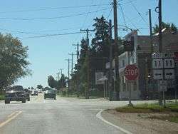
Spring Prairie, Wisconsin
Spring Prairie is a town in Walworth County, Wisconsin, United States. The population was 2,089 at the 2000 census. The unincorporated communities of Honey Creek, Spring Prairie, and Voree are located in Spring Prairie. The unincorporated community of Honey Lake is located partially in Spring Prairie.
Spring Prairie, Wisconsin | |
|---|---|
 | |
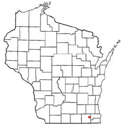 Location of Spring Prairie, Wisconsin | |
| Coordinates: 42°43′1″N 88°21′34″W | |
| Country | |
| State | |
| County | Walworth |
| Area | |
| • Total | 35.8 sq mi (92.8 km2) |
| • Land | 35.7 sq mi (92.6 km2) |
| • Water | 0.1 sq mi (0.2 km2) |
| Elevation | 909 ft (277 m) |
| Population (2000) | |
| • Total | 2,089 |
| • Density | 58.4/sq mi (22.6/km2) |
| Time zone | UTC-6 (Central (CST)) |
| • Summer (DST) | UTC-5 (CDT) |
| Area code(s) | 262 |
| FIPS code | 55-76175[2] |
| GNIS feature ID | 1584200[1] |
| Website | http://www.springprairiewi.com |
History
Spring Prairie was originally called "Franklin." The name was changed when an early settler suggested naming the settlement after the natural springs that discharged into Spring Brook, a branch of Sugar Creek.[3]
Geography
According to the United States Census Bureau, the town has a total area of 35.8 square miles (92.8 km²), of which, 35.8 square miles (92.6 km²) of it is land and 0.1 square miles (0.2 km²) of it (0.22%) is water.
Demographics
At the 2000 census there were 2,089 people in 726 households, including 590 families, in the town. The population density was 58.4 people per square mile (22.6/km²). There were 765 housing units at an average density of 21.4 per square mile (8.3/km²). The racial makeup of the town was 97.75% White, 0.81% African American, 0.38% Native American, 0.19% Asian, 0.14% from other races, and 0.72% from two or more races. Hispanic or Latino of any race were 1.39%.[2]
Of the 726 households 37.3% had children under the age of 18 living with them, 71.8% were married couples living together, 5.1% had a female householder with no husband present, and 18.6% were non-families. 13.9% of households were one person and 4.5% were one person aged 65 or older. The average household size was 2.88 and the average family size was 3.18.
The age distribution was 27.0% under the age of 18, 7.4% from 18 to 24, 28.5% from 25 to 44, 28.5% from 45 to 64, and 8.6% 65 or older. The median age was 39 years. For every 100 females, there were 104.0 males. For every 100 females age 18 and over, there were 105.4 males.
The median household income was $59,583 and the median family income was $61,563. Males had a median income of $43,355 versus $25,938 for females. The per capita income for the town was $22,471. About 1.9% of families and 3.1% of the population were below the poverty line, including 2.7% of those under age 18 and 3.5% of those age 65 or over.
Notable people
- John Bell, legislator
- Henry Allen Cooper, U.S. Representative
- Walter G. Derthick, legislator
- Orris Pratt, farmer and legislator
- Samuel Pratt, farmer and legislator
- Christian Keyser Preus, educator and Lutheran minister
- Herman Amberg Preus, President of the Synod of the Norwegian Evangelical Lutheran Church in America
- Rollin D. Salisbury, geologist
- Jacob Hamblin, explorer, missionary, peacemaker to the Indians of the Southwestern United States
References
- "US Board on Geographic Names". United States Geological Survey. 2007-10-25. Retrieved 2008-01-31.
- "U.S. Census website". United States Census Bureau. Retrieved 2008-01-31.
- Walworth County Historical Society. Romance of Walworth County Place names
Municipalities and communities of Walworth County, Wisconsin, United States | ||
|---|---|---|
| Cities | 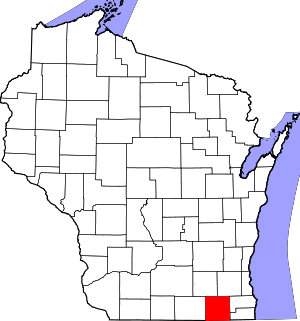 | |
| Villages | ||
| Towns | ||
| CDPs | ||
| Unincorporated communities |
| |
| Ghost towns/neighborhoods | ||
| Footnotes | ‡This populated place also has portions in an adjacent county or counties | |