Spring Hill, Tennessee
Spring Hill is a city in Maury and Williamson counties, Tennessee, located approximately 30 miles (48 km) south of Nashville. Spring Hill's population as of 2019 was 43,769.[7] Spring Hill is included in the Nashville metropolitan area.
Spring Hill, Tennessee | |
|---|---|
 Spring Hill City Hall, December 2013. | |
 Flag | |
| Motto(s): "A blend of Commerce, History and Country Living"[1] | |
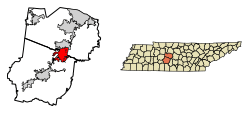 Location of Spring Hill in Williamson And Maury County Tennessee. | |
| Coordinates: 35°45′9″N 86°54′50″W | |
| Country | United States |
| State | Tennessee |
| Counties | Williamson, Maury |
| City | 1808 |
| Government | |
| • Type | City |
| • Mayor | Rick Graham[2] |
| Area | |
| • Total | 26.83 sq mi (69.50 km2) |
| • Land | 26.79 sq mi (69.38 km2) |
| • Water | 0.05 sq mi (0.12 km2) |
| Elevation | 751 ft (229 m) |
| Population (2010) | |
| • Total | 29,036 |
| • Estimate (2019)[4] | 43,769 |
| • Density | 1,547.97/sq mi (597.67/km2) |
| Time zone | UTC-6 (Central (CST)) |
| • Summer (DST) | UTC-5 (CDT) |
| ZIP code | 37174 |
| Area code(s) | 931 615 |
| FIPS code | 47-70580[5] |
| GNIS feature ID | 1303764[6] |
| Website | www |
History
The first settlers of Spring Hill arrived in 1808 and the city was established in 1809.[8] Albert Russell was the first person to build a home on the land that became Spring Hill.
Spring Hill was the site of a Civil War battle, now known as the Battle of Spring Hill, on November 29, 1864.
Later, Spring Hill was the home of a preparatory school, Branham and Hughes Military Academy, the campus of which now serves as the main campus of Tennessee Children's Home, a ministry associated with the Churches of Christ.
Geography
Spring Hill is located at 35°45′9″N 86°54′50″W (35.752556, -86.914021).[9]
According to the United States Census Bureau, the city has a total area of 17.7 square miles (45.9 km²), of which 17.7 square miles (45.9 km²) is land and 0.04 square mile (0.1 km²) (0.17%) is water.
The official main street of Spring Hill is also called US Highway 31, Columbia Pike or Nashville Highway.
Demographics
| Historical population | |||
|---|---|---|---|
| Census | Pop. | %± | |
| 1880 | 400 | — | |
| 1910 | 695 | — | |
| 1920 | 403 | −42.0% | |
| 1930 | 416 | 3.2% | |
| 1940 | 543 | 30.5% | |
| 1950 | 541 | −0.4% | |
| 1960 | 689 | 27.4% | |
| 1970 | 685 | −0.6% | |
| 1980 | 989 | 44.4% | |
| 1990 | 1,464 | 48.0% | |
| 2000 | 7,715 | 427.0% | |
| 2010 | 29,036 | 276.4% | |
| Est. 2019 | 43,769 | [4] | 50.7% |
| Sources:[10][11] | |||
2010 census
As of the 2010 United States Census,[12] there were 29,036 people, 9,861 households, and 7,884 families living in the city. The population density was 1,640.45 persons per square mile and the housing unit density was 557.12 units per square mile. The racial makeup of the city was 89.14% White, 5.39% Black or African American, 1.64% Asian, 0.24% Native American, 0.17% Pacific Islander, 1.53% from other races, and 1.90% from two or more races. Those of Hispanic or Latino origins were 5.65% of the population.
Of the 9,861 households, 50.34% had children under the age of 18 living in them, 67.26% were married couples living together, 2.80% had a male householder with no wife present, 9.89% had a female householder with no husband present, and 20.05% were non-families. 16.49% of all households were made up of individuals and 3.26% had someone living alone who was 65 years of age or older. The average household size was 2.94 and the average family size was 3.33.
Of the 29,036 residents, 33.89% were under the age of 18, 61.08% were between the ages of 18 and 64, and 5.02% were 65 years of age or older. The median age was 31.9 years. 51.46% of the residents were female, and 48.54% were male.
The median household income in the city was $72,744 and the median family income was $78,125. Males had a median income of $54,905 versus $42,216 for females. The per capita income for the city was $27,709. About 2.8% of families and 3.6% of the population were below the poverty line, including 4.4% of those under the age of 18 and 2.9% of those age 65 and over.
2000 census
As of the 2000 census,[6] there were 7,715 people, 2,634 households and 2,159 families living in the city. The population density was 435.6 people per square mile (168.2/km²). There were 2,819 housing units at an average density of 159.2 per square mile (61.5/km²). The racial makeup of the city was 88.33% White, 7.80% African American, 0.32% Native American, 0.49% Asian, 0.06% Pacific Islander, 1.81% from other races and 1.17% from two or more races. Hispanic or Latino of any race were 3.98% of the population.
There were 2,634 households out of which 50.3% had children under the age of 18 living with them, 72.3% were married couples living together, 6.9% had a female householder with no husband present and 18.0% were non-families. 14.7% of all households were made up of individuals and 2.8% had someone living alone who was 65 years of age or older. The average household size was 2.90 and the average family size was 3.24.
In the city, the population was spread out with 32.8% under the age of 18, 6.4% from 18 to 24, 42.0% from 25 to 44, 15.2% from 45 to 64 and 3.6% who were 65 years of age or older. The median age was 30 years. For every 100 females, there were 100.2 males. For every 100 females age 18 and over, there were 98.4 males.
The median income for a household in the city was $60,872 and the median income for a family was $62,643. Males had a median income of $50,819 versus $29,821 for females. The per capita income for the city was $21,688. About 3.1% of families and 4.0% of the population were below the poverty line, including 5.0% of those under age 18 and 8.3% of those age 65 or over.
Recent growth
The population was 7,715 at the 2000 census. Rapid growth has taken place in recent years with a population of 23,462 in 2007[13] and a 2010 census population of 29,036 and a population of 31,140 in 2012. In 2018, Spring Hill officially hit 40,000 residents.
Development
In November, 2015, the Spring Hill Board of Mayor and Aldermen approved the ‘Spring Hill Rising: 2040’ comprehensive plan. The plan outlines the city's long-term development vision and ways to accomplish that vision.[14]
In 2016, the city hired Chicago-based planning and zoning consultant, Camiros Ltd, to oversee the creation of a new zoning code to implement the vision described in ‘Spring Hill Rising: 2040’. The resulting 'Spring Hill Unified Development Code' (UDC), updates the previous code created in 1987.[15]
The number of building permits issued has steadily climbed since a sharp decline that started in 2007 and hit a low in 2009. In 2017, permits were issued at a rate of 2.2 per day totaling 812 for the year. 2018 is on pace to match the previous year.[16]
Economy
Spring Hill was the site of the Saturn Corporation production facility, which operated from 1990 to 2007. The Saturn S-Series, Saturn ION, and Saturn VUE were produced there. In 2007, General Motors Corporation (GM), the parent company of Saturn, shut down the facility to retool it for production of other GM vehicles and renamed it Spring Hill Manufacturing. The plant reopened in February 2008 and became the assembly point for the new Chevrolet Traverse. However, after a battle among plants in Spring Hill, Orion Township, Michigan and Janesville, Wisconsin, GM announced on June 26, 2009 that they had chosen to build a new small car in Orion Township.[17] Nearly 2,500 Spring Hill auto workers were faced with lay-off, buy-out and early retirement.[18] The vehicle assembly part of the Spring Hill plant was idled in late 2009 when production of the Traverse was moved to Lansing, Michigan, while production of power trains and metal stamping continued.[19][20][21] In November 2011, GM announced plans for retooling of the vehicle assembly portion of the plant for use as an "ultra-flexible" plant which will initially be used to build the Chevy Equinox and GMC Terrain but will be designed for rapid retooling to other vehicles of similar size.[22][23][24]
Spring Hill has gone through rapid development and growth in recent years, causing General Motors to reopen their auto plant and begin hiring locally again, which will hire 1,000 new people.[25] In Addition to this, companies such as Ryder and Goodwill have announced new facilities in the Spring Hill area. Mars, Inc. has opened a facility in nearby Thompson's Station, TN.
Arts and culture
Attractions

Rippavilla Plantation, which is located at 5700 Main Street (TN-31, Columbia Pike, or Nashville Hwy), offers educational activities and an annual corn maze among other attractions.
Education
Schools in Maury County
- Columbia Academy (Private)
- Marvin Wright Elementary School (Public)
- Spring Hill Elementary School (Public)
- Spring Hill High School (Public)
- Spring Hill Middle School (Public)
Schools in Williamson County
- Allendale Elementary (Public)
- Bethesda Elementary (Public)
- Chapmans Retreat Elementary (Public)
- Heritage Elementary (Public)
- Heritage Middle (Public)
- Hillsboro Elementary/Middle (Public)
- Independence High (Public)
- Longview Elementary (Public)
- Spring Hill Academy (Private)
- Spring Station Middle (Public)
- Summit High (Public)
- Thompson's Station Elementary (Public)
- Thompson's Station Middle (Public)
Libraries
References
- "City of Spring Hill, Tennessee". City of Spring Hill, Tennessee. Retrieved August 14, 2012.
- springhilltn.org
- "2018 U.S. Gazetteer Files". United States Census Bureau. Retrieved February 23, 2020.
- "Population and Housing Unit Estimates". Retrieved May 21, 2020.
- "U.S. Census website". United States Census Bureau. Retrieved January 31, 2008.
- "US Board on Geographic Names". United States Geological Survey. October 25, 2007. Retrieved January 31, 2008.
- "Spring Hill city, Tennessee". quickfacts.census.gov. United States Census Bureau). 2018. Retrieved December 29, 2019.
- "City Town Info - Info on U.S. Cities, Careers, Schools & Colleges". www.citytowninfo.com.
- "US Gazetteer files: 2010, 2000, and 1990". United States Census Bureau. February 12, 2011. Retrieved April 23, 2011.
- "Census of Population and Housing: Decennial Censuses". United States Census Bureau. Retrieved March 4, 2012.
- "Incorporated Places and Minor Civil Divisions Datasets: Subcounty Resident Population Estimates: April 1, 2010 to July 1, 2012". Population Estimates. U.S. Census Bureau. Archived from the original on June 11, 2013. Retrieved December 11, 2013.
- "Spring Hill city, Tennessee". United States Census Bureau. 2010. Retrieved December 29, 2019.
- "Archived copy". Archived from the original on June 6, 2009. Retrieved June 18, 2009.CS1 maint: archived copy as title (link)
- Page, Jamie (November 17, 2015). "City of Spring Hill approves newly updated 'Spring Hill Rising: 2040' Comprehensive Plan". City of Spring Hill, TN website. Archived from the original on August 29, 2018.
- "BOMA approves Unified Development Code". August 21, 2018.
- "Spring Hill TN Prepares For Future Development". Live Middle Tennessee. August 28, 2018.
- Bunkley, Nick. "G.M. Picks Michigan to Build Small Car." NY Times. June 26, 2009. Retrieved on June 26, 2009.
- Johnson, Bonna. "GM picks Michigan over Spring Hill." The Tennessean. June 26, 2009. Retrieved on June 26, 2009.
- "GM Investing $483 Million at Tennessee Engine Plant". American Machinist. September 20, 2010. Archived from the original on July 18, 2012.
- "Spring Hill Manufacturing". GM News. General Motors. Archived from the original on July 20, 2012. Retrieved March 5, 2012.
- "Buick's Ecotec 2.0L Turbo Makes Best Engines List". Chevrolet Media Europe. General Motors. Retrieved March 5, 2012.
- Bunkley, Nick (November 21, 2011). "Ex-Saturn Plant to Reopen, And G.M. to Add 700 Jobs". New York Times. Retrieved March 5, 2012.
- "Spring Hill Assembly Reborn as Ultra-Flexible Operation". General Motors. Retrieved March 5, 2012.
- Bowman, Zach. "Senator Corker Heckled At GM Spring Hill". Autoblog. AOL. Retrieved March 5, 2012.
- Melissa Burden (October 13, 2015). "GM to begin taking applications to work at Spring Hill". detroitnews.com.
External links
- City of Spring Hill Official Website
- The Battle of Spring Hill, Tennessee by John K. Shellenberger
Municipalities and communities of Maury County, Tennessee, United States | ||
|---|---|---|
| Cities | Maury County map | |
| CDPs | ||
| Unincorporated communities | ||
| Footnotes | ‡This populated place also has portions in an adjacent county or counties | |
Municipalities and communities of Williamson County, Tennessee, United States | ||
|---|---|---|
| Cities | Williamson County map | |
| Towns | ||
| Unincorporated communities | ||
| Footnotes | ‡This populated place also has portions in an adjacent county or counties | |
| Authority control |
|
|---|