Spice Valley Township, Lawrence County, Indiana
Spice Valley Township is one of nine townships in Lawrence County, Indiana, United States. As of the 2010 census, its population was 2,423 and it contained 1,137 housing units.[2]
Spice Valley Township | |
|---|---|
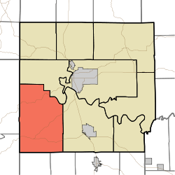 Location in Lawrence County | |
| Coordinates: 38°45′11″N 86°37′29″W | |
| Country | |
| State | |
| County | Lawrence |
| Government | |
| • Type | Indiana township |
| • Trustee | Michelle Cornett[1] |
| Area | |
| • Total | 71.25 sq mi (184.5 km2) |
| • Land | 70.34 sq mi (182.2 km2) |
| • Water | 0.91 sq mi (2.4 km2) 1.28% |
| Elevation | 650 ft (198 m) |
| Population (2010) | |
| • Total | 2,423 |
| • Density | 34.4/sq mi (13.3/km2) |
| ZIP codes | 47421, 47446, 47452, 47470 |
| GNIS feature ID | 0453863 |
History
The Williams Bridge was listed in the National Register of Historic Places in 1981.[3]
Geography
According to the 2010 census, the township has a total area of 71.25 square miles (184.5 km2), of which 70.34 square miles (182.2 km2) (or 98.72%) is land and 0.91 square miles (2.4 km2) (or 1.28%) is water.[2]
Unincorporated towns
- Bryantsville at 38.768662°N 86.57305°W
- Georgia at 38.710052°N 86.572215°W
- Huron at 38.722273°N 86.670552°W
- Moorestown at 38.718663°N 86.615828°W
- Williams at 38.804495°N 86.647219°W
(This list is based on USGS data and may include former settlements.)
Cemeteries
The township contains these eight cemeteries: Brunner, Bryantsville, Burton, Cox, Georgia, Grodey, Huron and Tincher.
Major highways
Lakes
- Half Moon Lake
Education
- Mitchell Community Schools
- North Lawrence Community Schools
Spice Valley Township residents may obtain a free library card from the Mitchell Community Public Library in Mitchell.[4]
Political districts
- Indiana's 4th congressional district
- State House District 62
- State Senate District 44
References
- "Spice Valley Township, Lawrence County, Indiana". Geographic Names Information System. United States Geological Survey. Retrieved 2009-10-08.
- United States Census Bureau 2008 TIGER/Line Shapefiles
- IndianaMap
- https://lawrencecounty.in.gov/government/township-trustees
- "Population, Housing Units, Area, and Density: 2010 - County -- County Subdivision and Place -- 2010 Census Summary File 1". United States Census. Archived from the original on 2020-02-12. Retrieved 2013-05-10.
- "National Register Information System". National Register of Historic Places. National Park Service. July 9, 2010.
- "Get a card". Mitchell Community Public Library. Retrieved 10 March 2018.
External links
- Indiana Township Association
- United Township Association of Indiana
- City-Data.com page for Spice Valley Township
Places adjacent to Spice Valley Township, Lawrence County, Indiana | |
|---|---|
Municipalities and communities of Lawrence County, Indiana, United States | ||
|---|---|---|
| Cities | Map of Indiana highlighting Lawrence County | |
| Town | ||
| Townships | ||
| CDPs | ||
| Unincorporated communities |
| |
| Former communities | ||