Spanish Bay (Nova Scotia)
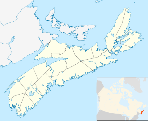
Spanish Bay [1] is a bay in the Canadian province of Nova Scotia. It is located on the Atlantic coast of Cape Breton Island at the mouth of Sydney Harbour, which forms part of Spanish Bay.[2] The current name for the bay, "Spanish Bay" (sometimes "Spanish Harbour", "Spaniards Bay" or "Port aux Espagnols") appears on maps of the area at least as far back as 1708.[3][4][5]
.jpg)
| Spanish Bay | |
|---|---|
_1.jpg) | |
 Spanish Bay Spanish Bay in Nova Scotia  Spanish Bay Spanish Bay (Canada) | |
| Location | Cape Breton Island, Nova Scotia |
| Coordinates | 46°16′45″N 60°12′42″W |
| Type | Bay |
| Part of | Cabot Strait |
| River sources | Sydney River, Balls Creek, Leitches Creek |
| Ocean/sea sources | Gulf of Saint Lawrence, Atlantic ocean |
| Basin countries | Canada |
| Max. width | 7 nautical miles (13 km; 8.1 mi) |
| Settlements | Cape Breton Regional Municipality
From west to east: |
| References | Geographical Names of Canada - Spanish Bay |
Description
Spanish Bay opens to the north-west directly onto the southern terminus of the Cabot Strait and so to the Gulf of Saint Lawrence. The bay measures approximately 7 nautical miles (13 km; 8.1 mi) wide at its mouth, between Alder Point on Boularderie Island to the north-west, and Low Point on Cape Breton Island to the south-east.
The bay's shores are mostly bold & rocky with numerous prominent headlands including Point Aconi, High Cape, Alder Point, Merritt Point, Bonar Head, Oxford Point, Black Point, Cranberry Point, McGillivray Point and Petries Point, although there is a 0.75 kilometres (0.47 mi) sandy beach at Florence Beach (Big Pond Beach) and a popular swimming beach at Polar Bear, just to the north of South Bar.
Communities
Communities along the shoreline of Spanish Bay include (from northwest to south to northeast):
See also
References
- "Geographical Names of Canada - Spanish Bay". Retrieved 5 June 2018.
- "Nova Scotia Geographical Names Database entry for "Spanish Bay, County of Cape Breton" (includes map)". Government of Nova Scotia. Retrieved 9 May 2020.
- "A new map of Nova Scotia and Cape Britain, with the adjacent parts of New England and Canada, composed from a great number of actual surveys, and other materials regulated by many new astronomical observations of the longitude as well as latitude - David Rumsey Historical Map Collection (includes map)". Thomas Jefferys, London, 1755. Retrieved April 8, 2012.
- "A new & accurate map of the islands of Newfoundland, Cape Briton, St. John and Anticosta; together with the neighbouring countries of Nova Scotia, Canada &c. Drawn from the most approved modern maps and charts, and regulated by astronl. observatns. - David Rumsey Historical Map Collection (includes map)". William Innys [et al.], London, 1747. Retrieved April 8, 2012.
- "Carte du Canada ou de la Nouvelle France et des decouvertes que y ont ete faites. Dressee sur plusieurs observations et sur un grand nombre de relations imprimees ou manuscrites. Par Guillaume Del'Isle, Geographe de l'Academie Royale des Sciences. A Paris - David Rumsey Historical Map Collection (includes map)". Guillaume DeLisle, Quai de l'Horloge a l'Aigle d'Or, Paris, 1708. Retrieved April 8, 2012.
- Notes
- Nautical chart #4266 SYDNEY HARBOUR, published by Canadian Hydrographic Service, 28 February 2014
- Nautical chart #4367 FLINT ISLAND TO / À CAPE SMOKEY, published by Canadian Hydrographic Service, 3 April 2003