Southside, Independence County, Arkansas
Southside is an incorporated city located in Independence County, Arkansas, United States.
Southside, Arkansas | |
|---|---|
 Location of Southside in Independence County, Arkansas. | |
| Country | United States |
| State | Arkansas |
| County | Independence |
| Incorporated | 2014 |
| Government | |
| Area | |
| • Total | 9.82 sq mi (25.44 km2) |
| • Land | 9.82 sq mi (25.43 km2) |
| • Water | 0.00 sq mi (0.01 km2) |
| Population (2010) | |
| • Total | 102 |
| • Estimate (2017)[2] | 3,954 |
| • Density | 402.65/sq mi (155.46/km2) |
| Time zone | UTC-6 (CST) |
| • Summer (DST) | UTC-5 (CDT) |
| FIPS code | 05-65630 [3] |
The elevation of Southside is 354 feet (108 m).[4]
The spur route of Arkansas Highway 14 connects Southside with Salado.[5]
History
Southside was incorporated on October 29, 2014.
Education
Students in Southside can go to Southside School District or Batesville School District, Arkansas.
References
- "2017 U.S. Gazetteer Files". United States Census Bureau. Retrieved Aug 22, 2018.
- "Population and Housing Unit Estimates". Retrieved March 24, 2018.
- "Feature ID 68757: Township of Barren (Independence County, Arkansas)". Geographic Names Information System. United States Geological Survey. Retrieved May 31, 2014.
- "Southside". Geographic Names Information System. United States Geological Survey. 30 Apr 1980. Retrieved 2009-07-11.
- https://www.arkansashighways.com/maps/Counties/County%20PDFs/IndependenceCounty.pdf
External links
Municipalities and communities of Independence County, Arkansas, United States | ||
|---|---|---|
| Cities | 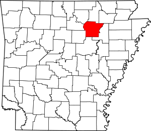 Map of Arkansas highlighting Independence County | |
| Towns | ||
| Unincorporated communities | ||
| Footnotes | ‡This populated place also has portions in an adjacent county or counties | |
This article is issued from Wikipedia. The text is licensed under Creative Commons - Attribution - Sharealike. Additional terms may apply for the media files.