South Kings Peak
South Kings Peak is the second highest peak in Utah, United States[2] with an elevation of 13,518 feet (4,120 m).[1] It lies just south of the spine of the central Uinta Mountains, in the Ashley National Forest in northeastern Utah, in north-central Duchesne County. It lies within the boundaries of the High Uintas Wilderness.
| South Kings Peak | |
|---|---|
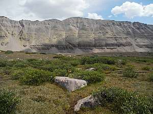 South Kings Peak viewed from the west | |
| Highest point | |
| Elevation | 13,518 ft (4,120 m) NAVD 88[1] |
| Prominence | 352 ft (107 m) [2] |
| Coordinates | 40°45′57″N 110°22′40″W [1] |
| Geography | |
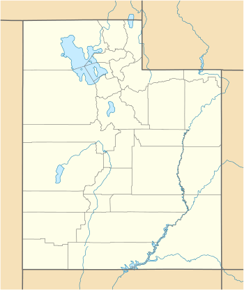 South Kings Peak Location in Utah | |
| Location | Duchesne County, Utah, U.S. |
| Parent range | Uinta Mountains |
| Topo map | USGS Mount Powell |
See also

- Kings Peak
References
- "Kings Peak Target". NGS data sheet. U.S. National Geodetic Survey. Retrieved 2016-04-22.
- "South Kings Peak, Utah". Peakbagger.com. Retrieved 2016-04-22.
External links
| Wikimedia Commons has media related to South Kings Peak (Utah). |
- "South Kings Peak". Geographic Names Information System. United States Geological Survey.
- "South Kings Peak". SummitPost.org.
This article is issued from Wikipedia. The text is licensed under Creative Commons - Attribution - Sharealike. Additional terms may apply for the media files.