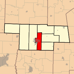
South Fork Township, Audrain County, Missouri
South Fork Township is one of eight townships in Audrain County, Missouri, United States. As of the 2010 census, its population was 5,431.[3]
South Fork Township | |
|---|---|
 | |
| Coordinates: 39°10′11″N 091°51′40″W | |
| Country | United States |
| State | Missouri |
| County | Audrain |
| Area | |
| • Total | 46.34 sq mi (120.03 km2) |
| • Land | 45.48 sq mi (117.78 km2) |
| • Water | 0.87 sq mi (2.25 km2) 1.87% |
| Elevation | 751 ft (229 m) |
| Population (2010) | |
| • Total | 5,431 |
| • Density | 119/sq mi (46.1/km2) |
| FIPS code | 29-68744[2] |
| GNIS feature ID | 0766247 |
Geography
South Fork Township covers an area of 46.3 square miles (120.0 km2) and contains one incorporated settlement, Vandiver. It contains three cemeteries: East Lawn Memorial, Lockridge and New Hope.
Blackmore Lake, Teal Lake and Timber Lake are within this township. The streams of Beaverdam Creek, Davis Creek, Elm Branch, Long Branch, Scattering Fork and Youngs Creek run through this township.
Transportation
South Fork Township contains one airport or landing strip, Mexico Memorial Airport.
References
- "US Board on Geographic Names". United States Geological Survey. 2007-10-25. Retrieved 2008-01-31.
- "U.S. Census website". United States Census Bureau. Retrieved 2008-01-31.
- "Geographic Identifiers: 2010 Demographic Profile Data (G001): South Fork township, Audrain County, Missouri". U.S. Census Bureau, American Factfinder. Archived from the original on February 12, 2020. Retrieved June 25, 2013.
External links
Municipalities and communities of Audrain County, Missouri, United States | ||
|---|---|---|
| Cities | 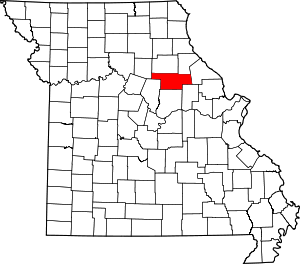 Map of Missouri highlighting Audrain County | |
| Villages | ||
| Townships | ||
| Unincorporated communities | ||
| Ghost town | ||
| Footnotes | ‡This populated place also has portions in an adjacent county or counties | |
This article is issued from Wikipedia. The text is licensed under Creative Commons - Attribution - Sharealike. Additional terms may apply for the media files.