South Carolina Highway 83
South Carolina Highway 83 (SC 83) is a primary state highway in the U.S. state of South Carolina. It connects the communities of eastern Marlboro County with Maxton, North Carolina.
| ||||
|---|---|---|---|---|
 | ||||
| Route information | ||||
| Maintained by SCDOT | ||||
| Length | 4.82 mi[1] (7.76 km) | |||
| Existed | 1938–present | |||
| Major junctions | ||||
| South end | ||||
| North end | ||||
| Location | ||||
| Counties | Marlboro | |||
| Highway system | ||||
| ||||

Route description
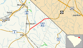
SC 83 is a two-lane rural highway that traverses 4.8 miles (7.7 km) north of Clio at SC 381 to the North Carolina state line where the road continues as North Carolina Highway 83 (NC 83).[2][3]
History
The highway was established in 1938 as a renumbering of SC 68 to match NC 83; no changes have been made since.[4]
Junction list
The entire route is in Marlboro County.
| Location | mi[1] | km | Destinations | Notes | |
|---|---|---|---|---|---|
| | 0.00 | 0.00 | |||
| | 4.82 | 7.76 | North Carolina state line | ||
| 1.000 mi = 1.609 km; 1.000 km = 0.621 mi | |||||
References
- South Carolina Department of Transportation: Statewide Highways 2012. Specifics: . Files: .
- Google (September 5, 2012). "South Carolina Highway 83" (Map). Google Maps. Google. Retrieved September 5, 2012.
- General Highway System - Marlboro County, South Carolina (PDF) (Map). South Carolina Department of Transportation. June 2005. Retrieved September 7, 2013.
- "Mapmikey's South Carolina Highways Page". Retrieved September 5, 2012.
External links

This article is issued from Wikipedia. The text is licensed under Creative Commons - Attribution - Sharealike. Additional terms may apply for the media files.