Sotensko pod Kalobjem
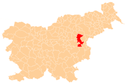
Sotensko pod Kalobjem (pronounced [ˈsoːtɛnskɔ pɔt ˈkaːlɔbjɛm]) is a small settlement in the Municipality of Šentjur in eastern Slovenia. It lies just off the regional road leading south out of Šentjur towards Šentrupert. The area is part of the historical Styria region. The municipality is now included in the Savinja Statistical Region.[2]
Sotensko pod Kalobjem | |
|---|---|
 Sotensko pod Kalobjem Location in Slovenia | |
| Coordinates: 46°11′29.44″N 15°23′27.6″E | |
| Country | |
| Traditional region | Styria |
| Statistical region | Savinja |
| Municipality | Šentjur |
| Area | |
| • Total | 0.5 km2 (0.2 sq mi) |
| Elevation | 309.1 m (1,014.1 ft) |
| Population (2002) | |
| • Total | 34 |
| [1] | |
Name
The name of the settlement was changed from Sotensko to Sotensko pod Kalobjem in 1953.[3]
References
- Statistical Office of the Republic of Slovenia
- Šentjur municipal site Archived 2011-01-15 at the Wayback Machine
- Spremembe naselij 1948–95. 1996. Database. Ljubljana: Geografski inštitut ZRC SAZU, DZS.
External links
This article is issued from Wikipedia. The text is licensed under Creative Commons - Attribution - Sharealike. Additional terms may apply for the media files.