Soso, Mississippi
Soso is a town in Jones County, Mississippi, United States. The population was 408 at the 2010 census.[3]
Soso, Mississippi | |
|---|---|
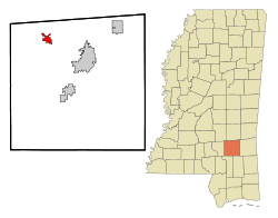 Location of Soso, Mississippi | |
 Soso, Mississippi Location in the United States | |
| Coordinates: 31°45′16″N 89°16′27″W | |
| Country | United States |
| State | Mississippi |
| County | Jones |
| Area | |
| • Total | 2.04 sq mi (5.28 km2) |
| • Land | 2.03 sq mi (5.26 km2) |
| • Water | 0.01 sq mi (0.01 km2) |
| Elevation | 315 ft (96 m) |
| Population (2010) | |
| • Total | 408 |
| • Estimate (2018)[2] | 394 |
| • Density | 196.85/sq mi (76.01/km2) |
| Time zone | UTC-6 (Central (CST)) |
| • Summer (DST) | UTC-5 (CDT) |
| ZIP code | 39480 |
| Area code(s) | 601 |
| FIPS code | 28-69160 |
Paul Davis, a singer and songwriter from Rose Hill, Mississippi, wrote a song called "Sweet Magnolia Blues", which referred to Soso.
History
According to tradition, the name "Soso" was derived from an old settler's common response to a question about how he was doing: "so-so".[4]
After the Civil War, yeoman farmers returned to the area. The town developed a small mixed-race community. Among its notable residents was Unionist Newton Knight, who lived there mostly after the Reconstruction era with his wife Rachel and family. Knight was known for having led the Knight Company in and around Jones County during 1863 and 1864 in resistance to Confederate authorities, trying to protect local farmers. After the war he lived in Jasper County for a time, where he was active in the Republican Party. In 1872 he was appointed as a deputy U.S. Marshal for the Southern District. After Reconstruction ended, Knight retired from politics, as white Democrats took over county and state offices.[5]
Rachel was a freedwoman who had aided the resistance. (In an historic photograph she appears to have been of mixed race.)[5] She and Knight had several children together.
2020 tornado
On April 12, 2020, the town was struck by a large and deadly EF4 tornado. It caused major damage to homes, churches, and the local fire department building. Numerous trees were snapped throughout town, and several mobile homes were destroyed.[6]
Geography
Soso is located in northwestern Jones County at 31°45′16″N 89°16′27″W (31.754465, -89.274120).[7] Mississippi Highway 28 passes through the center of town, leading southeast 5 miles (8 km) to U.S. Route 84 and northwest 10 miles (16 km) to Taylorsville. Laurel, the largest city in Jones County, is 10 miles southeast of Soso via Highways 28 and 84. Mississippi Highway 29 has its northern terminus in Soso and leads south 12 miles (19 km) to Ellisville.
According to the United States Census Bureau, Soso has a total area of 2.1 square miles (5.5 km2), of which 0.004 square miles (0.01 km2), or 0.23%, are water.[3]
Government
Among government and public services, Soso is home to the Soso Volunteer Fire Department, the Soso Police Department, the Soso Town Hall, and the Soso Community Water Service.
Demographics
| Historical population | |||
|---|---|---|---|
| Census | Pop. | %± | |
| 1910 | 162 | — | |
| 1920 | 142 | −12.3% | |
| 1930 | 214 | 50.7% | |
| 1980 | 434 | — | |
| 1990 | 366 | −15.7% | |
| 2000 | 379 | 3.6% | |
| 2010 | 408 | 7.7% | |
| Est. 2018 | 394 | [2] | −3.4% |
| U.S. Decennial Census[8] | |||
At the 2010 census there were 408 people, 160 households, and 116 families in the town. The population density was 189.7 people per square mile (73.2/km²). There were 174 housing units at an average density of 87.1 per square mile (33.6/km²). The racial makeup of the town was 79.2% White, 20.3% African American, and 0.5% from two or more races. Hispanic or Latino of any race were 2.2%.[9]
Of the 157 households 30.6% had children under the age of 18 living with them, 56.3% were married couples living together, 11.3% had a female householder with no husband present, and 27.5% were non-families. 27.5% of households were one person and 12.5% were one person aged 65 or older. The average household size was 2.55 and the average family size was 3.00.
The age distribution was 29.7% under the age of 19, 36.5% under the age of 50 and 33.8% over the age of 50
The data below is from the 2000 census.
The median household income was $29,135 and the median family income was $31,346. Males had a median income of $19,231 versus $22,250 for females. The per capita income for the town was $15,455. About 15.7% of families and 15.0% of the population were below the poverty line, including 25.6% of those under age 18 and 21.3% of those age 65 or over.
Education
Soso is served by the Jones County School District.
Elementary-aged students attend West Jones Elementary School, while middle and high school students attend West Jones Middle and High Schools.
References
- "2017 U.S. Gazetteer Files". United States Census Bureau. Retrieved Jan 6, 2019.
- "Population and Housing Unit Estimates". Retrieved March 27, 2020.
- "Geographic Identifiers: 2010 Census Summary File 1 (G001): Soso town, Mississippi". American Factfinder. U.S. Census Bureau. Archived from the original on February 13, 2020. Retrieved August 15, 2018.
- Jun 9, 1971. "Some towns sure have funny names". The Miami News. pp. 4A. Retrieved 19 May 2015.
- James R. Kelly, "Newton Knight and the Legend of the Free State of Jones", Mississippi History Now, April 2009; accessed 11 July 2016
- Dangerous Storms with Damaging Winds and Tornadoes Spread Into Southeast; The Weather Channel; April 13, 2020.
- "US Gazetteer files: 2010, 2000, and 1990". United States Census Bureau. 2011-02-12. Retrieved 2011-04-23.
- "Census of Population and Housing". Census.gov. Retrieved June 4, 2015.
- "U.S. Census website". United States Census Bureau. Retrieved 2008-01-31.
Municipalities and communities of Jones County, Mississippi, United States | ||
|---|---|---|
| Cities | 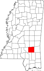 Map of Mississippi highlighting Jones County | |
| Towns | ||
| CDP | ||
| Other unincorporated communities | ||
| Indian reservation | ||
| Footnotes | ‡This populated place also has portions in an adjacent county or counties | |