Social Circle, Georgia
Social Circle is a city in southern Walton County, extending into Newton County, in the U.S. state of Georgia, 45 miles east of Atlanta.
Social Circle, Georgia | |
|---|---|
| Motto(s): "Georgia's Greatest Little Town" | |
 Location in Walton County and the state of Georgia | |
| Coordinates: 33°39′N 83°43′W | |
| Country | United States |
| State | Georgia |
| Counties | Walton, Newton |
| named: | 1826 |
| Incorporated | 1832 |
| Government | |
| • Mayor | David Keener |
| • City Council District 1 | Traysa Price |
| • City Council District 2 | Tyson Jackson |
| • City Council District | Steve Shelton |
| Area | |
| • Total | 14.69 sq mi (38.03 km2) |
| • Land | 14.58 sq mi (37.75 km2) |
| • Water | 0.11 sq mi (0.28 km2) |
| Elevation | 886 ft (270 m) |
| Population (2010) | |
| • Total | 4,262 |
| • Estimate (2018)[2] | 4,549 |
| • Density | 312.09/sq mi (120.50/km2) |
| Time zone | UTC-5 (Eastern (EST)) |
| • Summer (DST) | UTC-4 (EDT) |
| ZIP code | 30025 |
| Area code(s) | 470/678/770 |
| FIPS code | 13-71660[3] |
| GNIS feature ID | 0333086[4] |
| Website | |
History
It is unclear why the name "Social Circle" was applied to this place.[5] According to tradition, Social Circle was named from an incident in which a group of people living in the settlement offered water to a weary traveler, whose response was "This certainly is a social circle".[6] The city also officially notes that a citizen of another village community which was already known by the name of Social Circle joined the settlement in its early days, and this less colorful explanation may be the real source of the unique name.[7]
Social Circle was incorporated as a town in 1869, and as a city in 1904.[7]
Geographical data
According to the United States Census Bureau, the city has a total area of 11.3 square miles (29 km2), of which 11.2 square miles (29 km2) are land and 0.04-square-mile (0.10 km2) (100%) is water.
A CSX Transportation line maintenance facility operates in the city's railroad station. The city's railyard contains one of the relatively few remaining concrete coaling towers in the southeastern United States.
City Metadata
| Historical population | |||
|---|---|---|---|
| Census | Pop. | %± | |
| 1870 | 405 | — | |
| 1880 | 606 | 49.6% | |
| 1890 | 737 | 21.6% | |
| 1900 | 1,229 | 66.8% | |
| 1910 | 1,590 | 29.4% | |
| 1920 | 1,781 | 12.0% | |
| 1930 | 1,766 | −0.8% | |
| 1940 | 1,735 | −1.8% | |
| 1950 | 1,685 | −2.9% | |
| 1960 | 1,780 | 5.6% | |
| 1970 | 1,961 | 10.2% | |
| 1980 | 2,591 | 32.1% | |
| 1990 | 2,755 | 6.3% | |
| 2000 | 3,379 | 22.6% | |
| 2010 | 4,262 | 26.1% | |
| Est. 2018 | 4,549 | [2] | 6.7% |
| U.S. Decennial Census[8] | |||
According to United States Census data, there were about 4,500 people, 1,671 households, and 1,210 families residing in the city. The racial makeup of the city was 67% White, 30% African American, 0.5% Native American, 1% Asian, less than 0.5% were Pacific Islander, 0.5% were from other races, and 0.4% from two or more races. Hispanic or Latino of any race were 8% of the population.
There were 1,671 occupied households, of which about 40.9% had children under the age of 18 living with them, 49% were married couples living together, 17.8% had a female householder with no husband present, and 4% were non-families. Also, 24% of all households were people living alone and 3.2% had someone living alone who was 65 years of age or older. The average household size was 2.7 people.
In the city, the population was spread out with 29% under the age of 18, 8% from 18 to 24, 29% from 25 to 44, 26% from 45 to 64, and 8% who were 65 years of age or older. The median age was 34.5 years. The female sector accounted for about 48.7% of the population, while males accounted for about 51.3%.
The median income for a household in the city was $47,027. The per capita income for the city was $22,129. About 19% of families and 23% of the city's population were below the poverty line, including 43% of those under age 18, and 12% of those age 65 or over.[9]
Major access junctions
![]()
![]()
Bypass
The 2.8-mile Social Circle Highway runs alongside to the east side of the city. It is a controlled speed two-lane asphalt highway. The northside section is named James V. Burgess Highway while the southside section is named Martin Luther King, Jr. The highway has been open to the public since at least June 2, 2015. Both the bypass and the downtown main street are under the designation of State Route 11.
| |
|---|---|
| Location | Social Circle |
| Length | 2.8 mi (4.5 km) |
Education
The Social Circle City School District holds pre-school to grade twelve, and consists of two elementary schools, a middle school, and a high school.[10] The district has 90 full-time teachers and over 1,448 students.[11]
- Social Circle Primary School
- Social Circle Elementary School
- Social Circle Middle School
- Social Circle High School
Notable people
- Danny McDevitt – former baseball pitcher, retired here
- Kyle Chandler – actor
- Jessie Lysiak - MasterChef top 3
See also
References
- "2018 U.S. Gazetteer Files". United States Census Bureau. Retrieved February 12, 2020.
- "Population and Housing Unit Estimates". Retrieved June 4, 2019.
- "U.S. Census website". United States Census Bureau. Retrieved January 31, 2008.
- "US Board on Geographic Names". United States Geological Survey. October 25, 2007. Retrieved January 31, 2008.
- Krakow, Kenneth K. (1975). Georgia Place-Names: Their History and Origins (PDF). Macon, GA: Winship Press. p. 208. ISBN 0-915430-00-2.
- Moyer, Armond; Moyer, Winifred (1958). The origins of unusual place-names. Keystone Pub. Associates. p. 122.
- "Social Circle History". Retrieved September 9, 2018.
- "Census of Population and Housing". Census.gov. Retrieved June 4, 2015.
- 2010 United States Census
- Georgia Board of Education, Retrieved June 26, 2010.
- School Stats, Retrieved June 26, 2010.
External links
| Wikimedia Commons has media related to Social Circle, Georgia. |
Municipalities and communities of Newton County, Georgia, United States | ||
|---|---|---|
| Cities |  Map of Georgia highlighting Newton County | |
| Town | ||
| Unincorporated communities | ||
| Footnotes | ‡This populated place also has portions in an adjacent county or counties | |
Municipalities and communities of Walton County, Georgia, United States | ||
|---|---|---|
| Cities | 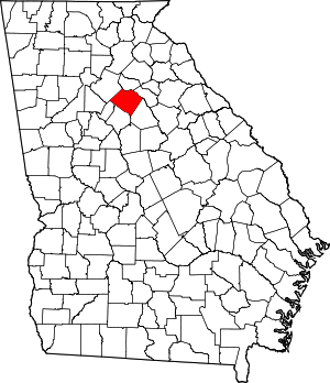 Map of Georgia highlighting Walton County | |
| Towns | ||
| Unincorporated communities | ||
| Footnotes | ‡This populated place also has portions in an adjacent county or counties | |
| Authority control |
|
|---|