Soatá
Soatá is a town and municipality in Boyacá Department, Colombia. Soatá is located on the western slopes of the Cordillera Oriental mountain range, at the northeast end of the Department of Boyacá. It is the capital of the Northern Boyacá Province. Soatá borders Boavita in the east, Tipacoque in the north, Susacón in the south and in the west it borders the municipality Onzaga of the department of Santander.[1]
Soatá | |
|---|---|
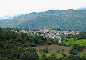 View of Soatá | |
.svg.png) Flag | |
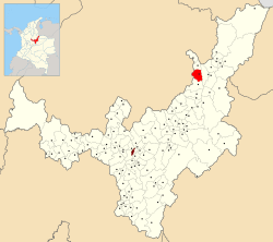 Location of the town and municipality of Soatá in Boyacá Department | |
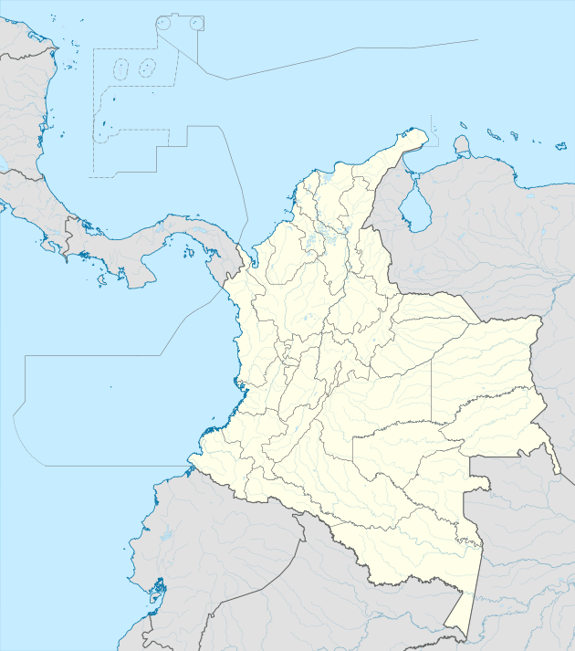 Soatá Location in Colombia | |
| Coordinates: 6°20′N 72°40′W | |
| Country | |
| Department | Boyacá |
| Province | Northern Boyacá Province |
| Founded | 10 December 1545 |
| Founded by | Juan Rodríguez Parra |
| Government | |
| • Type | Municipality |
| • Mayor | Carlos Javier Gutiérrez Sandoval (2020-2023) |
| Area | |
| • City | 136 km2 (53 sq mi) |
| Elevation | 1,950 m (6,400 ft) |
| Population (2016) | |
| • City | 7,069 |
| • Density | 52/km2 (130/sq mi) |
| • Urban | 5,237 |
| Website | Official website |
Climate
| | ||||||||||||||||||||||||||||||||||||||||||||||||||||||||||||
|---|---|---|---|---|---|---|---|---|---|---|---|---|---|---|---|---|---|---|---|---|---|---|---|---|---|---|---|---|---|---|---|---|---|---|---|---|---|---|---|---|---|---|---|---|---|---|---|---|---|---|---|---|---|---|---|---|---|---|---|---|
| Climate chart (explanation) | ||||||||||||||||||||||||||||||||||||||||||||||||||||||||||||
| ||||||||||||||||||||||||||||||||||||||||||||||||||||||||||||
| ||||||||||||||||||||||||||||||||||||||||||||||||||||||||||||
Etymology
Soatá in the Chibcha language of the Muisca means tillage of the Sun.[2]
History
Soatá was already populated during the Herrera Period and at the time of the Spanish conquest, Soatá was inhabited by the Muisca. The village was part of the rule of the cacique Tundama from the city with the same name, presently known as Duitama.
The inhabitants of Soatá are descendants of a mix of Muisca, Caribbean and Choques. Modern Soatá was founded by sergeant Juan Rodríguez Parra in 1545.[1]
Demographics and geography
In 2005 Soatá had a population of 8.730 inhabitants[3] of which 63% living in the urban zone and 47% live in the eight subdivisions that comprise the rural area. The subdivisions (veredas) are: Los Molinos, La Laguna, Llano Grande, El Espinal, La Chorrera and La Costa. The urban center of Soatá is located at an elevation of 1,950 metres (6,400 ft) above sea level.[1]
Economy
Its economy is of subsistence and it characterizes by agriculture and the cattle ranch in form of minifundios, standing out the cultures of the sugar cane, coffee, tobacco, tomatoes, maize, wheat, barley, fruit trees, dates and flowers.[1]
The cattle sector is distinguished by the presence of goat, pigs and cows.
In the industrial sector, one stands out the production of bricks, floor pieces, canvas shoes, straw hats, panela and bee honey; it excels the elaboration of candies and treats. The production of dates has gained Soatá the title of city of the date palm of Colombia.
Soatá counts on tourist potential by the wealth of its cultural expressions, standing out its gastronomy, natural variety of landscapes and scenic places.
Paleontology
In the Soatá Formation, a brown shale and siltstone sequence defined in and named after Soatá, fossil remains of the Pleistocene genera Neochoerus, Odocoileus and the species Haplomastodon waringi have been found.[4]
Related to Soatá
- Cayo Leonidas Peñuela
- Lorenzo Cárdenas
Festivals
- Our Lady of Mount Carmel Festival
- Torbellino's Festival
Gallery
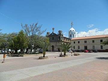 Central square
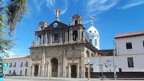 Church of Soatá
.jpg) Cathedral
Cathedral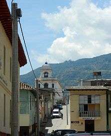 Chapel
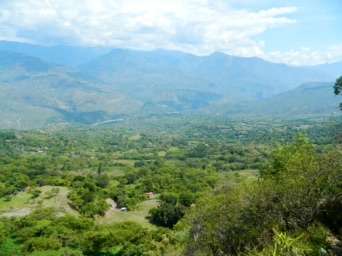 View of Chicamocha Canyon
 View of Soatá
 Soatá and surroundings
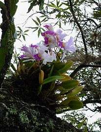 Orchid in Soatá
References
- (in Spanish) Official website Soatá - accessed 06-05-2016
- (in Spanish) Etymology Soatá
- (in Spanish) General Census 2005 - DANE
- Soatá in the Paleobiology Database
External links
| Wikimedia Commons has media related to Soatá. |