Snow River
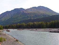
The Snow River is a 28-mile (45 km) tributary of Kenai Lake in the U.S. state of Alaska.[1] Beginning in the Kenai Mountains of the Kenai Peninsula, it flows southwest through Chugach National Forest where its main and south forks join to near Primrose at the southern inlet of the lake.[3] The river mouth is about 12 miles (19 km) northeast of Seward.[1] Along its final reaches, the river intersects the Iditarod Trail and passes under the Seward Highway.[3] The glacier from which it flows has an associated glacial dammed lake that releases every few years, often causing flooding in Primrose and Kenai Lake.[4]
| Snow River | |
|---|---|
 Snow River | |
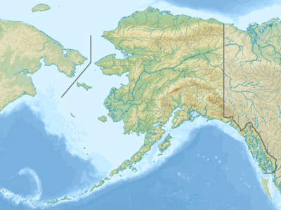 Location of the mouth of the Snow River in Alaska | |
| Location | |
| Country | United States |
| State | Alaska |
| Borough | Kenai Peninsula |
| Physical characteristics | |
| Source | Snow Glacier |
| ⁃ location | Chugach National Forest |
| ⁃ coordinates | 60°26′14″N 149°01′43″W[1] |
| ⁃ elevation | 1,721 ft (525 m)[2] |
| 2nd source | Near Godwin Glacier (South Fork) |
| Mouth | Kenai Lake |
⁃ location | 12 miles (19 km) northeast of Seward |
⁃ coordinates | 60°20′18″N 149°21′16″W[1] |
⁃ elevation | 436 ft (133 m)[1] |
| Length | 28 mi (45 km)[1] |
See also
References
- "Snow River". Geographic Names Information System. United States Geological Survey. March 31, 1981. Retrieved December 11, 2013.
- Derived by entering source coordinates in Google Earth.
- Alaska Atlas & Gazetteer (7th ed.). Yarmouth, Maine: DeLorme. 2010. p. 71. ISBN 978-0-89933-289-5.
- Glacial Dammed Lake Data, National Weather Service
External links
- Primrose Campground – U.S. Forest Service
- Snow River Near Seward – National Weather Service
| Authority control |
|
|---|
This article is issued from Wikipedia. The text is licensed under Creative Commons - Attribution - Sharealike. Additional terms may apply for the media files.