Skiu-Kaya
Skiu (also Sku and Skyu) and Kaya (elev. 3500 m) are adjacent villages in the Markha River valley in Ladakh, India.[2] The villages contain 9 and 12 households, respectively; the boundary between the villages is not clearly defined.[3] They lie within the Hemis National Park.[4]
Skiu-Kaya | |
|---|---|
Village | |
 Skiu-Kaya  Skiu-Kaya | |
| Coordinates: 33.97°N 77.26°E | |
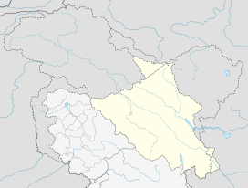
| Country | |
| Union Territory | Ladakh |
| District | Leh |
| Languages | |
| • Official | Ladakhi |
| Time zone | UTC+5:30 (IST) |
| PIN | 194104[1] |
Wheat and vegetables are cultivated by villagers, who also harvest wild seabuckthorn berries.[3]
Skiu and Kaya each have a Buddhist monastery (gompa). The monastery at Skiu was constructed in the 11th century; Rinchen Zangpo laid its foundation.[5]
References
- "Skiu-Kaya (Google Maps)". Google Maps. Retrieved 28 March 2020.
- Partha S Banerjee (2016). Ladakh and Zanskar Trekking Map (Map). 1:175,000. Milestone Himalayan Series. Kolkata: Milestone Books. ISBN 978-81-903270-9-1.
- Himalayan Homestay Treks map. Published by Snow Leopard Conservancy India and on sale in Leh, Ladakh. (Contact information: Ibex Hotel Complex, Fort Road, Leh, Ladakh, India. Tel 01982-250953. www.himalayan-homestays.com.)
- "Hemis National Park on Google Maps". Retrieved 28 October 2016.
- https://www.flickr.com/photos/jenfromalaska/3906713871/
This article is issued from Wikipedia. The text is licensed under Creative Commons - Attribution - Sharealike. Additional terms may apply for the media files.