Siwan, Bihar
Siwan is a city and nagar parishad in the Indian state of Bihar.[5] It is the administrative headquarters of Siwan district and one of the urban settlements out of three in the district. It is located close to Uttar Pradesh.[6]
Siwan | |
|---|---|
City | |
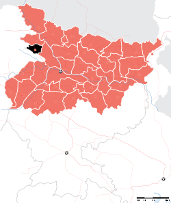
 Siwan Location in Bihar, India  Siwan Siwan (India)  Siwan Siwan (Asia) | |
| Coordinates: 26.22°N 84.36°E | |
| Country | |
| State | Bihar |
| District | Siwan |
| Subdivision | Siwan Subdivision |
| Block | Siwan Block |
| Established | 1924[1] |
| Government | |
| • Type | Council–manager |
| • Body | Siwan Municipal Council |
| • Chairperson | Sindhu Singh[2] (BJP) |
| • Deputy chairman | Bablu Shah |
| Area | |
| • Total | 69.4 km2 (26.8 sq mi) |
| Area rank | 53rd |
| Elevation | 72 m (236 ft) |
| Population (2011)[3] | |
| • Total | 135,066 |
| • Rank | 18th |
| • Density | 1,900/km2 (5,000/sq mi) |
| Language | |
| • Official | Hindi[4] |
| • Additional official | Urdu[4] |
| Time zone | UTC+5:30 (IST) |
| Pin Code | 841226-841227 |
| ISO 3166 code | IN-BR |
| Vehicle registration | BR-29 |
| Climate | Cwa |
| Lok Sabha constituency | Siwan |
| Vidhan Sabha constituency | Siwan |
| Website | https://siwan.nic.in/ |
History
The Siwan Municipal Council (SMC) was established in 1924.[1] It was the subdivisional headquarter of Siwan subdivision and Siwan subdivision was a subdivision of old Saran district.
Geography and climate
Siwan city is located at coordinates 26.22°N 84.36°E Latitude and longitude. It has an average elevation of 72 metres (236 ft).[7] Daha River, which is a small river, which floods in rainy season pass through the west of the town. The river dries up during summer. Daha river is also the most polluted river of Siwan district.
The weather of Siwan is mild and generally warm and temperate. This climate is considered to be Cwa according to the Köppen-Geiger climate classification.[8]
| Month | Jan | Feb | Mar | Apr | May | Jun | Jul | Aug | Sep | Oct | Nov | Dec | Year |
|---|---|---|---|---|---|---|---|---|---|---|---|---|---|
| Average high °C (°F) | 23.1 (73.6) |
26.1 (79.0) |
32.4 (90.3) |
36.2 (97.2) |
38.6 (101.5) |
36.2 (97.2) |
32.8 (91.0) |
32.3 (90.1) |
32. (90) |
31.8 (89.2) |
28.7 (83.7) |
24.7 (76.5) |
31.2 (88.3) |
| Daily mean °C (°F) | 16.4 (61.5) |
18.9 (66.0) |
24.5 (76.1) |
28.9 (84.0) |
32 (90) |
31.4 (88.5) |
29.4 (84.9) |
29.2 (84.6) |
28.7 (83.7) |
26.7 (80.1) |
21.6 (70.9) |
17.6 (63.7) |
25.4 (77.8) |
| Average low °C (°F) | 9.8 (49.6) |
11.8 (53.2) |
16.7 (62.1) |
21.7 (71.1) |
25.5 (77.9) |
26.6 (79.9) |
26 (79) |
26.2 (79.2) |
25.5 (77.9) |
21.7 (71.1) |
14.5 (58.1) |
10.5 (50.9) |
19.7 (67.5) |
| Average precipitation mm (inches) | 21 (0.8) |
7 (0.3) |
11 (0.4) |
7 (0.3) |
25 (1.0) |
164 (6.5) |
257 (10.1) |
316 (12.4) |
192 (7.6) |
54 (2.1) |
6 (0.2) |
2 (0.1) |
1,062 (41.8) |
| Source: Climate-data.org[8] | |||||||||||||
Demographics
As of 2011 Indian Census, Siwan had a total population of 135,066, of which 70,756 were males and 64,310 were females. Population within the age group of 0 to 6 years was 18,282. The total number of literates in Siwan was 92,967, which constituted 68.8% of the population with male literacy of 73.6% and female literacy of 63.6%. The effective literacy rate of 7+ population of Siwan was 79.6%, of which male literacy rate was 85.2% and female literacy rate was 73.5%. The Scheduled Castes and Scheduled Tribes population was 8,244 and 1,514 respectively. Siwan had 21223 households in 2011.[3]
As of 2001 India census, Siwan had a population of 108,172 of which 57,223 were male and 50,949 female.[9]
Transport
NH-531 connects Siwan to Gopalganj and Chhapra. NH-531 meets to NH-27 at Gopalganj. Which is second longest road in India. Bihar State Highway-47 connects Barharia, Mairwa and Guthani to Siwan. State Highway-73 and 89 also connects Siwan to nearest town and villages.
There is a Siwan Junction railway station in Siwan which connects to major cities of India.
There is no airports in Siwan. Jay Prakash Narayan Airport which is situated in Patna, is the nearest airport to Siwan.
Notable people
- Azazul Haque
- Abdul Ghafoor
- Avishek Sinha
- Apoorvanand
- Baccha Prasad Singh
- Bishwanath Singh
- Brajkishore Prasad
- Chandrashekhar Prasad
- Indradeep Sinha
- Jai Prakash Narayan Singh
- Janardan Tiwari
- Kaushalendra Pratap Shahi
- Kavita Singh
- Khesari Lal Yadav
- Mangal Pandey
- Manoj Bhawuk
- Mihir Diwakar
- Mohammad Shahabuddin
- Natwarlal
- Nirupama Pandey
- Om Prakash Yadav
- Prabhavati Devi
- Ramesh Singh Kushwaha
- Rajendra Prasad
- Raza Naqvi Wahi
- Syed Ali Akhtar Rizvi
- Satyendra Dubey
- Sunil Prasad
- Vashishtha Narayan Singh
See also
- List of cities in Bihar
References
- "City Development Plan for Siwan" (PDF). www.urban.bih.nic.in. Retrieved 24 June 2018.
- "सीवान नगर परिषद की चेयरमैन बनी सिंधू देवी". Hindustan (in Hindi). Retrieved 5 May 2019.
- "Census of India: Siwan". www.censusindia.gov.in. Retrieved 4 December 2019.
- "52nd REPORT OF THE COMMISSIONER FOR LINGUISTIC MINORITIES IN INDIA" (PDF). nclm.nic.in. Ministry of Minority Affairs. Archived from the original (PDF) on 25 May 2017. Retrieved 9 March 2019.
- "Municipalities of Siwan district". siwan.nic.in. Retrieved 22 April 2019.
- "Siwan News". www.siwanonline.com. Retrieved 14 June 2018.
- "Siwan, Bihar, India". www.latlong.net. Retrieved 19 June 2018.
- "Climate:Siwan". Retrieved 19 June 2018.
- "Census of India 2001: Data from the 2001 Census, including cities, villages and towns (Provisional)". Census Commission of India. Archived from the original on 16 June 2004. Retrieved 1 November 2008.
Headquarter: Siwan | ||
| Siwan Subdivision |
|  |
| Maharajganj Subdivision |
| |
| Municipalities | ||