Sirutar
Sirutar is a village located in Bhaktapur District. Initially a Village Development Committee, it comes under Suryavinayak Municipality after local level restructuring in 2016.
Sirutar सिरुटार | |
|---|---|
Village Development Committee | |
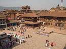
 Sirutar Location in Nepal | |
| Coordinates: 27.65°N 85.38°E | |
| Country | |
| Zone | Bagmati Zone |
| District | Bhaktapur District |
| Population (1991) | |
| • Total | 3,882 |
| • Religions | Hindu |
| Time zone | UTC+5:45 (Nepal Time) |
Sirutar is a village and Village Development Committee in Bhaktapur District in the Bagmati Zone of central Nepal. At the time of the 1991 Nepal census it had a population of 3882 with 645 houses in it.[1]
Sirutar extends from east to west in the Southern territory of Bhaktapur district. This V.D.C resembles ‘P’ shape of the English alphabet. It is almost 4 km from Bhaktapur nagar and is 9 km from the Kathmandu city. Sirutar V.D.C. is situation about 1,300 meters above the sea level. This V.D.C. lies in between Bhaktapur and Lalitpur district. Dadhikot lies in the east of this V.D.C., Balkot and Tikathali in the west, Dadhikot and Balkot in the North, and Lamatar, Lubhu and Tikathali V.D.Cs in the South.[2]
The name ‘Sirutar’ came from two names in Nepali – ‘Siru’ meaning a kind of plants with hard stem that grow in dry lands and ‘tar’ meaning a dry land that is suitable for the growth of plants like Siru. That being said, Sirutar is a dry, barren land that does not have proper irrigation and is covered by Siru. An anecdote supports this naming: long time back, this place had thick human settlement compared with the neighboring villages; the lands were also fertile that gave good amount of crops. There was a king's palace with a beautiful garden protected with compounded walls. This place was thus also called Swaga in Newari language, meaning a garden. A group of Newaris worked in the palace. Later, the people from this place started migrating for some sudden reasons and the fertility of the lands also diminished. Sati out of anger cursed this place to only let Siru grow. Hence, Siru started to grow here. However, no inscriptions and scriptures are found to prove this anecdote.[2]
In winter, the temperature reaches up to 2-10⁰C and in summer, it reaches up to 21-32⁰C.[2]
Majority of the population in this VDC are Hindu; there are temples of Mahadev, Bhairav, Ganesh, Saraswati, Balkumari, and Devi.[2]
References
- "Nepal Census 2001". Nepal's Village Development Committees. Digital Himalaya. Retrieved 2008-08-26.
- Siru Souvenir(Siru Smarika) (Fourth ed.). Siru Intellectual Society.
Headquarter: Bhaktapur | |||
 | Municipalities |  | |
| Former VDCs | |||