Sirangala
Shirangala( ಶಿರಂಗಾಲ ) is a village in Kodagu district of Karnataka state, India.

Shirangala checkpost
Location
Shirangala is located between Konanur and Kushalanagar towns on the bank of Cauvery river.[1] Shirangala is 37 km from Madikeri and 19 km from Somvarpet. The distance from Shirangala to Mangalore and Bangalore are 185 km and 209 km respectively.
Post office
There is a post office in the village and the pincode is 571232.[2]
Administration
Shirangala is administered as part of Somavarpet taluk in Kodagu district.
Villages and suburbs
- Kudige - 10 km
- Nerugalale - 14 km
- Mullusoge - 15 km
- Siddapurgate - 5 km
- Manajuru - 1.5 km
- Seegodu - 4 km
Image gallery
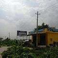 Siddapurgate
 Manajuru village
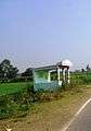 Seegodu village
References
- "12°33'45.4"N 76°00'29.2"E". Google.com. Retrieved 12 February 2019.
- "Pin Code of Sirangala in Kodagu, Karnataka". Mapsofindia.com. Retrieved 12 February 2019.
This article is issued from Wikipedia. The text is licensed under Creative Commons - Attribution - Sharealike. Additional terms may apply for the media files.