Sinagoga
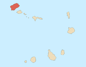
Sinagoga is a settlement in the northeastern part of the island of Santo Antão, Cape Verde. It is situated on the coast, 4 kilometers east of Ribeira Grande and 18 km north-northeast of the island capital Porto Novo. It is situated on the national road connecting Ribeira Grande and Pombas (EN1-SA02).
Sinagoga | |
|---|---|
Settlement | |
 Sinagoga | |
| Coordinates: 17.178°N 25.032°W | |
| Country | Cape Verde |
| Island | Santo Antão |
| Municipality | Ribeira Grande |
| Civil parish | Nossa Senhora do Rosário |
| Elevation | 16 m (52 ft) |
| Population (2010)[1] | |
| • Total | 603 |
| ID | 11106 |
Its name means "synagogue" in Portuguese. It is said that the village was primarily inhabited by Jewish people in the second half of the 19th century, and surnames of Jewish origin can still be found in the area.[2]
Climate
Sinagoga has a hot desert climate. The annual rainfall is 291 millimeters. The average annual temperature is 23.4 °C (74.1 °F).[3]
| Climate data for Sinagoga, 0 metres ASL | |||||||||||||
|---|---|---|---|---|---|---|---|---|---|---|---|---|---|
| Month | Jan | Feb | Mar | Apr | May | Jun | Jul | Aug | Sep | Oct | Nov | Dec | Year |
| Average high °C (°F) | 23.3 (73.9) |
23.1 (73.6) |
23.6 (74.5) |
24.1 (75.4) |
24.9 (76.8) |
25.6 (78.1) |
26.4 (79.5) |
27.4 (81.3) |
27.6 (81.7) |
27.4 (81.3) |
26.4 (79.5) |
24.3 (75.7) |
25.3 (77.5) |
| Daily mean °C (°F) | 21.4 (70.5) |
21.2 (70.2) |
21.5 (70.7) |
21.9 (71.4) |
22.7 (72.9) |
23.6 (74.5) |
24.3 (75.7) |
25.4 (77.7) |
25.8 (78.4) |
25.5 (77.9) |
24.4 (75.9) |
22.6 (72.7) |
23.4 (74.1) |
| Average low °C (°F) | 19.6 (67.3) |
19.3 (66.7) |
19.5 (67.1) |
19.8 (67.6) |
20.6 (69.1) |
21.7 (71.1) |
22.3 (72.1) |
23.5 (74.3) |
24.1 (75.4) |
23.7 (74.7) |
22.5 (72.5) |
21.0 (69.8) |
21.5 (70.7) |
| Average rainfall mm (inches) | 14 (0.6) |
5 (0.2) |
1 (0.0) |
0 (0) |
0 (0) |
0 (0) |
11 (0.4) |
44 (1.7) |
128 (5.0) |
44 (1.7) |
26 (1.0) |
18 (0.7) |
291 (11.3) |
| Source: [3] | |||||||||||||
References
- "2010 Census results". Instituto Nacional de Estatística Cabo Verde (in Portuguese). 24 November 2016.
- Aldeia de Sinagoga em Santo Antão, Isa Lima Fernandes, 2005, p. 20-21
- Climate-Data.ORG
Subdivisions of the island of Santo Antão | |||||||||
|---|---|---|---|---|---|---|---|---|---|
| Paul |
|  | |||||||
| Porto Novo |
| ||||||||
| Ribeira Grande |
| ||||||||
This article is issued from Wikipedia. The text is licensed under Creative Commons - Attribution - Sharealike. Additional terms may apply for the media files.