Sina District
Sina District is one of five districts of the San Antonio de Putina Province in the Puno Region of Peru.[1]
Sina | |
|---|---|
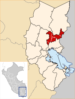 Location of Sina in the San Antonio de Putina Province | |
| Country | |
| Region | Puno |
| Province | San Antonio de Putina |
| Founded | May 2, 1854 |
| Capital | Sina |
| Government | |
| • Mayor | Ricardo Flores Hilasaca |
| Area | |
| • Total | 163.43 km2 (63.10 sq mi) |
| Elevation | 3,229 m (10,594 ft) |
| Population (2007 census) | |
| • Total | 1,472 |
| • Density | 9.0/km2 (23/sq mi) |
| Time zone | UTC-5 (PET) |
| UBIGEO | 211005 |
Geography
The Apolobamba mountain range traverses the district. The highest peaks of the district is Chawpi Urqu at 6,044 m (19,829 ft) above sea level which is also the highest elevation of the range. Other mountains are listed below:[2]
|
|
History
Sina District was created on May 2, 1854.
Ethnic groups
The people in the district are mainly indigenous citizens of Quechua descent. Quechua is the language which the majority of the population (80.79%) learnt to speak in childhood, 15.54% of the residents started speaking using the Spanish language (2007 Peru Census).[3]
Mayors
- 2011-2014: Ricardo Flores Hilasaca.
- 2007-2010: Marcial Huanca Mamani.
Festivities
- Candlemas, the Feast of the Purification of the Virgin.
- Cross of May
References
- (in Spanish) Instituto Nacional de Estadística e Informática. Banco de Información Distrital Archived 2008-04-23 at the Wayback Machine. Retrieved April 11, 2008.
- escale.minedu.gob.pe/ UGEL map Putina Province (Puno Region)
- inei.gob.pe Archived 2013-01-27 at the Wayback Machine INEI, Peru, Censos Nacionales 2007, Frequencias: Preguntas de Población: Idioma o lengua con el que aprendió hablar (in Spanish)
External links
| |
|---|---|
| Azángaro | |
| Carabaya | |
| Chucuito | |
| El Collao |
|
| Huancané | |
| Lampa | |
| Melgar | |
| Moho | |
| Puno | |
| San Antonio de Putina | |
| San Román | |
| Sandia | |
| Yunguyo | |
This article is issued from Wikipedia. The text is licensed under Creative Commons - Attribution - Sharealike. Additional terms may apply for the media files.