Silsbee, Texas
Silsbee is a town in Hardin County, Texas, United States. This city is one hundred and three miles northeast of Houston. The population was 6,611 at the 2010 census.[3] It is part of the Beaumont–Port Arthur metropolitan area.
Silsbee, Texas | |
|---|---|
.jpg) Panoramic view of Silsbee at night | |
| Nickname(s): Smoketown | |
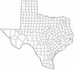 Location of Silsbee, Texas | |
 | |
| Coordinates: 30°20′53″N 94°10′49″W | |
| Country | |
| State | |
| County | Hardin |
| Area | |
| • Total | 7.7 sq mi (20.0 km2) |
| • Land | 7.7 sq mi (19.9 km2) |
| • Water | 0.04 sq mi (0.1 km2) |
| Elevation | 82 ft (25 m) |
| Population (2010) | |
| • Total | 6,611 |
| • Density | 861/sq mi (332.4/km2) |
| Time zone | UTC-6 (Central (CST)) |
| • Summer (DST) | UTC-5 (CDT) |
| ZIP code | 77656 |
| Area code(s) | 409 |
| FIPS code | 48-67832[1] |
| GNIS feature ID | 1347123[2] |
| Website | www |
Geography
Silsbee is located in eastern Hardin County at 30°20′53″N 94°10′49″W (30.348095, -94.180220).[4] U.S. Route 96, a four-lane bypass, forms the southeast border of the city; the highway leads northeast 50 miles (80 km) to Jasper and south 20 miles (32 km) to Beaumont. Houston is 104 miles (167 km) southwest of Silsbee via Beaumont. Texas State Highway 327 runs through downtown Silsbee south of the city center, leading east to US 96 and west 9 miles (14 km) to Kountze, the Hardin county seat.
According to the United States Census Bureau, Silsbee has a total area of 7.7 square miles (20.0 km2), of which 0.04 square miles (0.1 km2), or 0.64%, are water.[3]
Historical development
Silsbee was first referred to as "Mill Town" when the site was reached by the Gulf, Beaumont, and Kansas City Railway in 1894. The town was renamed in recognition of Nathaniel Silsbee, an investor from Boston, Massachusetts, who helped provide funds for the railway.[5] The railroad was a project of John Henry Kirby, who established the Kirby Lumber Company in the city. This business was the main employer and strength of the Silsbee economy from the city's beginning.[6]
Demographics
| Historical population | |||
|---|---|---|---|
| Census | Pop. | %± | |
| 1940 | 2,525 | — | |
| 1950 | 3,179 | 25.9% | |
| 1960 | 6,277 | 97.5% | |
| 1970 | 7,271 | 15.8% | |
| 1980 | 7,684 | 5.7% | |
| 1990 | 6,368 | −17.1% | |
| 2000 | 6,393 | 0.4% | |
| 2010 | 6,611 | 3.4% | |
| Est. 2018 | 6,651 | [7] | 0.6% |
| U.S. Decennial Census[8] | |||
As of the census[9] of 2010, 6,611 people, 2,520 households, and 1,763 families resided in the city. The population density was 881.5 people per square mile (327.8/km²). The 2,790 housing units averaged 353.5 per square mile (136.5/km²). The racial makeup of the city was 65.8% White, 30.3% African American, 0.4% Native American, 0.6% Asian, 0.015% Pacific Islander, 1.4% from other races, and 01.5% from two or more races. Hispanics or Latinos of any race were 4.0% of the population.
Of the 2,520 households, 30.8% had children under the age of 18 living with them, 47.1% were married couples living together, 18.4% had a female householder with no husband present, and 30.0% were not families; 10.5% of all households were made up of individuals, and 12.0% had someone living alone who was 65 years of age or older. The average household size was 2.52 and the average family size was 3.04.
In the city, the population was distributed as 25.7% under the age of 18, 8.2% from 19 to 24, 23.1% from 25 to 44, 25.6% from 45 to 64, and 17.4% who were 65 years of age or older. The median age was 34.7 years. Of the entire population, 45.9% were male and 54.1% were female. Of those individuals age 18 and over, 32.5% were male and 67.5% were female.
The median income for a household in the city was $49,121, and for a family was $51,518. About 16.6% of the population was below the poverty line; 14.0% of families were below the poverty line, while only 3.9% of married families were in poverty. Of those age 65 or over, 4.4% were below the poverty line.
Education
The city is served by the Silsbee Independent School District, with a total of four schools — Laura Reeves Elementary (PK, K), Silsbee Elementary (1-5), Edwards-Johnson Memorial Silsbee Middle School (6-8), and Silsbee High School (9-12).
Notable people
- Len Garrett, football player
- Mark Henry, actor, powerlifter, Olympic weightlifter, strongman, and WWE wrestler
- James Hunter, football player
- Chloe Jones, pornographic actress, Hollywood actress
- Brandi McCain, professional basketball player in the Women's National Basketball Association
- Gary Oliver, musician, worship leader, song writer, senior pastor
- Phil McDonald, musician, song writer for Punch Punch Kick
- LaQuan Stallworth, professional basketball player in the FIBA and Women's National Basketball
References
- "U.S. Census website". United States Census Bureau. Retrieved 2008-01-31.
- "US Board on Geographic Names". United States Geological Survey. 2007-10-25. Retrieved 2008-01-31.
- "Geographic Identifiers: 2010 Census Summary File 1 (G001): Silsbee city, Texas". American Factfinder. U.S. Census Bureau. Archived from the original on February 13, 2020. Retrieved February 2, 2018.
- "US Gazetteer files: 2010, 2000, and 1990". United States Census Bureau. 2011-02-12. Retrieved 2011-04-23.
- Handbook of Texas Online, Handbook of Texas Online, accessed May 5, 2007
- Houstonian founds Silsbee because of natural resources Archived 2006-08-27 at the Wayback Machine, access May 5, 2007
- https://www.census.gov/quickfacts/fact/table/silsbeecitytexas/PST045218
- "Census of Population and Housing". Census.gov. Retrieved June 4, 2015.
- "U.S. Census website". US Census Department. Retrieved 2012-10-28.
External links
- U.S. Geological Survey Geographic Names Information System: Silsbee, Texas
- City of Silsbee official website
- Silsbee Chamber of Commerce
- "Life on the American Newsfront: Oil Well Burns Two Months". Life Magazine: 29–31. April 26, 1937. Retrieved 29 July 2010.
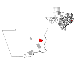
Municipalities and communities of Hardin County, Texas, United States | ||
|---|---|---|
| Cities | 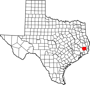 Hardin County map | |
| CDPs | ||
| Other unincorporated communities | ||
| Ghost town | ||
| Footnotes | ‡This populated place also has portions in an adjacent county or counties | |