Siesta Key, Florida
Siesta Key is a barrier island off the southwest coast of the U.S. state of Florida, located between Roberts Bay and the Gulf of Mexico. A portion of it lies within the city boundary of Sarasota, but the majority of the key is a census-designated place (CDP) in Sarasota County. Siesta Key is part of the Bradenton–Sarasota–Venice Metropolitan Statistical Area.
Siesta Key, Florida Little Sarasota Key, Sarasota Key | |
|---|---|
 Lifeguard stand at Siesta Key Beach | |
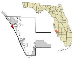 Location in Sarasota County and the state of Florida | |
| Coordinates: 27°16′31″N 82°33′9″W | |
| Country | United States |
| State | Florida |
| County | Sarasota |
| Area | |
| • Total | 3.5 sq mi (9.0 km2) |
| • Land | 2.4 sq mi (6.1 km2) |
| • Water | 1.1 sq mi (2.9 km2) |
| Elevation | 3 ft (1 m) |
| Population (2010) | |
| • Total | 6,565 |
| • Density | 2,775/sq mi (1,071.5/km2) |
| Time zone | UTC−05:00 (EST) |
| • Summer (DST) | UTC−04:00 (EDT) |
| ZIP Code | 34242 |
| Area code(s) | 941 |
| FIPS code | 12-66000[1] |
| GNIS feature ID | 1802950[2] |
History
From the 1800s and early 1900s, Siesta Key was known by a variety of names, including "Little Sarasota Key" and "Sarasota Key".[3] The first attempts to develop the key was by the Siesta Land Company in 1907 consisting of Harry Higel, Captain Louis Roberts, and E.M. Arbogast. The company platted the northern end of the key as "Siesta on the Gulf" as well as dredged bayous and built docks. The only access to Siesta Key was by boat or ferry until the first bridge connecting it to the mainland was completed in 1917.[4] The bridge was later replaced in 1927 along with an addition of a second bridge located on the southern end of the key. The entire key was officially recognized as "Siesta Key" by 1952.[3]
Geography
According to the United States Census Bureau, the CDP has a total area of 3.5 square miles (9.0 km2), of which 2.4 square miles (6.1 km2) is land and 1.1 square miles (2.9 km2), or 32.08%, is water.[5]
Siesta Key is made up of four main districts: Siesta Beach, Crescent Beach, Turtle Beach, and Siesta Key Village.[6] It contains a suburban residential area located on the Siesta Key barrier island on the West coast of Florida, just west of the town of Sarasota. The community on Siesta Key consists of single family homes, condominiums, retail shops and art galleries.
Beaches
Beaches on Siesta Key include Siesta Beach,[7] Crescent Beach,[8] and Turtle Beach.[9]
Demographics
| Historical population | |||
|---|---|---|---|
| Census | Pop. | %± | |
| 1970 | 4,460 | — | |
| 1980 | 7,010 | 57.2% | |
| 1990 | 7,772 | 10.9% | |
| 2000 | 7,150 | −8.0% | |
| 2010 | 6,565 | −8.2% | |
| source:[10] | |||

The population of Siesta Key was 6,565 at the 2010 US Census.[5]
At the time of the 2000 US Census, there were 7,150 people, 3,783 households, and 2,273 families residing in the CDP.[1] The population density was 3,120.1 people per square mile (1,205.5/km2). There were 7,885 housing units at an average density of 3,440.9/sq mi (1,329.4/km²). There were 3,783 households out of which 9.9% had children under the age of 18 living with them, 54.9% were married couples living together, 3.7% had a female householder with no husband present, and 39.9% were non-families. Of all households 33.9% were made up of individuals and 17.9% had someone living alone who was 65 years of age or older. The average household size was 1.89 and the average family size was 2.34.
In the CDP, the population was spread out with 9.0% under the age of 18, 1.8% from 18 to 24, 15.6% from 25 to 44, 33.9% from 45 to 64, and 39.6% who were 65 years of age or older. The median age was 60 years. For every 100 females, there were 90.5 males. For every 100 females age 18 and over, there were 88.9 males.
The median income for a household in the CDP was $66,397, and the median income for a family was $81,345. Males had a median income of $55,240 versus $32,263 for females. The per capita income for the CDP was $53,290. About 3.0% of families and 4.4% of the population were below the poverty line, including 4.1% of those under age 18 and 3.2% of those age 65 or over.
References
- "U.S. Census website". United States Census Bureau. Retrieved January 31, 2008.
- "US Board on Geographic Names". United States Geological Survey. October 25, 2007. Retrieved January 31, 2008.
- "The Siesta Key Beach Pavilion". Sarasota History Alive!. Retrieved September 4, 2018.
- "Bridges Played a Role in Siesta Key Development". Sarasota History Alive!. Retrieved September 4, 2018.
- "Geographic Identifiers: 2010 Demographic Profile Data (G001): Siesta Key CDP, Florida". U.S. Census Bureau, American Factfinder. Archived from the original on February 12, 2020. Retrieved April 15, 2013.
- "Welcome to Siesta Key!". Siesta Key Chamber of Commerce. Retrieved September 4, 2018.
- Ferguson, J. (2015). Moon Sarasota & Naples: Including Sanibel Island & the Everglades. Moon Handbooks. Avalon Travel Publishing. p. 125. ISBN 978-1-63121-156-0.
- "Google Maps". Google Maps. Retrieved January 18, 2017.
- Adams, Rick (December 10, 2015). "Erosion of Turtle Beach to be repaired with beach restoration project". Sarasota News. Retrieved February 6, 2016.CS1 maint: ref=harv (link)
- "CENSUS OF POPULATION AND HOUSING (1790-2000)". U.S. Census Bureau. Retrieved July 31, 2010.
- Explore Sarasota and Vicinity, Kenneth F. Tricebock, 1988
External links
| Wikimedia Commons has media related to Siesta Key, Florida. |
Municipalities and communities of Sarasota County, Florida, United States | ||
|---|---|---|
| Cities | 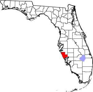 | |
| Town | ||
| CDPs | ||
| Unincorporated communities | ||
| Footnotes | ‡This populated place also has portions in an adjacent county or counties, †This populated place also has portions in the City of North Port | |