Sierra Carapé
Sierra Carapé or Sierra de Carapé is a hill range located in Maldonado Department, in southern Uruguay. The range crosses the Maldonado Department from west to east and enters the Rocha Department.
| Sierra Carapé | |
|---|---|
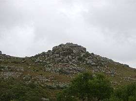 A rocky summit in this range of hills. | |
| Highest point | |
| Peak | Cerro Catedral (Cathedral Hill) |
| Elevation | 513.66 m (1,685.2 ft) |
| Coordinates | 34°22′55.9″S 54°40′27.7″W |
| Geography | |
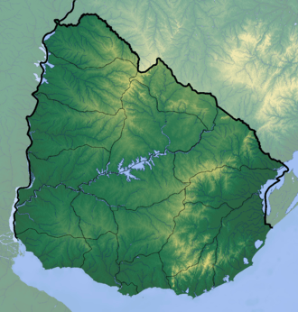 | |
| Country | Uruguay |
| Range coordinates | 34°20′S 54°39′W |
| Parent range | Cuchilla Grande |
| Geology | |
| Age of rock | Precambrian |
| Type of rock | Granite, gneiss |
Highest point in Uruguay
This range has the highest point of the country, the Cerro Catedral, with 513.66 metres (1,685.24 feet) of altitude.
External links
- (in Spanish) Cerro Catedral, Site of the Municipality of Maldonado, Uruguay.
- (in English) Peakbagger.com: Cerro Catedral, Uruguay
Capital: | ||
| Towns and villages |  | |
| Sights | ||
This article is issued from Wikipedia. The text is licensed under Creative Commons - Attribution - Sharealike. Additional terms may apply for the media files.