Shungnak, Alaska
Shungnak (Inupiaq: Isiŋnaq or Nuurviuraq) is a city in Northwest Arctic Borough, Alaska, United States. At the 2010 census the population was 262, up from 256 in 2000.
Shungnak Isiŋnaq / Nuurviuraq | |
|---|---|
City | |
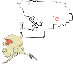 Location in Northwest Arctic Borough and the state of Alaska. | |
| Coordinates: 66°53′9″N 157°8′15″W | |
| Country | United States |
| State | Alaska |
| Borough | Northwest Arctic |
| Incorporated | May 4, 1967[1] |
| Government | |
| • Mayor | Melvin Lee[2] |
| • State senator | Donny Olson (D) |
| • State rep. | John Lincoln (D) |
| Area | |
| • Total | 8.98 sq mi (23.26 km2) |
| • Land | 8.05 sq mi (20.85 km2) |
| • Water | 0.93 sq mi (2.41 km2) |
| Elevation | 144 ft (44 m) |
| Population | |
| • Total | 262 |
| • Estimate (2018)[5] | 267 |
| • Density | 33.16/sq mi (12.80/km2) |
| Time zone | UTC-9 (Alaska (AKST)) |
| • Summer (DST) | UTC-8 (AKDT) |
| ZIP code | 99773 |
| Area code | 907 |
| FIPS code | 02-70100 |
| GNIS feature ID | 1413983 |
History
Shungnak originally was settled in 1899, approximately 10 miles to the east along the Kobuk River.[6] The name "Shungnak" is derived from the Eskimo term "issingnak," which means jade, a stone found in the surrounding area.[7] In the 1920s, erosion along the river caused many residents to abandon the old townsite. In 1927, they resettled at a site originally known as "Kochuk." Residents decided to rename Kochuk as the new Shungnak. At the old Shungnak village, some residents chose to remain. To avoid confusion between the two villages, Old Shungnak became Kobuk in 1928.
Shungnak officially incorporated in 1967.
Geography
Shungnak is located at 66°53′09″N 157°08′15″W [8]
According to the United States Census Bureau, the city has a total area of 9.6 square miles (25 km2), of which 8.4 square miles (22 km2) is land and 1.3 square miles (3.4 km2) of it (13.10%) is water.
Demographics
| Historical population | |||
|---|---|---|---|
| Census | Pop. | %± | |
| 1930 | 145 | — | |
| 1940 | 193 | 33.1% | |
| 1950 | 141 | −26.9% | |
| 1960 | 135 | −4.3% | |
| 1970 | 165 | 22.2% | |
| 1980 | 202 | 22.4% | |
| 1990 | 223 | 10.4% | |
| 2000 | 256 | 14.8% | |
| 2010 | 262 | 2.3% | |
| Est. 2018 | 267 | [5] | 1.9% |
| U.S. Decennial Census[10] | |||
The present Shungnak first appeared on the 1930 U.S. Census as an unincorporated village. The Shungnak listed on the 1910 and 1920 censuses was for the Old Shungnak, which became Kobuk in 1928. This Shungnak has reported on every census since 1930. It was formally incorporated as a city in 1967.
As of the census [11] of 2000, there were 256 people, 56 households, and 51 families residing in the city. The population density was 30.6 people per square mile (11.8/km²). There were 64 housing units at an average density of 7.7 per square mile (3.0/km²). The racial makeup of the city was 5.47% White and 94.53% Alaska Native.
Of those 56 households, 66.1% had children under the age of 18 living with them, 53.6% were married couples living together, 16.1% had a female householder with no husband present, and 8.9% were non-families. In addition, 7.1% of all households were made up of individuals and 1.8% had someone living alone who was 65 years of age or older. The average household size was 4.57 and the average family size was 4.53.
In the city, the age distribution of the population shows 48.4% under the age of 18; 8.6% from 18 to 24; 23.8% from 25 to 44; 12.9% from 45 to 64; and 6.3% who were 65 years of age or older. The median age was 19 years. For every 100 females age 18 and over, there were 103.1 males.
The median income for a household in the city was $44,375, and the median income for a family was $41,000. Males had a median income of $25,750 versus $33,750 for females. The per capita income for the city was $10,377. About 21.7% of families and 35.8% of the population were below the poverty line, including 46.2% of those under the age of eighteen and none of those 65 or over.
Facilities
The Shungnak School, operated by the Northwest Arctic Borough School District, serves the community. As of 2017 it had 7 teachers and 86 students, with Alaska Natives making up 95% of the student body.[12]
The source of municipal water is from a reservoir intermittently filled from the Kobuk River. Previously, there was a water infiltration gallery that was destroyed by ice. Groundwater wells have proven unsuccessful.[9]
The town has a 3,400-ft gravel runway owned by the state of Alaska.[13] In the summer of 2006, only part of a fuel shipment was able to be delivered by barge and the remainder of the town's fuel needs had to be supplied by air. This resulted in the price of gasoline rising to $8.10 per gallon at the town's only filling station in 2006–07.
References
- 1996 Alaska Municipal Officials Directory. Juneau: Alaska Municipal League/Alaska Department of Community and Regional Affairs. January 1996. p. 143.
- 2015 Alaska Municipal Officials Directory. Juneau: Alaska Municipal League. 2015. p. 148.
- "2018 U.S. Gazetteer Files". United States Census Bureau. Retrieved Jul 1, 2019.
- "2010 City Population and Housing Occupancy Status". U.S. Census Bureau. Retrieved May 14, 2012.
- "Population and Housing Unit Estimates". Retrieved June 4, 2019.
- "Geological Survey Professional Paper". 1949.
- NWArctic Archived 2007-08-17 at the Wayback Machine
- "US Gazetteer files: 2010, 2000, and 1990". United States Census Bureau. 2011-02-12. Retrieved 2011-04-23.
- "Archived copy". Archived from the original on 2007-09-27. Retrieved 2007-06-09.CS1 maint: archived copy as title (link)
- "Census of Population and Housing". Census.gov. Retrieved June 4, 2015.
- "U.S. Census website". United States Census Bureau. Retrieved 2008-01-31.
- Home. Shungnak School. Retrieved on March 26, 2017.
- Maniilaq Association | Shungnak
External links
- Subsistence wildlife harvests in five northwest Alaska communities, 2001-2003: results of a household survey / by Kawerak, Inc., Maniilaq Association, and the Alaska Department of Fish and Game; by Susan Georgette et al. Hosted by Alaska State Publications Program.
Municipalities and communities of Northwest Arctic Borough, Alaska, United States | ||
|---|---|---|
Borough seat: Kotzebue | ||
| Cities | 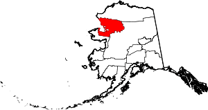 Northwest Arctic Borough map | |
| CDPs | ||
| Unincorporated communities | ||
| Ghost towns | ||
| Authority control |
|
|---|