Sherfield on Loddon
Sherfield on Loddon—formerly Sherfield upon Loddon[2]—is a village and civil parish in the English county of Hampshire. It is located at grid reference SU680580, approximately 12 miles (19 km) south of Reading and 6 miles (10 km) north of Basingstoke.
| Sherfield on Loddon | |
|---|---|
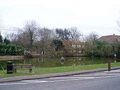 The village duck pond | |
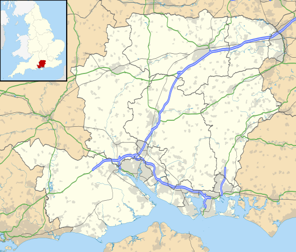 Sherfield on Loddon Location within Hampshire | |
| Population | 1,636 (Census, 2001) 3,107 (2011 Census)[1] |
| OS grid reference | SU680580 |
| District | |
| Shire county | |
| Region | |
| Country | England |
| Sovereign state | United Kingdom |
| Post town | HOOK |
| Postcode district | RG27 |
| Dialling code | 01256 |
| Police | Hampshire |
| Fire | Hampshire |
| Ambulance | South Central |
| UK Parliament | |
At the 2011 census it had a population of 1,505. This increased to 3,107 at the 2011 Census, mainly due to the Sherfield Park development on the edge of Basingstoke.
In 2016, Sherfield Park was separated to form a parish of its own.
Descent of the manor
Sherfield on Loddon originally formed part of the Manor of Odiham.
FitzAldelin
In the 12th century the manor was granted by Henry II to William Fitz Aldelin, who is reputed to have built the original Manor House.
Warblington
Sherfield was held in the reign of Edward I (1272-1307) by Thomas de Warblington, High Sheriff of Hampshire, tenant-in-chief from the king in serjeanty by the services providing laundresses, of dismembering malefactors and measuring the gallons and bushels in the royal household.[3]
Puttenham
The manor passed by marriage from the Warblingtons to the Puttenham family. The reputed 1589 author of The Arte of English Poesie, George Puttenham, grew up at Sherfield Court but, as an adult, disputed its ownership with his niece.
Wellesley
The Manor was eventually purchased by the Duke of Wellington in 1838.
Modern day
The present village developed about one mile north of the Manor house and church from around the 14th century. By the start of the twentieth century there were about forty homes surrounding the main village green with more homes around the Manor and Church.
In 1917 Bramley Camp (Army Training Camp) opened to the southwest of the Village creating employment opportunities for both Sherfield on Loddon and Bramley.
A bypass was built around the village in 1974, moving the main Reading to Basingstoke road to the east.
From 2004 to 2014, the Sherfield Park development was built on the edge of Basingstoke within the boundaries of the civil parish. By the time it was completed, the new development's population outnumbered that of the original village. In 2016, Sherfield Park was separated to become a civil parish of its own.
Geography
Sherfield is located 12 miles (19 km) south of the large town of Reading and 6 miles (10 km) north of Basingstoke. The village is on the A33 road, between Reading and Basingstoke. The parish includes the hamlets of Church End and Wildmoor.
Places adjacent to Sherfield on Loddon | ||||||||||
|---|---|---|---|---|---|---|---|---|---|---|
| ||||||||||
Schools
- Sherfield School
- The Loddon School
- North Foreland Lodge (1947–2003)
References
- "Civil Parish population 2011". Neighbourhood Statistics. Office for National Statistics. Retrieved 9 January 2017.
- "Parishes: Sherfield-upon-Loddon - British History Online". www.british-history.ac.uk.
- Longcroft, Charles John. A Topographical Account of the Hundred of Bosmere in the County of Southampton, Including the Parishes of Havant, Warblington and Hayling. London, 1857, p.100. Longcroft quotes as his source "Pas. Comms. 24 & 25 Edw. I" (i.e. 1295/6).
External links
- Sherfield on Loddon parish council
- Sherfield on Loddon Village Hall website
- Sherfield Park Community website
- The White Hart (pub), Sherfield on Loddon
![]()
