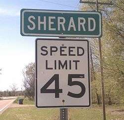
Sherard, Mississippi
Sherard is an unincorporated community located in Coahoma County, Mississippi, United States. Sherard is located along Mississippi Highway 1, 6 miles (9.7 km) west of Clarksdale.
Sherard, Mississippi | |
|---|---|
 | |
 Sherard  Sherard | |
| Coordinates: 34°12′56″N 90°42′22″W | |
| Country | United States |
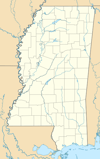
| State | Mississippi |
| County | Coahoma |
| Elevation | 164 ft (50 m) |
| Time zone | UTC-6 (Central (CST)) |
| • Summer (DST) | UTC-5 (CDT) |
| ZIP code | 38669 |
| Area code(s) | 662 |
| GNIS feature ID | 677650[1] |
History
Sherard is named for the Sherard family, who cleared the land for a plantation in 1874. The plantation originally had two cotton gins, a saw mill, and pecan processing equipment.[2] Sherard is located on the former Yazoo and Mississippi Valley Railroad and in 1910 was home to four general stores and the Memphis Shingle Company.[3] A post office first began operation under the name Sherard in 1890.[4]
Sherard is served by the Coahoma County School District. Residents are served by Sherard Elementary School and Coahoma County Junior-Senior High School.[5]
A cultivar of pecan known as Sherard was developed in Sherard in 1916.[6]
Notable person
- Lewis C. Hudson, Brigadier General in the Marine Corps, lived in Sherard in the 1920s.
References
- U.S. Geological Survey Geographic Names Information System: Sherard, Mississippi
- Best Books on (1938). Mississippi; a Guide to the Magnolia State,. Best Books on. pp. 347–8. ISBN 978-1-62376-023-6.
- Howe, Tony. "Sherard, Mississippi". Mississippi Rails. Retrieved 10 June 2020.
- "Coahoma County". Jim Forte Postal History. Retrieved 10 June 2020.
- "Schools." Coahoma County School District. Retrieved on July 6, 2017.
- Proceedings of the ... convention of the American Pomological Society. 1922. p. 301.
Municipalities and communities of Coahoma County, Mississippi, United States | ||
|---|---|---|
| City | 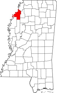 Map of Mississippi highlighting Coahoma County | |
| Towns | ||
| CDP | ||
| Other unincorporated communities | ||
| Ghost towns | ||
| Footnotes | ‡This populated place also has portions in an adjacent county or counties | |