Shawnee Township, Fountain County, Indiana
Shawnee Township is one of eleven townships in Fountain County, Indiana, United States. As of the 2010 census, its population was 672 and it contained 282 housing units.[1]
Shawnee Township | |
|---|---|
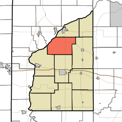 Location of Shawnee Township in Fountain County | |
| Coordinates: 40°13′18″N 87°15′38″W | |
| Country | United States |
| State | Indiana |
| County | Fountain |
| Government | |
| • Type | Indiana township |
| Area | |
| • Total | 34.82 sq mi (90.2 km2) |
| • Land | 34.67 sq mi (89.8 km2) |
| • Water | 0.16 sq mi (0.4 km2) |
| Elevation | 673 ft (205 m) |
| Population (2010) | |
| • Total | 672 |
| • Density | 19.4/sq mi (7.5/km2) |
| FIPS code | 18-69084 |
| GNIS feature ID | 453841 |
Geography
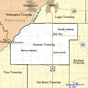
According to the 2010 census, the township has a total area of 34.82 square miles (90.2 km2), of which 34.67 square miles (89.8 km2) (or 99.57%) is land and 0.16 square miles (0.41 km2) (or 0.46%) is water.[1] It contains no incorporated settlements. The unincorporated communities of Aylesworth and Rob Roy both lie along the route of U.S. Route 41, while Fountain is in the far west on the east banks of the Wabash River. State Road 55 shares the route of U.S. 41 south from Attica until it reaches Rob Roy, at which point State Road 55 goes east while U.S. 41 continues south.
References
- "Population, Housing Units, Area, and Density: 2010 - County -- County Subdivision and Place -- 2010 Census Summary File 1". United States Census. Archived from the original on 2020-02-12. Retrieved 2013-05-10.
- "Beulah Cemetery". Geographic Names Information System. United States Geological Survey. Retrieved 2011-09-10.
- "Brown Cemetery". Geographic Names Information System. United States Geological Survey. Retrieved 2011-09-10.
External links
Places adjacent to Shawnee Township, Fountain County, Indiana | |
|---|---|
Municipalities and communities of Fountain County, Indiana, United States | ||
|---|---|---|
| Cities | Map of Indiana highlighting Fountain County | |
| Towns | ||
| Townships | ||
| Unincorporated communities | ||