Sharon, Oklahoma
Sharon is a town in Woodward County, Oklahoma, United States. The population was 135 at the 2010 census.
Sharon, Oklahoma | |
|---|---|
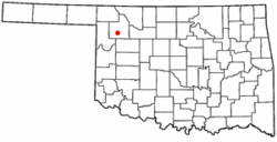 Location of Sharon, Oklahoma | |
| Coordinates: 36°16′35″N 99°20′19″W | |
| Country | United States |
| State | Oklahoma |
| County | Woodward |
| Area | |
| • Total | 0.14 sq mi (0.35 km2) |
| • Land | 0.14 sq mi (0.35 km2) |
| • Water | 0.00 sq mi (0.00 km2) |
| Elevation | 2,044 ft (623 m) |
| Population (2010) | |
| • Total | 135 |
| • Estimate (2018)[2] | 133 |
| • Density | 977.94/sq mi (376.86/km2) |
| Time zone | UTC-6 (Central (CST)) |
| • Summer (DST) | UTC-5 (CDT) |
| ZIP code | 73857 |
| Area code(s) | 580 |
| FIPS code | 40-66650[3] |
| GNIS feature ID | 1097956[4] |
Geography
Sharon is located at 36°16′35″N 99°20′19″W (36.276429, -99.338533).[5]
According to the United States Census Bureau, the town has a total area of 0.1 square miles (0.26 km2), all of it land.
Demographics
| Historical population | |||
|---|---|---|---|
| Census | Pop. | %± | |
| 1930 | 227 | — | |
| 1940 | 226 | −0.4% | |
| 1950 | 133 | −41.2% | |
| 1960 | 97 | −27.1% | |
| 1970 | 155 | 59.8% | |
| 1980 | 171 | 10.3% | |
| 1990 | 108 | −36.8% | |
| 2000 | 122 | 13.0% | |
| 2010 | 135 | 10.7% | |
| Est. 2018 | 133 | [2] | −1.5% |
| U.S. Decennial Census[6] | |||
As of the census[3] of 2000, there were 122 people, 45 households, and 32 families residing in the town. The population density was 1,013.2 people per square mile (392.5/km²). There were 52 housing units at an average density of 431.9 per square mile (167.3/km²). The racial makeup of the town was 94.26% White, 4.10% Native American, and 1.64% from two or more races.
There were 45 households out of which 33.3% had children under the age of 18 living with them, 66.7% were married couples living together, and 26.7% were non-families. 24.4% of all households were made up of individuals and 13.3% had someone living alone who was 65 years of age or older. The average household size was 2.71 and the average family size was 3.18.
In the town, the population was spread out with 31.1% under the age of 18, 2.5% from 18 to 24, 28.7% from 25 to 44, 15.6% from 45 to 64, and 22.1% who were 65 years of age or older. The median age was 36 years. For every 100 females, there were 82.1 males. For every 100 females age 18 and over, there were 100.0 males.
The median income for a household in the town was $45,000, and the median income for a family was $46,667. Males had a median income of $24,688 versus $28,333 for females. The per capita income for the town was $12,444. There were 10.0% of families and 18.4% of the population living below the poverty line, including 35.4% of under eighteens and none of those over 64.
References
- "2018 U.S. Gazetteer Files". United States Census Bureau. Retrieved Feb 12, 2020.
- "Population and Housing Unit Estimates". Retrieved June 4, 2019.
- "U.S. Census website". United States Census Bureau. Retrieved 2008-01-31.
- "US Board on Geographic Names". United States Geological Survey. 2007-10-25. Retrieved 2008-01-31.
- "US Gazetteer files: 2010, 2000, and 1990". United States Census Bureau. 2011-02-12. Retrieved 2011-04-23.
- "Census of Population and Housing". Census.gov. Retrieved June 4, 2015.
External links
Municipalities and communities of Woodward County, Oklahoma, United States | ||
|---|---|---|
| City | 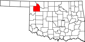 Map of Oklahoma highlighting Woodward County | |
| Towns | ||
| Unincorporated communities | ||