Semboku, Akita
Semboku (仙北市, Semboku-shi) is a city located in Akita Prefecture, Japan. As of 31 December 2019, the city had an estimated population of 25,857 in 10,584 households,[1] and a population density of 24 persons per km². The total area of the city is 1,093.64 square kilometers (422 sq mi).
Semboku 仙北市 | |
|---|---|
 Semboku City Hall | |
 Flag  Seal | |
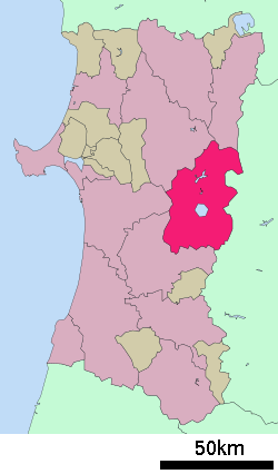 Location of Semboku in Akita Prefecture | |
 Semboku | |
| Coordinates: 39°42′06″N 140°43′53.4″E | |
| Country | Japan |
| Region | Tōhoku |
| Prefecture | Akita |
| Area | |
| • Total | 1,093.64 km2 (422.26 sq mi) |
| Population (December 2019) | |
| • Total | 25,857 |
| • Density | 24/km2 (61/sq mi) |
| Time zone | UTC+9 (Japan Standard Time) |
| Phone number | 0187-43-1111 |
| Address | 30 Miyanoshiro, Obonai, Tazawako, Semboku-shi, Akita-ken 014-1201 |
| Website | Official website |
Geography
Semboku is located in the mountains of central Akita Prefecture, bordering on Iwate Prefecture and the Ōu Mountains on the east. Lake Tazawa, the deepest lake in Japan, is located in the center of the city borders. Parts of the city are within the borders of the Towada-Hachimantai National Park.
Neighboring municipalities
- Akita Prefecture
- Iwate Prefecture
Demographics
Per Japanese census data,[2] the population of Semboku peaked in the early 1960s, and has since declined to the same level as a century ago.
| Historical population | ||
|---|---|---|
| Year | Pop. | ±% |
| 1920 | 29,123 | — |
| 1930 | 32,017 | +9.9% |
| 1940 | 37,453 | +17.0% |
| 1950 | 43,358 | +15.8% |
| 1960 | 43,765 | +0.9% |
| 1970 | 39,216 | −10.4% |
| 1980 | 39,098 | −0.3% |
| 1990 | 36,297 | −7.2% |
| 2000 | 33,565 | −7.5% |
| 2010 | 29,572 | −11.9% |
Climate
Semboku has a Humid continental climate (Köppen climate classification Dfa) with large seasonal temperature differences, with warm to hot (and often humid) summers and cold (sometimes severely cold) winters. Precipitation is significant throughout the year, but is heaviest from August to October. The average annual temperature in Semboku is 9.8 °C. The average annual rainfall is 1539 mm with September as the wettest month. The temperatures are highest on average in August, at around 24.0 °C, and lowest in January, at around -3.2 °C.[3]
History
The area of present-day Semboku was part of ancient Dewa Province. During the Edo period, the area came under the control of the Satake clan, who had been relocated to Kubota Domain from their former holdings in Hitachi Province. After the start of the Meiji period, the area became part of Semboku District, Akita Prefecture in 1878. The town of Kakunodate was established on April 1, 1889 with the establishment of the modern municipalities system.
The city of Semboku was established on March 22, 2005, from the merger of the towns of Kakunodate and Tazawako, and the village of Nishiki (all from Semboku District).
Government
Semboku has a mayor-council form of government with a directly elected mayor and a unicameral city legislature of 18 members. The city contributes one member to the Akita Prefectural Assembly. In terms of national politics, the city is part of Akita District 3 of the lower house of the Diet of Japan.
Economy
The economy of Semboku is based on agriculture, forestry and seasonal tourism.
Education
Semboku has seven public elementary schools and five public middle schools operated by the city government and one public high school operated by the Akita Prefectural Board of Education.
Transportation
Railway
![]()
![]()
- Tazawako - Sashimaki - Jindai - Shōden - Kakunodate
Akita Nairiku Jūkan Railway - Akita Nairiku Line
- Tozawa - Kami-Hinokinai - Sadōri - Ugo-Nakazato - Matsuba - Ugo-Nagatoro - Akita - Saimyoji - Ugo-Ōta - Kakunodate
Local attractions
 Buke-yashiki (samurai residences) street, Kakunodate
- Tamagawa Hot Spring has the highest flow rate of any hot spring in Japan at 150 liters/second, which feeds a 3 meter wide stream with a temperature of 98 degrees C. The water from Tamagawa Hot Spring is also very acidic.
- Towada-Hachimantai National Park
- Lake Tazawa – the deepest lake in Japan
- Ōfuka Onsen
- Kakunodate samurai residences
International relations
Twin towns — Sister cities
Semboku is twinned with:

Noted people from Semboku
- Ayako Fuji, musician
- Norihisa Satake, politician
- Shigehiro Taguchi, basketball player
- Yasuhiko Takahashi, wheel gymnastics acrobat
References
External links
| Wikimedia Commons has media related to Semboku, Akita. |
- Official Website (in Japanese)
- Semboku Sightseeing Info Website
Akita (capital) | ||
| Core city |
| |
| Cities | ||
| Districts | ||