Sefidrud Dam
Sefidrud Dam (originally named Shahbanu Farah Dam and also known as the Manjil Dam) is a buttress dam on the Sefīd-Rūd in the Alborz mountain range, located near Manjil in Gilan Province, northern Iran.
| Sefidrud Dam | |
|---|---|
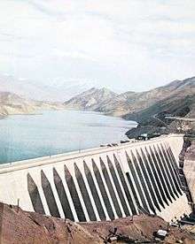 The dam in 1975 | |
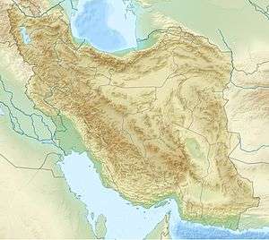 Location of Sefidrud Dam in Iran | |
| Location | Manjil, Iran |
| Coordinates | 36°45′31.27″N 49°23′16.03″E |
| Purpose | Power, irrigation |
| Status | Operational |
| Construction began | 1956 |
| Opening date | 1962 |
| Dam and spillways | |
| Type of dam | Buttress |
| Impounds | Sefīd-Rūd |
| Height | 106 m (348 ft) |
| Length | 425 m (1,394 ft) |
| Width (crest) | 8 m (26 ft) |
| Width (base) | 100 m (328 ft) |
| Reservoir | |
| Total capacity | 1,820,000,000 m3 (1,475,498 acre⋅ft) |
| Power Station | |
| Installed capacity | 87 MW |
It was constructed to store water for irrigation and produce hydroelectric power. The power station has an installed capacity of 87 MW. It is 106 m (348 ft) tall and forms a reservoir with a capacity of 1.82 km3 (1,475,498 acre⋅ft). Its structure contains 26 monoliths.[1]
The Tarik Dam is located 35 km (22 mi) downstream and diverts releases from the Sefidrud Dam for irrigation.
The extremely destructive 1990 Manjil–Rudbar earthquake occurred near the dam and caused portions of its concrete to crack. Repairs and mitigation efforts were undertaken in 1991.[2][3]
References
- Ghaemmaghami, A.R.; M. Ghaemian. "Experimental Study of Small Scale model of Sefid-rud Dam on Shaking Table" (PDF). Indian Institute of Technology Khanpur. Retrieved 7 June 2013. Cite journal requires
|journal=(help) - "Sefid Rud Dam". Structurae. Retrieved 7 June 2013.
- "SEFID RUD DAM, IRAN". NOAA. Retrieved 7 June 2013.
| Wikimedia Commons has media related to Sefid-Rud Dam. |
| Capital |  | |
|---|---|---|
| Counties and cities | ||
| Sights |
| |
| Populated places | ||
| Major reservoirs and dams in Iran |
|  |
|---|---|---|
| Under construction |
| |
| Ancient dams | ||
Also See: Dams and reservoirs in Iran | ||