Seaside, Oregon
Seaside is a city in Clatsop County, Oregon, United States. The name Seaside is derived from Seaside House, a historic summer resort built in the 1870s by railroad magnate Ben Holladay. The city's population was 6,457 at the 2010 census.[7]
Seaside, Oregon | |
|---|---|
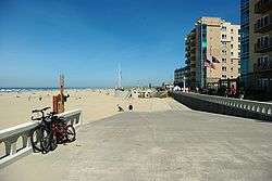 Seaside Promenade | |
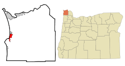 Location in Oregon and Clatsop County | |
| Coordinates: 45°59′34″N 123°55′20″W | |
| Country | United States |
| State | Oregon |
| County | Clatsop |
| Incorporated | 1899 |
| Government | |
| • Type | Council-Mamager |
| • Body | Seaside City Council |
| • Mayor | Jay Barber[1] |
| • City Manager | Mark J. Winstanley |
| Area | |
| • Total | 4.05 sq mi (10.49 km2) |
| • Land | 3.89 sq mi (10.09 km2) |
| • Water | 0.16 sq mi (0.41 km2) |
| Elevation | 17 ft (5.2 m) |
| Population | |
| • Total | 6,457 |
| • Estimate (2018)[4] | 6,795 |
| • Density | 1,744.99/sq mi (673.67/km2) |
| Time zone | UTC−08:00 (Pacific) |
| • Summer (DST) | UTC−07:00 (Pacific) |
| ZIP Code | 97138 |
| Area code(s) | 503 and 971 |
| FIPS code | 41-65950[5] |
| GNIS feature ID | 1136735[6] |
| Website | www.cityofseaside.us |
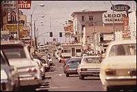
History
.jpg)
The Clatsop were a historic Native American tribe that had a village named Ne-co-tat (in their Chinook language) in this area. Indigenous peoples had long inhabited the coastal area.
About January 1, 1806, a group of men from the Lewis and Clark Expedition built a salt-making cairn at the site later developed as Seaside. The city was not incorporated until February 17, 1899, when coastal resort areas were being settled.[8] It is about 79 miles by car northwest of Portland, Oregon, a major population center.[9]
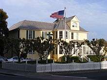
In 1912, Alexandre Gilbert (1843–1932) was elected Mayor of Seaside. Gilbert was a French immigrant, a veteran of the Franco Prussian War (1870-1871). After living in San Francisco, California and Astoria, Oregon, Gilbert moved to Seaside where he had a beach cottage (built in 1885). Gilbert was a real estate developer who donated land to the City of Seaside for its one-and-a-half-mile-long Promenade, or "Prom," along the Pacific beach.
In 1892 he added to his beach cottage. Nearly 100 years later, what was known as the Gilbert House was operated commercially as the Gilbert Inn since the mid-1980s. Both it and Gilbert's eponymous "Gilbert Block" office building on Broadway still survive.
Gilbert died at home in Seaside and is interred in Ocean View Abbey Mausoleum in Warrenton.
Geography
According to the United States Census Bureau, the city has a total area of 4.14 square miles (10.72 km2), of which 3.94 square miles (10.20 km2) is land and 0.20 square miles (0.52 km2) is water.[10]
_(19326200874).jpg)
Seaside lies on the edge of the Pacific Ocean, at the southern end of the Clatsop Plains, about 29 km (18 mi) south of where the Columbia River empties into the Pacific. The city is developed on both sides of the Necanicum River, which flows to the ocean at the city's northern edge. Tillamook Head towers over the southern edge of the city.

The geography associated with the gradual slope of the broad sandy beaches of Clatsop Spit provide excellent conditions for the formation of beds of millions of Pacific razor clams annually. The razor clams attract thousands of visitors to Seaside Beach each year.[11] Waves attract surfers all year round from the challenging point break off the tip of Tillamook Head to the sandy shores at "the cove" parking lot at Ocean Vista Drive.[12][13][14]
Climate
Seaside has an oceanic climate (Köppen Cfb), typical Pacific Northwest climate, bordering very closely on a warm-summer mediterranean climate (Köppen Csb). It receives rainy winters and mild-to-cool summers. Mean high temperature in the warmest month, August, is roughly 68 °F (20 °C).
| Climate data for Seaside, Oregon | |||||||||||||
|---|---|---|---|---|---|---|---|---|---|---|---|---|---|
| Month | Jan | Feb | Mar | Apr | May | Jun | Jul | Aug | Sep | Oct | Nov | Dec | Year |
| Average high °F (°C) | 52.1 (11.2) |
53.7 (12.1) |
55.2 (12.9) |
57.2 (14.0) |
60.8 (16.0) |
63.5 (17.5) |
66.3 (19.1) |
67.6 (19.8) |
67.3 (19.6) |
62.0 (16.7) |
54.8 (12.7) |
51.0 (10.6) |
59.3 (15.2) |
| Daily mean °F (°C) | 45.3 (7.4) |
45.8 (7.7) |
47.2 (8.4) |
49.2 (9.6) |
53.2 (11.8) |
56.5 (13.6) |
59.4 (15.2) |
60.0 (15.6) |
58.0 (14.4) |
53.4 (11.9) |
48.0 (8.9) |
44.1 (6.7) |
51.7 (10.9) |
| Average low °F (°C) | 38.6 (3.7) |
37.8 (3.2) |
39.3 (4.1) |
41.2 (5.1) |
45.5 (7.5) |
49.5 (9.7) |
52.5 (11.4) |
52.5 (11.4) |
48.7 (9.3) |
44.8 (7.1) |
41.2 (5.1) |
37.2 (2.9) |
44.1 (6.7) |
| Average precipitation inches (mm) | 10.74 (273) |
8.38 (213) |
8.45 (215) |
6.04 (153) |
4.09 (104) |
3.29 (84) |
1.47 (37) |
1.23 (31) |
2.29 (58) |
6.20 (157) |
11.65 (296) |
10.55 (268) |
74.39 (1,890) |
| Average precipitation days (≥ 0.01 in) | 20.4 | 16.7 | 19.4 | 17.0 | 14.4 | 11.8 | 8.1 | 6.9 | 8.4 | 14.2 | 20.4 | 19.6 | 177.4 |
| Source: NOAA [15] | |||||||||||||
Tsunami inundation zone

Part of Seaside is located in a tsunami inundation zone. Among other preparation, the City of Seaside has embarked on a program in which residents above the zone are asked to volunteer to store within their homes barrels of medical supplies, water purification systems, emergency rations, tarps, and radios, with each barrel having enough supplies to last 20 individuals for at least 3 days. As of January 2017, there are 119 barrels within volunteer households and a waiting list of interested households.[16]
Seismologists estimate that there is a one in three chance that Seaside will be hit by an earthquake and tsunami within the next fifty years.[17] On Tues. Nov. 8, 2016, Seaside citizens voted 65% to 35% to issue 99.7 million in bonds to move the remaining three schools out of the tsunami inundation zone.[18]
Demographics

| Historical population | |||
|---|---|---|---|
| Census | Pop. | %± | |
| 1880 | 75 | — | |
| 1890 | 87 | 16.0% | |
| 1900 | 191 | 119.5% | |
| 1910 | 1,121 | 486.9% | |
| 1920 | 1,802 | 60.7% | |
| 1930 | 1,565 | −13.2% | |
| 1940 | 2,902 | 85.4% | |
| 1950 | 3,886 | 33.9% | |
| 1960 | 3,877 | −0.2% | |
| 1970 | 4,402 | 13.5% | |
| 1980 | 5,193 | 18.0% | |
| 1990 | 5,359 | 3.2% | |
| 2000 | 5,900 | 10.1% | |
| 2010 | 6,457 | 9.4% | |
| Est. 2018 | 6,795 | [4] | 5.2% |
| Sources:[7][19][20] | |||
As of the census[3] of 2010, there were 6,457 people, 2,969 households, and 1,565 families residing in the city. The population density was 1,638.8 inhabitants per square mile (632.7/km2). There were 4,638 housing units at an average density of 1,177.2 per square mile (454.5/km2). The racial makeup of the city was 88.1% White, 0.6% African American, 0.8% Native American, 1.4% Asian, 0.1% Pacific Islander, 5.8% from other races, and 3.1% from two or more races. Hispanic or Latino of any race were 12.4% of the population.
There were 2,969 households of which 24.2% had children under the age of 18 living with them, 35.4% were married couples living together, 11.5% had a female householder with no husband present, 5.8% had a male householder with no wife present, and 47.3% were non-families. 38.6% of all households were made up of individuals and 15.4% had someone living alone who was 65 years of age or older. The average household size was 2.16 and the average family size was 2.83.
The median age in the city was 41.5 years. 20% of residents were under the age of 18; 9.3% were between the ages of 18 and 24; 24.7% were from 25 to 44; 28.6% were from 45 to 64; and 17.4% were 65 years of age or older. The gender makeup of the city was 48.3% male and 51.7% female.
Arts and culture
The Seaside Jazz Festival (formerly the Oregon Dixieland Jubilee) is an annual festival that features some of the most popular Trad Jazz and Swing bands in the US and Canada. Seaside holds an art walk the first Saturday of each month.[21]
Annual cultural events
Seaside hosts an annual 4th of July celebration which includes a parade, outdoor concerts, and one of the largest fireworks displays on the west coast.[22]
Every spring until 2016 (In 2017 and 2018 the conference was moved to Salem. in 2019 the Dorchester Conference was moved to Welches, Oregon.). Seaside hosted the Dorchester Conference, a convention of Oregon political activists, typically conservative, independent, or center-right. This convention was founded in 1964 by then-state representative Bob Packwood as a forum for all Republicans statewide.
In the 1990s it became dominated by members of the conservative branch of the party. Over the years the conference has attracted visits from presidential candidates, debates between Republican primary candidates, and discussions of wider political and social issues.[23] It is run by an independent board and is not formally affiliated with the Oregon Republican Party.[24]
The Miss Oregon Pageant, the official state finals to the Miss America Pageant, takes place annually at the Seaside Civic and Convention Center.[25]
The annual Salt Maker's Return is held in August. The themed event celebrates Seaside history. Five men of the Lewis and Clark expedition needed nearly two months to make the equivalent of 28 US gallons (110 l) of salt; it was critical for them to be able to preserve meat for the winter and their several thousand-mile journey home to the East.[26]

The beach and promenade at Seaside serve as the finish line for the Hood to Coast and Portland to Coast relays, held annually on the weekend before Labor Day.
Museums and other points of interest
Seaside is home to the Seaside Aquarium, featuring living regional marine life, a hands-on discovery center, and a 35-foot (11 m) gray whale skeleton, all within a short walk from the Lewis & Clark monument.[27]
Murals adorn several buildings throughout Seaside, depicting history, marine life, and life in Seaside.[28]
Media
Newspaper
Transportation
- Seaside has two major highways, U.S. Route 101 and U.S. Route 26.
- Seaside is served by an intercity bus system.
- Seaside Municipal Airport
- Seaside is currently working on a Transportation System Plan (TSP).[29] It will serve as the transportation element of the City of Seaside's Comprehensive Plan. The TSP will describe how the transportation network in Seaside is being used now and how it is expected to be used in the future (in 2030). TSPs need to be developed according to the State of Oregon's Transportation Planning Rule. At the end of the project, the recommended improvements will be consistent with the Clatsop County TSP and the Oregon Highway Plan.
Notable people
- Deborah Boone (born 1951), member of Oregon's House of Representatives
- Ken Carpenter (1926–2011), American football player
- Betsy Eby (born 1967), painter
- Charles Irving Elliott (1892-1972), Aviation Pioneer
- Karl Marlantes (born 1944), author, businessman and decorated Marine veteran.
- Ormond Robbins (1910–1984), author
- John Schlee (1939–2000), golfer
- E. E. Smith (1890–1965), author
- Tsin-is-tum (c. 1814–1905), Native American folklorist
- Mark Wiebe (born 1956), golfer
References
- Marx, R. J. (December 13, 2016). "Barber is named Seaside mayor". The Daily Astorian. p. 1.
- "2018 U.S. Gazetteer Files". United States Census Bureau. Retrieved Feb 12, 2020.
- "U.S. Census website". United States Census Bureau. Retrieved 2012-12-21.
- "Population and Housing Unit Estimates". Retrieved June 4, 2019.
- "U.S. Census website". United States Census Bureau. Retrieved 2008-01-31.
- "US Board on Geographic Names". United States Geological Survey. 2007-10-25. Retrieved 2008-01-31.
- "2010 Census profiles: Oregon cities alphabetically R-S" (PDF). Portland State University Population Research Center. Retrieved September 29, 2011.
- Leeds, W. H. (1899). "Special Laws". The State of Oregon General and Special Laws and Joint Resolutions and Memorials Enacted and Adopted by the Twentieth Regular Session of the Legislative Assembly. Salem, Oregon: State Printer: 959.
- "Seaside, OR to Portland, OR", Distance between Cities website, 2016
- "US Gazetteer files 2010". United States Census Bureau. Archived from the original on 2012-07-02. Retrieved 2012-12-21.
- "Oregon's Clams". clamdigging.info. Retrieved 2016-04-22.
- Anderson, Don. "Point Break offers awesome, but dangerous surfing". The Astorian. Retrieved 2019-09-20.
- "Surfing in Oregon? It makes sense (really)". The Seattle Times. 2012-08-22. Retrieved 2019-09-20.
- Burningham, Lucy (2013-08-16). "Surfing Oregon's North Coast". Wall Street Journal. ISSN 0099-9660. Retrieved 2019-09-20.
- "NowData – NOAA Online Weather Data". National Oceanic and Atmospheric Administration. Retrieved 2012-07-20.
- Tsunami Supply Barrel Program, City of Seaside.
- The Really Small Ones, New Yorker, Kathryn Schulz, Nov. 4, 2016.
- Seaside Voters Back Bond To Move Schools From Tsunami Zone, OPB [Oregon Public Broadcasting], by R.J. Marx, Daily Astorian | Nov. 9, 2016. This article includes a photo from another school district entirely of a student taking cover under a desk during a tsunami drill.
- Moffatt, Riley. Population History of Western U.S. Cities & Towns, 1850-1990. Lanham: Scarecrow, 1996, 215.
- "Subcounty population estimates: Oregon 2000-2007". United States Census Bureau, Population Division. 2009-03-18. Archived from the original (CSV) on 2009-07-09. Retrieved 2009-05-09.
- First Saturday Artwalk - Seaside Chamber of Commerce Archived 2013-03-07 at the Wayback Machine
- "Archived copy". Archived from the original on 2010-06-14. Retrieved 2010-05-02.CS1 maint: archived copy as title (link)
- Dorchester Conference
- "Republican Party: We're not Dorchester". The Oregonian.
- "Miss Oregon Pageant starts today in Seaside," The Oregonian, 8 July 2004.
- "The Salt Works – Lewis and Clark National Historical Park". National Park Service. Retrieved 2016-08-03.
- "Seaside Activities and Attractions – Seaside Aquarium". Coast Explorer Magazine. Retrieved 2016-08-03.
- "Art & History Al Fresco: Historical Murals in Seaside Oregon". Coast Explorer Magazine. December 25, 2010. Retrieved 2016-08-03.
- "Seaside Transportation System Plan". seasidetsp.org. Retrieved 2016-08-03.
External links
| Wikimedia Commons has media related to Seaside, Oregon. |
| Wikivoyage has a travel guide for Seaside (Oregon). |
- City of Seaside (official website)
- Entry for Seaside in the Oregon Blue Book
- Seaside Chamber of Commerce
- Seaside Historical Society
- Seaside Visitor's Bureau
- Seaside Downtown Development Association
- Seaside, Oregon at Curlie
Municipalities and communities of Clatsop County, Oregon, United States | ||
|---|---|---|
| Cities |  Clatsop County map | |
| CDPs | ||
| Other unincorporated communities | ||
| Authority control |
|
|---|