Saraighat
Saraighat (Pron: ˌʃəraɪˈgɑ:t) is a neighborhood in the Indian city of Guwahati, on the north bank of the river Brahmaputra. Sarai was a small village where the old abandoned N.F. Railway station of Amingaon was located. The famous Battle of Saraighat was fought near this place on the river in 1671.
Saraighat | |
|---|---|
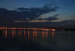 Dusk over Saraighat Bridge | |
 Saraighat Location in Assam, India  Saraighat Saraighat (India) | |
| Coordinates: 26°10′33″N 91°40′20″E | |
| Country | |
| State | Assam |
| District | Kamrup |
| Bridge Constructed by | The Braithwaite, Burn & Jessop Construction Company Limited |
| Languages | |
| • Official | Assamese |
| Time zone | UTC+5:30 (IST) |
| ISO 3166 code | IN-AS |
| Vehicle registration | AS |
| Coastline | 0 kilometres (0 mi) |
There is a road-cum-rail bridge over the river Brahmaputra joining the north and south banks at Saraighat. This was the first bridge built over the Brahmaputra River in Assam.
Saraighat Bridge
Saraighat Bridge is the first rail-cum-road bridge constructed over the Brahmaputra River in Assam.
The idea of constructing a bridge over the Brahmaputra was first mooted in 1910 and the thought gathered momentum during the Second World War. Initially there were doubts over the stability of the railway line between Bongaigaon and Amingaon following devastating floods in 1942-43. However, when the line had been satisfactorily stabilized, the Railway Minister announced the decision to construct the bridge in the Budget session of the Parliament in 1958.
The bridge was built by the Northeast Frontier Railway, under the direction of chief engineer Bankim Chandra Ganguli. Hindustan Construction Company built the foundations and piers for the bridge, and Braithwaite Burn and Jessop company built the double-warren trusses between the piers and the shore. Construction of Saraighat Bridge was started in the dry season of 1958-59. The bridge was completed in September 1962 and the first engine rolled across it on 23 September 1962, followed by Goods Train service from 31 October that year.[1] The roadway opened in March 1963. Prime Minister Jawaharlal Nehru dedicated the bridge and formally named it after the Battle of Saraighat on 7 June 1963.
Giving details of the construction of the historic bridge, Railway sources said that the total cost of construction was around Rs 10.65 crore[2] and the total length of it is 4258 feet. The road is 24 feet wide with six feet wide footpath on both sides.
Sources revealed that the bridge has 12 spans and 14,000 tonnes of steel, 4.2 cubic feet concrete, and 40,000 tonnes of cement. 100 million cubic feet of earthwork were used to construct the bridge. A 40 feet clearance is kept from the normal high flood level to ensure free navigation under the bridge.
In April 2012, the Railways entrusted the IIT Guwahati with the responsibility of studying the effect of age on the bridge. The experts gave the opinion that the structure and all the pillars of the bridge are in sound condition and the bridge would be able to serve the North East region of the country for years to come.
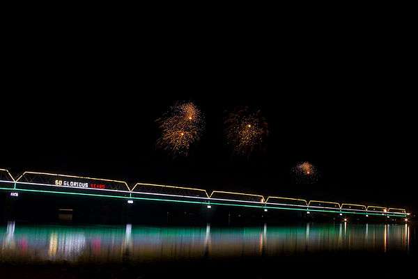
A companion three-lane concrete road bridge was inaugurated in 2017[3].
The Lachit Borphukan Park is situated on the south end and Chilarai Park situated on the north end of the bridge.[4]
See also
- List of longest bridges in the world
- List of longest bridges above water in India
References
| Wikimedia Commons has media related to Saraighat. |
- Nov 7, Kangkan Kalita | TNN | Updated; 2012; Ist, 1:09. "50 years of Saraighat bridge | Guwahati News - Times of India". The Times of India. Retrieved 17 August 2019.CS1 maint: numeric names: authors list (link)
- Nov 7, Kangkan Kalita | TNN | Updated; 2012; Ist, 1:09. "50 years of Saraighat bridge | Guwahati News - Times of India". The Times of India. Retrieved 17 August 2019.CS1 maint: numeric names: authors list (link)
- "Assam: A reason to cheer! After 10 years of waiting, 2nd Saraighat Bridge finally inaugurated". The North East Today. 29 January 2017. Retrieved 26 December 2017.
- Saraighat Bridge of Assam - bridging the gap Archived 16 June 2013 at the Wayback Machine India-north-east.com