Santa Margarita, Samar
Santa Margarita, officially the Municipality of Santa Margarita, (Waray: Bungto san Magsohong), is a 4th class municipality in the province of Samar, Philippines. According to the 2015 census, it has a population of 26,348 people.[3]
Santa Margarita | |
|---|---|
| Municipality of Santa Margarita | |
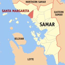 Map of Samar with Santa Margarita highlighted | |
| |
.svg.png) Santa Margarita Location within the Philippines | |
| Coordinates: 12°02′16″N 124°39′28″E | |
| Country | |
| Region | Eastern Visayas (Region VIII) |
| Province | Samar |
| District | 1st district of Samar |
| Barangays | 36 (see Barangays) |
| Government | |
| • Type | Sangguniang Bayan |
| • Mayor | Gemma P. Zosa |
| • Vice Mayor | Simplicio D. Galibo Jr. |
| • Congressman | Edgar Mary S. Sarmiento |
| • Municipal Council | Councilors
|
| • Electorate | 18,605 voters (2019) |
| Area | |
| • Total | 129.12 km2 (49.85 sq mi) |
| Elevation | 6.6 m (21.7 ft) |
| Population (2015 census)[3] | |
| • Total | 26,348 |
| • Density | 200/km2 (530/sq mi) |
| • Households | 5,611 |
| Economy | |
| • Income class | 4th municipal income class |
| • Poverty incidence | 36.35% (2015)[4] |
| • Revenue (₱) | 75,505,321.58 (2016) |
| Time zone | UTC+8 (PST) |
| ZIP code | 6718 |
| PSGC | |
| IDD : area code | +63 (0)55 |
| Climate type | tropical rainforest climate |
| Native languages | Waray Tagalog |
Formerly known as Magsohong, it is bounded to the north by the city of Calbayog and to the south by Gandara.
Barangays
Santa Margarita is politically subdivided into 36 barangays.
- Agrupacion
- Arapison
- Avelino
- Bahay
- Balud
- Bana-ao
- Burabod
- Cagsumje
- Cautod (Poblacion)
- Camperito
- Campeig
- Can-ipulan
- Canmoros
- Cinco
- Curry
- Gajo
- Hindang
- Ilo
- Imelda
- Inoraguiao
- Jolacao
- Lambao
- Mabuhay
- Mahayag
- Matayonas
- Monbon (Poblacion)
- Nabulo
- Napuro
- Napuro II
- Palale
- Panabatan
- Panaruan
- Roxas
- Salvacion
- Solsogon
- Sundara
Climate
| Climate data for Santa Margarita, Samar | |||||||||||||
|---|---|---|---|---|---|---|---|---|---|---|---|---|---|
| Month | Jan | Feb | Mar | Apr | May | Jun | Jul | Aug | Sep | Oct | Nov | Dec | Year |
| Average high °C (°F) | 28 (82) |
29 (84) |
29 (84) |
31 (88) |
31 (88) |
30 (86) |
29 (84) |
29 (84) |
29 (84) |
29 (84) |
29 (84) |
28 (82) |
29 (85) |
| Average low °C (°F) | 21 (70) |
21 (70) |
21 (70) |
22 (72) |
24 (75) |
24 (75) |
24 (75) |
25 (77) |
24 (75) |
24 (75) |
23 (73) |
22 (72) |
23 (73) |
| Average precipitation mm (inches) | 72 (2.8) |
52 (2.0) |
65 (2.6) |
62 (2.4) |
87 (3.4) |
129 (5.1) |
153 (6.0) |
124 (4.9) |
147 (5.8) |
157 (6.2) |
139 (5.5) |
117 (4.6) |
1,304 (51.3) |
| Average rainy days | 17.4 | 13.4 | 16.8 | 18.0 | 22.0 | 25.3 | 26.2 | 24.2 | 24.9 | 26.0 | 23.3 | 20.8 | 258.3 |
| Source: Meteoblue [5] | |||||||||||||
History
The town used to be a barrio in Calbayog named Magsohong, but on June 29, 1878, the principalía of Magsohong, petitioned the Gobierno Superior to establish Magsohong as an independent pueblo. They argued that Magsohong was four hours away from Calbayog, it already had a casa real or a Juzgado de Paz of nipa,[6] a church with a techada (roof) of nipa; a convent; an escuela also made of wood and nipa; and had more than 300 tributos. The petition was endorsed by the cura parroco, the Gobernadorcillo as well as the principalía of Calbayog. Fourteen years later, Royal Decree No. 25 dated September 25, 1892 approved the establishment of the pueblo of Magsohong renamed Santa Margarita. The new pueblo had three visitas: Balud, San Bernardo, and Londara.[7] However, it remained under the parish of Calbayog.
Demographics
| Population census of Santa Margarita | ||
|---|---|---|
| Year | Pop. | ±% p.a. |
| 1903 | 4,106 | — |
| 1918 | 8,028 | +4.57% |
| 1939 | 9,331 | +0.72% |
| 1948 | 10,940 | +1.78% |
| 1960 | 13,404 | +1.71% |
| 1970 | 15,814 | +1.67% |
| 1975 | 16,194 | +0.48% |
| 1980 | 16,922 | +0.88% |
| 1990 | 16,878 | −0.03% |
| 1995 | 19,146 | +2.39% |
| 2000 | 21,740 | +2.76% |
| 2007 | 23,488 | +1.07% |
| 2010 | 24,850 | +2.07% |
| 2015 | 26,348 | +1.12% |
| Source: Philippine Statistics Authority [3][8][9][10] | ||
Natural attractions
- Arapison Falls
- Baluarte
- Burabod Picnic Grove
- Calvary Hill
- The Oldest Bell
- The Oldest Natural Spring Water[11]
Alimango Festival
July 25 (Alimango Festival) - this dance festival revolves around the courtship between the female alimango (the mud crab Scylla serrata found in fishponds) Atabayi and the male Amamakhao. It also depicts the capture of the alimango with the use of the bobo and giant bentol (kinds of traps).[12] Dancers, dressed as alimango, flex their hands as if to bite. Snare drums and talutang highlight the fast rhythm of the dance.
References
- "Municipality". Quezon City, Philippines: Department of the Interior and Local Government. Retrieved 31 May 2013.
- "Province: Samar (Western Samar)". PSGC Interactive. Quezon City, Philippines: Philippine Statistics Authority. Retrieved 12 November 2016.
- Census of Population (2015). "Region VIII (Eastern Visayas)". Total Population by Province, City, Municipality and Barangay. PSA. Retrieved 20 June 2016.
- "PSA releases the 2015 Municipal and City Level Poverty Estimates". Quezon City, Philippines. Retrieved 12 October 2019.
- "Santa Margarita: Average Temperatures and Rainfall". Meteoblue. Retrieved 29 February 2020.
- relics of the old Juzgado
- http://lgugandarasamar.gov.ph/
- Census of Population and Housing (2010). "Region VIII (Eastern Visayas)". Total Population by Province, City, Municipality and Barangay. NSO. Retrieved 29 June 2016.
- Censuses of Population (1903–2007). "Region VIII (Eastern Visayas)". Table 1. Population Enumerated in Various Censuses by Province/Highly Urbanized City: 1903 to 2007. NSO.
- "Province of Samar (Western Samar)". Municipality Population Data. Local Water Utilities Administration Research Division. Retrieved 17 December 2016.
- 12.04162°N 124.658186°E
- "Alimango Festival: Watch the Dancing Mud Crabs of Samar". choosephilippines.com. 22 June 2016. Retrieved 6 October 2017.