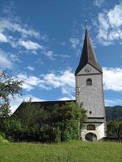
Sankt Margareten im Rosental
Sankt Margareten im Rosental (Slovene: Šmarjeta v Rožu) is a town in the district of Klagenfurt-Land in the Austrian state of Carinthia.
Sankt Margareten im Rosental | |
|---|---|
 | |
 Coat of arms | |
 Sankt Margareten im Rosental Location within Austria | |
| Coordinates: 46°33′N 14°25′E | |
| Country | Austria |
| State | Carinthia |
| District | Klagenfurt-Land |
| Government | |
| • Mayor | Lukas Wolte |
| Area | |
| • Total | 43.99 km2 (16.98 sq mi) |
| Elevation | 607 m (1,991 ft) |
| Population (2018-01-01)[2] | |
| • Total | 1,099 |
| • Density | 25/km2 (65/sq mi) |
| Time zone | UTC+1 (CET) |
| • Summer (DST) | UTC+2 (CEST) |
| Postal code | 9173 |
| Area code | 04226 |
| Website | www.st-margareten.at |
Geography
The municipality lies in the southeast Rosental at the foot of the Hochobir. On the north, the Drau forms the municipal boundary, on the east the Freibach, and on the south and the west tributaries of the Karawank and the Inzegraben.
Population
According to the 2001 census 11,8% of the population are Carinthian Slovenes.
| Village | Number of people 1991 | Percent of Slovenes 1991 | Percent of Slovenes 1951 |
|---|---|---|---|
| Trieblach/Treblje | 92 | 35,3% | 56,2% |
| Gupf/Vrh | 85 | 15,3% | 85,1% |
| Niederdörfl/Doljna vas | 184 | 19,6% | 84,9% |
| St.Margarethen/Šmarjeta | 274 | 16,1% | 59,6% |
| Homölisch/Hmelše | 9 | 33,3% | 98,1% |
| Gotschuchen/Kočuha | 221 | 15,4% | 79,1% |
| Sabosach/Zavoze | 47 | 25,5% | 55,2% |
| Seel/Selo | 30 | 33,3% | 50,0% |
| Dobrowa/Dobrava | 33 | 21,2% | 91,5% |
| Hintergupf/Zavrh | 34 | 19,4% | 100% |
| Dullach/Dole | 56 | 5,4% | 95,1% |
| Oberdörfl/Gornja vas | 88 | 5,0% | 23,2% |
Notable people
- Karl Matthäus Woschitz (b. 1937), theologian and bible scholar
District Klagenfurt Land
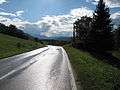 Between Sankt Margarethen and Oberdörfl, road panorama
 Between Oberdörfl and Abtei, panorama
References
- "Dauersiedlungsraum der Gemeinden Politischen Bezirke und Bundesländer - Gebietsstand 1.1.2018". Statistics Austria. Retrieved 10 March 2019.
- "Einwohnerzahl 1.1.2018 nach Gemeinden mit Status, Gebietsstand 1.1.2018". Statistics Austria. Retrieved 9 March 2019.
| Wikimedia Commons has media related to Sankt Margareten im Rosental. |
| Authority control |
|
|---|
This article is issued from Wikipedia. The text is licensed under Creative Commons - Attribution - Sharealike. Additional terms may apply for the media files.