Sanddrif
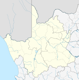
Sanddrif is a town in Richtersveld Local Municipality in the Northern Cape province of South Africa, on the banks of the Orange River.[2] It is located 57 km east of Alexander Bay.[3]
Sanddrif | |
|---|---|
 Sanddrif  Sanddrif | |
| Coordinates: 28°25′38″S 16°46′38″E | |
| Country | South Africa |
| Province | Northern Cape |
| District | Namakwa |
| Municipality | Richtersveld |
| Area | |
| • Total | 2.70 km2 (1.04 sq mi) |
| Population (2011)[1] | |
| • Total | 1,854 |
| • Density | 690/km2 (1,800/sq mi) |
| Racial makeup (2011) | |
| • Black African | 17.4% |
| • Coloured | 78.5% |
| • Indian/Asian | 0.2% |
| • White | 3.3% |
| • Other | 0.6% |
| First languages (2011) | |
| • Afrikaans | 78.2% |
| • Xhosa | 12.9% |
| • English | 1.9% |
| • Tswana | 1.1% |
| • Other | 5.9% |
| Time zone | UTC+2 (SAST) |
Mining in the region began in the 1900s leading to the displacement of the indigenous Nama people. Diamond mines were again established in the 1970s, bringing a source of employment but also socio-economic upheaval, threatening the traditional Nama lifestyle.[3] The subsequent migration of Xhosa people who came to the area to work in the mines led Sanddrif to acquire the nickname of "Rainbow Town".[4] Sanddrif has nevertheless seen ethnic conflict between the indigenous Namas and the Xhosa migrants.[5]
The Baken diamond mine, located outside Sanddrif, was opened by Trans Hex Group in May 2001.[6]
References
- "Main Place Sanddrif". Census 2011.
- "Sanddrift". Richtersveld National Park. Retrieved 29 August 2014.
- "Sanddrift". Explore the Richtersveld. Retrieved 29 August 2014.
- François Odendaal; Helen Suich (2007-01-01). Richtersveld: The Land and Its People. Struik. p. 129. ISBN 978-1-77007-341-8.
- Gitanjali Maharaj (1999). Between unity and diversity: essays on nation-building in post-Apartheid South Africa. Idasa. p. 50. ISBN 978-1-874864-90-5.
- "Diamond plant throughput rises 67%". MiningWeekly.com. Retrieved 29 August 2014.
Municipalities and communities of Namakwa District Municipality, Northern Cape | ||
|---|---|---|
District seat: Springbok | ||
| Hantam | .svg.png) Namakwa District within South Africa | |
| Kamiesberg | ||
| Karoo Hoogland | ||
| Khâi-Ma | ||
| Nama Khoi | ||
| Richtersveld | ||