San Jerónimo (Los Barbosa)
San Jerónimo (Los Barbosa)[1] is a locality and municipal agency of San Martín de Hidalgo Municipality, Jalisco, Mexico. As of the 2010 census, the village had a total population of 355, making it the eleventh-largest locality in the municipality and the second-largest in the territorial sub-committee.
San Jerónimo (Los Barbosa) | |
|---|---|
Locality and Municipal Agency | |
.jpg) Central view of San Jerónimo | |
 Flag  Seal | |
San Jerónimo (Los Barbosa) Location in Mexico | |
| Coordinates: 20°24′18″N 103°59′12″W | |
| Country | |
| State | |
| Region | Valles |
| Municipality | San Martín de Hidalgo |
| Territorial sub-committee | Santa Cruz de las Flores |
| Incorporated | March 25, 1925 |
| Government | |
| • Type | Municipal Agency |
| • Municipal Agent | Armando Díaz |
| • Municipal Sub-agent | José Luis Tapia Navarro |
| Elevation | 4,842 ft (1,476 m) |
| Population (2010) | |
| • Total | 355 |
| • Rank | 11th in San Martín de Hidalgo Municipality |
| Demonym(s) | Barboseño |
| Time zone | UTC-6 (Central Standard Time) |
| • Summer (DST) | UTC-5 (Central Daylight Time) |
| Website | Official website |
San Jerónimo is the home of the state-funded San Jerónimo Dam which cost
It is situated 45 miles southwest of Guadalajara, and 80 miles east of Puerto Vallarta.
History
The village of San Jerónimo was first annotated as one of the settlements comprising the jurisdiction of Cocula in 1744.
Demographics
2010
According to the 2010 Censo General de Población y Vivienda, San Jerónimo (Los Barbosa) had a population of 355 inhabitants, of which 164 were male and 191 were female.[2] There were 103 inhabited houses.[2]
| Historical population | ||
|---|---|---|
| Year | Pop. | ±% |
| 1900 | 360 | — |
| 1910 | 277 | −23.1% |
| 1921 | 310 | +11.9% |
| 1930 | 428 | +38.1% |
| 1940 | 401 | −6.3% |
| 1950 | 445 | +11.0% |
| 1960 | 458 | +2.9% |
| 1970 | 515 | +12.4% |
| 1980 | 506 | −1.7% |
| 1990 | 494 | −2.4% |
| 1995 | 493 | −0.2% |
| 2000 | 465 | −5.7% |
| 2005 | 341 | −26.7% |
| 2010 | 355 | +4.1% |
| Source: INEGI | ||
Government
San Jerónimo is one of the 18 municipal agencies of San Martín de Hidalgo Municipality and belongs to the territorial sub-committee of Santa Cruz de las Flores. A municipal agent and a municipal sub-agent preside over San Jerónimo in the administrative and representative sense and are appointed and removed by the municipal council.
San Jerónimo is located in the 18th Local Electoral District.[3]
Agriculture
San Jerónimo was incorporated into an ejido on March 25, 1925, with a total of 582 hectares of communal land.
Unincorporated communities
- La Madera, part of the village
- Planta de Beneficio, former settlement outside the village
See also
References
- Pueblos de America - SAN JERóNIMO (LOS BARBOSA) (in Spanish)
- "Productos y servicios - Catálogo de claves de entidades federativas, municipios y localidades - consulta y descarga, page 215". www.inegi.org.mx. Retrieved 20 March 2013.
- "Instituto Electoral de Jalisco - División del territorio del Estado de Jalisco 2012" (PDF). www.iepcjalisco.org.mx. Retrieved 20 March 2013.
External links
- San Jerónimo's official website
- (in Spanish) Information of San Jerónimo
- (in Spanish) Information of the Municipality
Localities of San Martín de Hidalgo Municipality, Jalisco, Mexico | ||
|---|---|---|
Municipal seat: San Martín de Hidalgo | ||
| Municipal delegations | 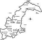 | |
| Municipal agencies | ||
| Other communities |
| |