Salvatierra, Guanajuato
Salvatierra (Spanish: [salβaˈtjera] (![]()
San Andrés de Salvatierra Ciudad de Salvatierra | |
|---|---|
 View of the Tetilla hills | |
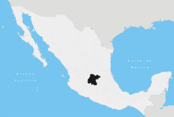
 Location of Salvatierra in Mexico | |
| Coordinates: 20°12′56″N 100°53′46″W | |
| Country | |
| Founded (officially) | 1644 (By Garcia Sarmiento de Sotomayor) |
| Government | |
| • Municipal president | Alejandrina Lanuza (PRI) |
| Elevation | 1,749 m (5,738 ft) |
| Population (2000) | |
| • Total | 34,066 city; 94,558 municipality |
| Time zone | UTC-6 (Central Standard Time) |
| • Summer (DST) | UTC-5 (Central Daylight Time) |
| Website | Official Website of the City of Salvatierra |
| Average temperature 18°C | |
In pre-Columbian times the area was known as Guatzindeo or "Place of beautiful vegetation"[3] by the mostly Purépecha inhabitants.
Three municipal employees, Mario Francisco Solano Muñoz, Hecotr Méndoza Beltrán, and Isaac Puente, were gunned down in their car on March 25, 2019. No arrests have been made.[4]
San Andrés de Salvatierra
The first inhabitants of valley of Huatzindeo belonged to the Chichimeca culture, who by the 12th century were found in many communities across the valley. The Chichimeca were eventually conquered by the Purépecha people, along with most of the lower region of the present-day state of Guanajuato.
The first Europeans to arrive to the valley of Huatzindeo were Franciscan friars who came to the region with the intent of converting the native populations to Christianity. The Franciscan friars built and ran the first Spanish "hospitalillo," hospital, in the indigenous village of Huatziendeo (located to the left of the Lerma river) between 1535 and 1550.
The Franciscan friars were soon joined by caciques and other Spanish pioneers who settled in the valley of Huatzindeo and built haciendas. Much of the hard labor at the haciendas was provided via encomiendas by the indigenous population.
By 1600 typhoid fever, smallpox and other diseases had almost wiped out the native population who lacked the needed antibodies since these diseases were alien to the native population at the time, and the village of Huatzindeo ceased to exist. Many of the Spaniards already in the area relocated to Yuririapundaro, while others remained and founded San Andrés Chochones. San Andrés Chochones was built on the right side of the Lerman river – directly across from where the village of Huatzindeo had once stood.
San Andrés de Salvatierra was founded under the order of Spanish viceroy Don Garcia Sarmiento de Sotomayor, 2nd Count of Salvatierra and Marquis of Sobroso, on February 9, 1644.[5] In 1646 the town was granted the title of city, becoming the first city in the state of Guanajuato.[6]
Due to its rich soil and strategic location (midway between the three most populated areas, namely Mexico City, Guadalajara, and Monterrey) for most of the next three centuries the city was one of the most prosperous in the state of Guanajuato. However, unlike León, Irapuato, and Celaya, Salvatierra never developed into a strong industrial town and has seen its working population shrink with many choosing to relocate to nearby cities and others leaving the country entirely to seek jobs in the United States. Some microregions in the municipality have immigration levels of well over 50%, while the rate stands at 30% in the city.[7]
Cities and areas in the United States with sizable populations from Salvatierra include the metro areas of Los Angeles, Dallas, Houston, Detroit, Atlanta, Philadelphia, Moline, and Chicago.[8]
Microregions
| Name | Population |
|---|---|
| Urireo | 7,649 |
| San Nicolás de los Agustinos | 6,878 |
| San Pedro de los Naranjos | 4,365 |
| El Sabino | 3,904 |
| Maravatío del Encinal | 3,262 |
| Cupareo | 1,982 |
| Santo Tomás Huatzindeo | 1,950 |
| Ojo de Agua de Ballesteros | 1,633 |
| San Miguel Eménguaro | 1,526 |
| La Luz | 1,283 |
| La Quemada | 1,123 |
| La Estancia de San José del Carmen | 1,252 |
| La Estancia del Carmen de Maravatio (short name El Carmen) or (La Estancia)-- contrary to its name it belongs to Salvatierra | 1,250 |
Sister cities

References
- "2005 Census". INEGI: Instituto Nacional de Estadística, Geografía e Informática. Archived from the original on 2010-01-18. Retrieved 2007-03-22.
- "Mexican Municipality Encyclopedia". Enciclopedia de los Municipios de México. Archived from Guanajuato the original Check
|url=value (help) on 2007-03-17. Retrieved 2007-03-22. - City profile Archived 2007-06-09 at the Wayback Machine
- "Ejecutan a tres funcionarios de Guanajuato" [Three municipal employees are executed in Guanajuato] (in Spanish). La Prensa. March 26, 2019. Retrieved March 30, 2019.
- Notas geográficas, históricas y genealógicas (in Spanish)
- Joya colonial del estado de Guanajuato Archived 2007-06-09 at the Wayback Machine
- Programa de protección a migrantes
- Firman Convenio de Hermandad
External links
- Cupareo, Mpio. de Salvatierra
- Municipality Web site (in Spanish)