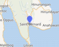
Saint Bernard, Southern Leyte
Saint Bernard, officially the Municipality of Saint Bernard, is a 4th class municipality in the province of Southern Leyte, Philippines. According to the 2015 census, it has a population of 28,395 people.[3]
Saint Bernard | |
|---|---|
| Municipality of Saint Bernard | |
 St. Bernard Skyline | |
 Map of Southern Leyte with Saint Bernard highlighted | |
| |
.svg.png) Saint Bernard Location within the Philippines | |
| Coordinates: 10°17′N 125°08′E | |
| Country | |
| Region | Eastern Visayas (Region VIII) |
| Province | Southern Leyte |
| District | 2nd District |
| Founded | December 9, 1954 |
| Barangays | 30 (see Barangays) |
| Government | |
| • Type | Sangguniang Bayan |
| • Mayor | Manuel O. Calapre |
| • Vice Mayor | Antonio C. Dalugdugan |
| • Congressman | Roger Mercado |
| • Electorate | 18,527 voters (2019) |
| Area | |
| • Total | 100.20 km2 (38.69 sq mi) |
| Elevation | 4.8 m (15.7 ft) |
| Population (2015 census)[3] | |
| • Total | 28,395 |
| • Density | 280/km2 (730/sq mi) |
| • Households | 5,899 |
| Economy | |
| • Income class | 4th municipal income class |
| • Poverty incidence | 40.24% (2015)[4] |
| • Revenue (₱) | 82,759,889.85 (2016) |
| Time zone | UTC+8 (PST) |
| ZIP code | 6613 |
| PSGC | |
| IDD : area code | +63 (0)53 |
| Climate type | tropical rainforest climate |
| Native languages | Kinabalian Boholano dialect Cebuano Tagalog |
| Website | www |
It is situated on the Pacific coast and the first town form the mountain road from the eastern side of Sogod Bay.
Barangays
Saint Bernard is politically subdivided into 30 barangays but only 28 are considered truly functioning barangays.
- Atuyan
- Ayahag
- Bantawon (Zero Population in 2015 according to PSGC. At present, there are around 110 people living in the once deserted barrio)
- Bolodbolod
- Nueva Esperanza (Cabac-an)
- Cabagawan (Renamed as Maria Asuncion)
- Carnaga
- Catmon
- Guinsaugon (Transformed into a memorial site after the disaster and it is a no-build zone, thus becoming a non-functioning barangay)
- Himatagon (Poblacion)
- Himbangan
- Himos-onan
- Hinabian
- Hindag-an
- Kauswagan (Zero Population as all of its residents transferred to other safe places as the area is landslide prone)
- Libas
- Lipanto
- Magatas
- Magbagacay
- Mahayag
- Mahayahay
- Malibago
- Malinao
- New Guinsaugon (This is the relocation site of the survivors of the Guinsaugon Tragedy of February 2006. This is a coastal barrio)
- Panian
- San Isidro
- Santa Cruz
- Sug-angon (The original barrio of Sug-angon was the neighboring barrio of Guinsaugon. Both Sug-angon and Guinsaugon were destroyed by the Guinsaugon Landslide Tragedy of February 2006. It was within the peaks of Sug-angon that the landslide started. Later, the survivors of Sug-angon were relocated near the coast and is also adjacent to Barrio New Guinsaugon)
- Tabon-tabon
- Tambis I
- Tambis II
History
_makes_an_aerial_assessment_of_the_deadly_Feb._17_landslide_during_over-flight_of_the_area.jpg)
This town was formerly the largest barrio of San Juan, then known as "Himatagon". On December 9, 1954, President Ramon Magsaysay issued Executive Order No. 84, converting the barrio as a municipality of Saint Bernard. It was through the efforts of Leyte Governor Bernardo Torres that the conversion was made possible in response to the lingering clamour of the inhabitants for an independent and separate municipality from San Juan. As a gratitude to Governor Bernardo Torres, the people unanimously renamed Himatagon as Saint Bernard, with the honorific title "Saint" being a translation of the vernacular honorific "San" which is given to persons of virtue, wisdom or generosity and the name Bernard being the English version of the name Bernardo.[5]
On February 17, 2006, a tragic series of mudslides killed over 1100 residents in Barangay Guinsaugon. Affected families were treated by the Philippine government and other non-government organizations from all over the world. New houses were built, and the people chose New Guinsaugon as the name of their village located near the town proper.[6][7]
Demographics
| Population census of Saint Bernard | |||||||||||||||||||||||||||||||||||||
|---|---|---|---|---|---|---|---|---|---|---|---|---|---|---|---|---|---|---|---|---|---|---|---|---|---|---|---|---|---|---|---|---|---|---|---|---|---|
|
| ||||||||||||||||||||||||||||||||||||
| Source: Philippine Statistics Authority [3][8][9][10] | |||||||||||||||||||||||||||||||||||||
Climate
| Climate data for Saint Bernard, Southern Leyte | |||||||||||||
|---|---|---|---|---|---|---|---|---|---|---|---|---|---|
| Month | Jan | Feb | Mar | Apr | May | Jun | Jul | Aug | Sep | Oct | Nov | Dec | Year |
| Average high °C (°F) | 27 (81) |
28 (82) |
28 (82) |
29 (84) |
29 (84) |
29 (84) |
28 (82) |
28 (82) |
28 (82) |
28 (82) |
28 (82) |
28 (82) |
28 (82) |
| Average low °C (°F) | 21 (70) |
21 (70) |
21 (70) |
22 (72) |
24 (75) |
24 (75) |
24 (75) |
24 (75) |
24 (75) |
23 (73) |
23 (73) |
22 (72) |
23 (73) |
| Average precipitation mm (inches) | 78 (3.1) |
57 (2.2) |
84 (3.3) |
79 (3.1) |
118 (4.6) |
181 (7.1) |
178 (7.0) |
169 (6.7) |
172 (6.8) |
180 (7.1) |
174 (6.9) |
128 (5.0) |
1,598 (62.9) |
| Average rainy days | 16.7 | 13.8 | 17.3 | 18.5 | 23.2 | 26.5 | 27.1 | 26.0 | 26.4 | 27.5 | 24.6 | 21.0 | 268.6 |
| Source: Meteoblue [11] | |||||||||||||
Economy
Saint Bernard's economy are based in agriculture and marine culture. The municipality is considered among the fastest growing economy in the pacific area of Southern Leyte.
Saint Bernard is a peninsula and therefore it is almost entirely surrounded by water. The majority of the people who live in the flat lands engage in fishing as their main mode of livelihood. Those who live in the mountain barangays, live through farming.
The common mode of transportation is by bicycles with side cars, known locally as Potpot or pedicabs or, depending on the distance, tricycles with side cars, called trisikads or center cab. The LGU established the Saint Bernard Town Center for economic activities of some Small to Medium Entrepreneurs.
Places of interest
- Hindag An Falls- Barangay Hindag-an
- Tinago Beach- Barangay Magbagacay
- Tinago Spring Falls- Barangay Ayahag
- Lipanto Marine Sanctuary- Barangay Lipanto
- Himbangan Bird Sanctuary- Barangay Himbangan
- Sangat Cave and Beach- Barangay Hindag-an
- Saub Beach- Barangay Lipanto
- Ground Zero Memorial Park & Lawigan River- Lawigan River, access at Brgy Tambis 1
- Libas River- Barangay Libas
- Kissbone Cove and Resort- Barangay Magbagacay
- Santo Nino Shrine - Sitio Cansi, Barangay Himatagon
- Mun. Disaster Management Office - LGU Compound, Municipal Building, Barangay Himatagon
Education
There are accessible Elementary Schools in every Barangay in the Municipality of Saint Bernard as of 2019 census. List of Secondary Schools in the Municipality of Saint Bernard.
- Tambis National High School- Barangay Tambis 1
- Himbangan National High School- Barangay Himbangan
- Cristo Rey Regional High School- BarangayMalibago
- New Guinsaugon National High School - Relocation area of New Guinsaugon, Magbagacay
References
- "Municipality". Quezon City, Philippines: Department of the Interior and Local Government. Retrieved 31 May 2013.
- "Province: Southern Leyte". PSGC Interactive. Quezon City, Philippines: Philippine Statistics Authority. Retrieved 12 November 2016.
- Census of Population (2015). "Region VIII (Eastern Visayas)". Total Population by Province, City, Municipality and Barangay. PSA. Retrieved 20 June 2016.
- "PSA releases the 2015 Municipal and City Level Poverty Estimates". Quezon City, Philippines. Retrieved 12 October 2019.
- "Historical Background". Municipality of Saint Bernard, Southern Leyte. Archived from the original on 26 May 2012. Retrieved 15 July 2013.
- "Mud wipes out Philippines village". BBC News. 17 February 2006. Retrieved 15 July 2013.
- S. G. Evans; R. H. Guthrie; N. J. Roberts; N. F. Bishop (2007). "The disastrous 17 February 2006 rockslide-debris avalanche on Leyte Island, Philippines: a catastrophic landslide in tropical mountain terrain" (PDF). Natural Hazards and Earth System Sciences. 7 (1). Retrieved 15 July 2013.
- Census of Population and Housing (2010). "Region VIII (Eastern Visayas)". Total Population by Province, City, Municipality and Barangay. NSO. Retrieved 29 June 2016.
- Censuses of Population (1903–2007). "Region VIII (Eastern Visayas)". Table 1. Population Enumerated in Various Censuses by Province/Highly Urbanized City: 1903 to 2007. NSO.
- "Province of Southern Leyte". Municipality Population Data. Local Water Utilities Administration Research Division. Retrieved 17 December 2016.
- "Saint Bernard, Southern Leyte: Average Temperatures and Rainfall". Meteoblue. Retrieved 13 January 2019.
External links
| Wikimedia Commons has media related to Saint Bernard, Southern Leyte. |