Saint-Louis Parish, New Brunswick
Saint-Louis is a Canadian parish in Kent County, New Brunswick.[2]
Saint-Louis St. Louis | |
|---|---|
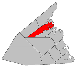 Location within Kent County, New Brunswick. | |
| Coordinates: 46.725°N 65.075°W | |
| Country | |
| Province | |
| County | Kent |
| Established | 1855 |
| Area | |
| • Land | 258.74 km2 (99.90 sq mi) |
| Population (2016)[1] | |
| • Total | 1,802 |
| • Density | 7.0/km2 (18/sq mi) |
| • Change 2011-2016 | |
| • Dwellings | 785 |
| Time zone | UTC-4 (AST) |
| • Summer (DST) | UTC-3 (ADT) |
Its population in the 2016 Census was 1,802.[1]
Delineation
Saint-Louis Parish is defined in the Territorial Division Act[3] as being bounded:
- South by Weldford Parish and Saint-Charles Parish, east by Saint-Charles Parish and the Gulf of Saint Lawrence, and north by a line commencing on the shore of the Gulf of Saint Lawrence, where the eastern prolongation of the southern line of Lot C, granted to George Kollock, intersects the same; thence westerly along said prolongation and line to the southerly prolongation of the eastern line of the William Dwyer lot, being lot number 41; thence northerly along said last mentioned prolongation and eastern line of said lot number 41, to the rear line of lot number 10, granted to James Graham; thence along the rear lines of lots granted to the said James Graham and to John Murphy, Thomas Jardine, Patrick MacKay, Patrick Harrington, and Dennis Harrington, to the eastern line of lot number 24, granted to Lucas Christian; thence southerly along said eastern line of lot number 24 to a line, being the western prolongation of the southern line of lot C, granted to George Kollock; thence westerly along said last mentioned prolongation to the post road; thence along the post road northerly to the northeast boundary of a grant to Basil White; thence along the northerly line of Basil White’s lot west to the old post road[lower-alpha 1]; thence along the old post road southerly to the northeast boundary of the grant to Peter Vautour; thence along the northerly side line of Peter Vautour’s lot to the northwest angle thereof; and thence south seventy-five degrees and thirty minutes west to the southern line of the parish, including the islands in front.
Communities
|
|
Demographics
Population
|
LanguageMother tongue (2016)[1]
|
See also
Footnotes
References
- "Census Profile, 2016 Census Saint-Louis, Parish [Census subdivision], New Brunswick". Statistics Canada. Retrieved September 14, 2019.
- "Saint-Louis Parish". New Brunswick Provincial Archives.
- "Territorial Division Act (R.S.N.B. 1973, c. T-3)". Government of New Brunswick website. Retrieved August 25, 2016.
- "No. 236" (PDF). 2015 Designated Highway Maps. Government of New Brunswick. Retrieved 25 August 2016.
- "Crown Grant Reference Map Viewer". GeoNB. Government of New Brunswick. Retrieved 25 August 2016.
- Statistics Canada: 1996, 2001, 2006 census
- 2011 Statistics Canada Census Profile: Saint-Louis Parish, New Brunswick
Places adjacent to Saint-Louis Parish, New Brunswick | ||||||||||
|---|---|---|---|---|---|---|---|---|---|---|
| ||||||||||
| Subdivisions |
|
|---|---|
| Cities | |
| Counties | |
| |
This article is issued from Wikipedia. The text is licensed under Creative Commons - Attribution - Sharealike. Additional terms may apply for the media files.