Sai Wan Ho
Sai Wan Ho is a primarily residential area on the northeastern shore of Hong Kong Island, Hong Kong, between Quarry Bay and Shau Kei Wan. It is part of the Eastern District, and is administered together with surrounding areas under the Eastern District Council.
| Sai Wan Ho | |||||||||||
|---|---|---|---|---|---|---|---|---|---|---|---|
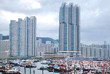
 Distant view of Sai Wan Ho | |||||||||||
| Traditional Chinese | 西灣河 | ||||||||||
| Simplified Chinese | 西湾河 | ||||||||||
| Literal meaning | West Bay River | ||||||||||
| |||||||||||
Location
Sai Wan Ho is conventionally agreed to extend between the Taikoo Shing Road, Shau Kei Wan Road and King's Road junction to the west, and the Shau Kei Wan tram depot in the east. It is bounded by the Victoria Harbour to the north, and mountains to the south.
Housing
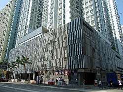
Sai Wan Ho is primarily residential. The hill was once filled with squatter settlements, which were later demolished and replaced with new residential buildings. Taikoo Shing, redeveloped from Taikoo Dockyard, spans the east end of the area. From the 1980s through the 2000s, extensive reclamation drastically reshaped the shore. Private housing estates were built near the new sea front, like Lei King Wan, Les Saisons and Grand Promenade. However, older buildings such as Tai On Building still remain further inland.
Amenities and attractions
- Sai Wan Ho Civic Centre, A community arts centre
- Hong Kong Film Archive
- Island East Sports Centre
- Sai Wan Ho Sports Centre
- Eastern Law Courts Building
- Sai Wan Ho Health Centre
- Aldrich Bay Park
- Sai Wan Ho Market, With Market and Cooked Food Centre
- Hong Kong Police Force Report Rooms, Traffic Hong Kong Island
- Sai Wan Ho Fire Station
Transport
- Sai Wan Ho Station, served by the Island Line
- Numerous buses and minibuses serve the area
- Coral Sea Shipping Services provide regular ferry services from Sai Wan Ho Ferry Pier to Kwun Tong and Sam Ka Tsuen
- Blue Sea Ferry provides regular ferry services from Sai Wan Ho to Tung Lung Island (formerly served by Lam Kee Ferry)
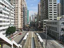
- Sai Wan Ho Tram Depot, is the northern depot of the Hong Kong Tramways, which is between North Point and Shau Kei Wan
- Island Eastern Corridor
Institutes
- Hong Kong Chinese Women's Club College, Government aided co-educational grammar school
- Munsang College (Hong Kong Island), Government aided co-educational grammar school
- Korean International School of Hong Kong, International school
| Wikimedia Commons has media related to Sai Wan Ho. |
Places adjacent to Sai Wan Ho | |
|---|---|
| Authority control |
|
|---|