Rwekunye
Rwekunye is a settlement in Kiryandongo District in the Western Region of Uganda.
Rwekunye | |
|---|---|
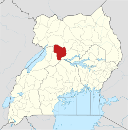
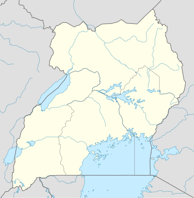 Rwekunye Location in Uganda | |
| Coordinates: 01°42′39″N 32°01′44″E | |
| Country | |
| Region | Western Region of Uganda |
| Districts of Uganda | Kiryandongo District |
| Elevation | 3,870 ft (1,180 m) |
Location
Rwekunye is 192 kilometres (119 mi) northwest of Kampala on the Kampala–Gulu Highway.[1] It is located immediately west of the larger area of Masindi Port, along the Rwekunye–Apac–Aduku–Lira–Kitgum–Musingo Road. The coordinates of Rwekunye are 1°42'39.0"N, 32°01'44.0"E (Latitude:1.710833; Longitude:32.028889).[2]
Overview
Rwekunye is functionally a suburb of the larger urban area of Masindi Port (estimated 2009 population 10,400),[3] located 5 kilometres (3 mi) to the east on the banks of the Victoria Nile.[4]
Points of interest
The town has additional points of interest, including the following:
- the Rwekunye–Apac–Aduku–Lira–Kitgum–Musingo Road meets the Kampala–Gulu Highway in Rwekunye
- Rwekunye central market
References
- Globefeed.com (25 July 2015). "Road Distance Between Kampala And Rwekunye With Route Map". Globefeed.com. Retrieved 25 July 2015.
- Google (25 July 2015). "Location of Rwekunye At Google Maps" (Map). Google Maps. Google. Retrieved 25 July 2015.
- UBOS (2009). "Kiryandongo District Community Information System: Chapter Two - Socio-Demographic Characteristics" (PDF). Kampala: Uganda Bureau of Statistics (UBOS). Retrieved 25 July 2015.
- GFC (25 July 2015). "Road Distance Between Rwekunye And Masindi Port With Map". Globefeed.com (GFC). Retrieved 25 July 2015.
External links
Capital: Kiryandongo | ||
| Towns and villages |
|  |
| Geography |
| |
| Economy | ||
| Energy |
| |
| Notable landmarks | ||
| Transport | ||
| Education | ||
| Health | ||
| Notable people | ||
This article is issued from Wikipedia. The text is licensed under Creative Commons - Attribution - Sharealike. Additional terms may apply for the media files.