Rutledge, Georgia
Rutledge is a city in Morgan County, Georgia, United States. Founded in 1871, the city had a population of 781 at the 2010 census.
Rutledge, Georgia | |
|---|---|
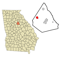 Location in Morgan County and the state of Georgia | |
| Coordinates: 33°37′33″N 83°36′39″W | |
| Country | United States |
| State | Georgia |
| County | Morgan |
| Area | |
| • Total | 3.32 sq mi (8.60 km2) |
| • Land | 3.29 sq mi (8.51 km2) |
| • Water | 0.04 sq mi (0.09 km2) |
| Elevation | 712 ft (217 m) |
| Population (2010) | |
| • Total | 781 |
| • Estimate (2018)[2] | 820 |
| • Density | 249.62/sq mi (96.38/km2) |
| Time zone | UTC-5 (Eastern (EST)) |
| • Summer (DST) | UTC-4 (EDT) |
| ZIP code | 30663 |
| Area code(s) | 706 |
| FIPS code | 13-67760[3] |
| GNIS feature ID | 0322022[4] |
| Website | www |
History
Rutledge had its start in the 1840s when the railroad was extended to that point.[5] The Georgia General Assembly incorporated Rutledge as a town in 1871.[6]
Geography
Rutledge is located at 33°37′33″N 83°36′39″W (33.625723, -83.610899).[7]
According to the United States Census Bureau, the city has a total area of 3.3 square miles (8.5 km²), of which 3.3 square miles (8.5 km²) is land and 0.30% is water.
Rutledge, off Interstate 20, is the gateway town to Hard Labor Creek State Park as well as Hard Labor Creek Observatory.
Demographics
| Historical population | |||
|---|---|---|---|
| Census | Pop. | %± | |
| 1870 | 235 | — | |
| 1880 | 273 | 16.2% | |
| 1890 | 588 | 115.4% | |
| 1900 | 469 | −20.2% | |
| 1910 | 696 | 48.4% | |
| 1920 | 643 | −7.6% | |
| 1930 | 523 | −18.7% | |
| 1940 | 550 | 5.2% | |
| 1950 | 482 | −12.4% | |
| 1960 | 478 | −0.8% | |
| 1970 | 628 | 31.4% | |
| 1980 | 694 | 10.5% | |
| 1990 | 659 | −5.0% | |
| 2000 | 707 | 7.3% | |
| 2010 | 781 | 10.5% | |
| Est. 2018 | 820 | [2] | 5.0% |
| U.S. Decennial Census[8] | |||
As of the census[3] of 2000, there were 707 people, 260 households, and 197 families residing in the city. The population density was 215.9 people per square mile (83.5/km²). There were 280 housing units at an average density of 85.5 per square mile (33.1/km²). The racial makeup of the city was 60.40% White, 38.33% African American, 0.85% Asian, and 0.42% from two or more races. Hispanic or Latino of any race were 0.71% of the population.
There were 260 households out of which 34.6% had children under the age of 18 living with them, 50.4% were married couples living together, 21.9% had a female householder with no husband present, and 24.2% were non-families. 22.7% of all households were made up of individuals and 11.9% had someone living alone who was 65 years of age or older. The average household size was 2.72 and the average family size was 3.19.
In the city, the population was spread out with 27.4% under the age of 18, 9.8% from 18 to 24, 25.3% from 25 to 44, 23.2% from 45 to 64, and 14.3% who were 65 years of age or older. The median age was 36 years. For every 100 females, there were 79.0 males. For every 100 females age 18 and over, there were 72.1 males.
The median income for a household in the city was $35,156, and the median income for a family was $38,875. Males had a median income of $37,750 versus $22,813 for females. The per capita income for the city was $17,732. About 9.9% of families and 9.6% of the population were below the poverty line, including 15.6% of those under age 18 and 0.9% of those age 65 or over.
Economy
Rutledge is a part of the Covington, Georgia movie industry.
References
- "2018 U.S. Gazetteer Files". United States Census Bureau. Retrieved Feb 12, 2020.
- "Population and Housing Unit Estimates". Retrieved June 4, 2019.
- "U.S. Census website". United States Census Bureau. Retrieved 2008-01-31.
- "US Board on Geographic Names". United States Geological Survey. 2007-10-25. Retrieved 2008-01-31.
- "Rutledge". GeorgiaInfo. Retrieved 28 May 2019.
- Krakow, Kenneth K. (1975). Georgia Place-Names: Their History and Origins (PDF). Macon, GA: Winship Press. p. 194. ISBN 0-915430-00-2.
- "US Gazetteer files: 2010, 2000, and 1990". United States Census Bureau. 2011-02-12. Retrieved 2011-04-23.
- "Census of Population and Housing". Census.gov. Retrieved June 4, 2015.
External links
- Rutledge Tourism and Community web site: "Small But Special" ~ Rutledge, Ga.
- Rutledge City Government web site: City of Rutledge Online
Municipalities and communities of Morgan County, Georgia, United States | ||
|---|---|---|
| Cities | 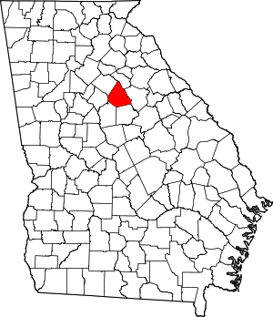 Map of Georgia highlighting Morgan County | |
| Towns | ||
| Unincorporated communities | ||