Rusovce
Rusovce (Croatian: Rosvar, Hungarian: Oroszvár (both means "Russian (Ruthenian) castle"), German: Karlburg, Rossenburg, Kerchenburg) is a borough in southern Bratislava on the right bank of the Danube river, close to the Hungarian border.
Rusovce | |
|---|---|
Borough | |
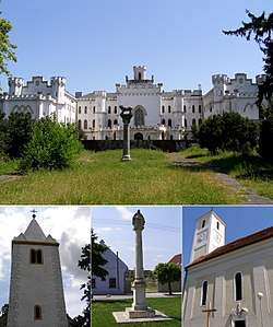 Top: Rusovce Mansion, bottom: St. Vitus Church, Column with Pietà, St. Mary Magdalene Church | |
 Coat of arms | |
 Area of Rusovce in Bratislava | |
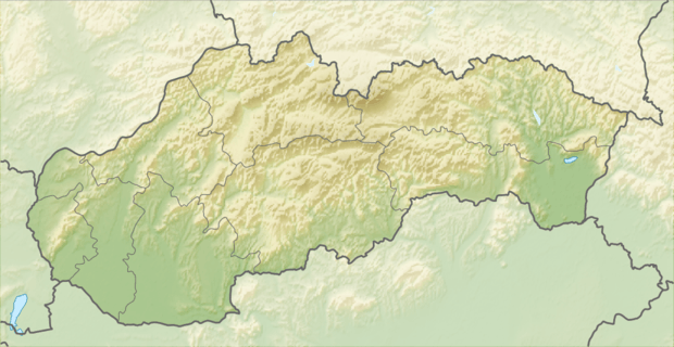 Rusovce Location of Rusovce in Slovakia | |
| Coordinates: 48°08′00″N 17°07′00″E | |
| Country | |
| Region | |
| District | Bratislava V |
| First mentioned | 1208 (Julian) |
| Government | |
| • Mayor | Lucia Tuleková Henčelová |
| Area | |
| • Total | 25.56 km2 (9.87 sq mi) |
| Elevation | 133 m (436 ft) |
| Population (1 January 2018) | |
| • Total | 3,964 |
| • Density | 160/km2 (400/sq mi) |
| Time zone | UTC+1 (CET) |
| • Summer (DST) | UTC+2 (CEST) |
| Postal code | 851 10 |
| Area code(s) | +421-2 |
| Car plate | BA, BL, BT |
| Website | www |
History
In the 1st century, there was a Roman settlement named Gerulata in today's Rusovce area. The first preserved written reference to the settlement is from 1208.
In 1910 Oroszvár had 1.802 inhabitants. Among them were 1.268 Germans, 439 Hungarians, 30 Slovaks, 20 Croats and 39 Others. It remained Hungarian after 1920 but became a border village close to Austria and Czechoslovakia. The German inhabitants were expulsed after 1945.
On October 15, 1947 - together with Čunovo and Jarovce - Rusovce became part of Czechoslovakia according to the Paris Peace Treaty. On January 1, 1972 it was made a borough of Bratislava.
Transport
A motorway and road border crossings into Hungary are located in Rusovce. Across the border is Rajka in Győr-Moson-Sopron County. There are no more border checks at both crossings from December 21, 2007 with Hungary and Slovakia joining the Schengen Area.
Tourism
Main sights include the ruins of the Roman military camp Gerulata, part of Limes Romanus, and Rusovce mansion built in the 19th century in the Neogothic style, located in the English park. Currently, it is closed to public.
Dunajské luhy Protected Landscape Area comprises some parts of the borough and is located east of the municipality.
Demographics
According to the 2011 census, the municipality had 2,845 inhabitants. 2,380 of inhabitants were Slovaks, 284 Hungarians and 181 others and unspecified.[1]
Gallery
 Rusovce mansion
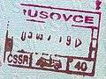 Old Czechoslovak passport stamp from Rusovce.
References
| Authority control |
|---|