Runge, Texas
Runge is a town in Karnes County, Texas, United States. The town is pronounced "Run-Gee". The population was 1,031 at the 2010 census.[3]
Runge, Texas | |
|---|---|
.jpg) First State Bank | |
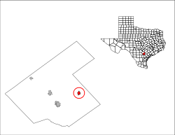
 Location of Runge, Texas | |
 | |
| Coordinates: 28°53′7″N 97°42′46″W | |
| Country | United States |
| State | Texas |
| County | Karnes |
| Area | |
| • Total | 1.22 sq mi (3.15 km2) |
| • Land | 1.20 sq mi (3.12 km2) |
| • Water | 0.008 sq mi (0.02 km2) |
| Elevation | 312 ft (95 m) |
| Population (2010) | |
| • Total | 1,031 |
| • Density | 854/sq mi (329.9/km2) |
| Time zone | UTC-6 (Central (CST)) |
| • Summer (DST) | UTC-5 (CDT) |
| ZIP code | 78151 |
| Area code(s) | 830 |
| FIPS code | 48-63788[1] |
| GNIS feature ID | 1367003[2] |
Geography
Runge is located in eastern Karnes County at 28°53′7″N 97°42′46″W (28.885172, -97.712769),[4] along Texas State Highway 72. Kenedy is 10 miles (16 km) to the southwest, and Yorktown is 15 miles (24 km) to the northeast.
According to the United States Census Bureau, Runge has a total area of 1.22 square miles (3.15 km2), of which 0.01 square miles (0.02 km2), or 0.66%, are water.[3]
Climate
The climate in this area is characterized by hot, humid summers and generally mild to cool winters. According to the Köppen Climate Classification system, Runge has a humid subtropical climate, abbreviated "Cfa" on climate maps.[5]
Demographics
| Historical population | |||
|---|---|---|---|
| Census | Pop. | %± | |
| 1920 | 1,070 | — | |
| 1930 | 1,136 | 6.2% | |
| 1940 | 1,001 | −11.9% | |
| 1950 | 1,055 | 5.4% | |
| 1960 | 1,036 | −1.8% | |
| 1970 | 1,147 | 10.7% | |
| 1980 | 1,244 | 8.5% | |
| 1990 | 1,139 | −8.4% | |
| 2000 | 1,080 | −5.2% | |
| 2010 | 1,031 | −4.5% | |
| Est. 2018 | 1,138 | [6] | 10.4% |
| U.S. Decennial Census[7] | |||
As of the census[1] of 2000, there were 1,080 people, 395 households, and 289 families residing in the town. The population density was 918.7 people per square mile (353.4/km²). There were 461 housing units at an average density of 392.1 per square mile (150.8/km²). The racial makeup of the town was 67.22% White, 2.22% African American, 1.11% Native American, 26.67% from other races, and 2.78% from two or more races. Hispanic or Latino of any race were 74.17% of the population.
There were 395 households out of which 34.9% had children under the age of 18 living with them, 47.6% were married couples living together, 17.5% had a female householder with no husband present, and 26.6% were non-families. 23.3% of all households were made up of individuals and 14.2% had someone living alone who was 65 years of age or older. The average household size was 2.73 and the average family size was 3.19.
In the town, the population was spread out with 32.2% under the age of 18, 5.9% from 18 to 24, 25.5% from 25 to 44, 19.4% from 45 to 64, and 17.0% who were 65 years of age or older. The median age was 34 years. For every 100 females, there were 88.5 males. For every 100 females age 18 and over, there were 84.4 males.
The median income for a household in the town was $20,417, and the median income for a family was $22,738. Males had a median income of $20,667 versus $16,375 for females. The per capita income for the town was $8,480. About 27.7% of families and 31.3% of the population were below the poverty line, including 40.9% of those under age 18 and 40.4% of those age 65 or over.
Education
The town is served by the Runge Independent School District.
Notable people
- Claude Davenport, former Major League Baseball player
- Mike Gisler, former National Football League offensive lineman
References
- "U.S. Census website". United States Census Bureau. Retrieved 2008-01-31.
- "US Board on Geographic Names". United States Geological Survey. 2007-10-25. Retrieved 2008-01-31.
- "Geographic Identifiers: 2010 Census Summary File 1 (G001), Runge town, Texas". American FactFinder. U.S. Census Bureau. Archived from the original on February 13, 2020. Retrieved April 18, 2019.
- "US Gazetteer files: 2010, 2000, and 1990". United States Census Bureau. 2011-02-12. Retrieved 2011-04-23.
- Climate Summary for Runge, Texas
- "Population and Housing Unit Estimates". Retrieved February 18, 2020.
- "Census of Population and Housing". Census.gov. Retrieved June 4, 2015.
Municipalities and communities of Karnes County, Texas, United States | ||
|---|---|---|
| Cities | 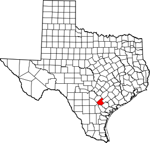 Karnes County map | |
| Town | ||
| Unincorporated communities | ||
| Ghost towns | ||
| Authority control |
|
|---|